MyTopo
Lake Marian NE Florida US Topo Map
Couldn't load pickup availability
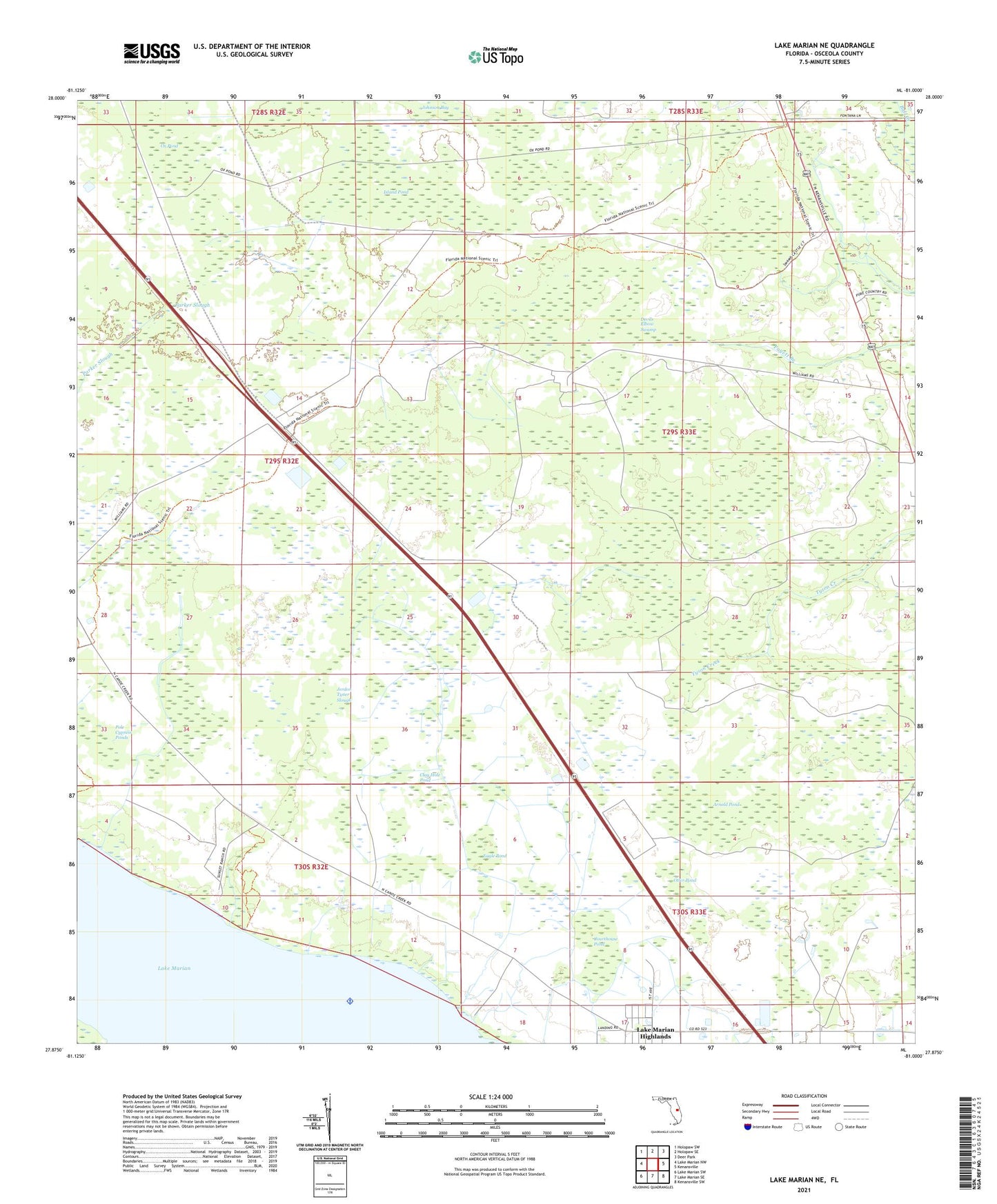
2024 topographic map quadrangle Lake Marian NE in the state of Florida. Scale: 1:24000. Based on the newly updated USGS 7.5' US Topo map series, this map is in the following counties: Osceola. The map contains contour data, water features, and other items you are used to seeing on USGS maps, but also has updated roads and other features. This is the next generation of topographic maps. Printed on high-quality waterproof paper with UV fade-resistant inks.
Quads adjacent to this one:
West: Lake Marian NW
Northwest: Holopaw SW
North: Holopaw SE
Northeast: Deer Park
East: Kenansville
Southeast: Kenansville SW
South: Lake Marian SE
Southwest: Lake Marian SW
This map covers the same area as the classic USGS quad with code o27081h1.
Contains the following named places: Arnold Pond, Camp Easy, Clay Hole Pond, Courthouse Pond, Devils Elbow Swamp, Eagle Pond, First Missionary Baptist Church of Kenansville, Island Pond, Jerdon Tyner Slough, Lake Marian, Lake Marian Highlands, Lucky L Ranch, Nittaw, Otter Pond, Ox Pond, Pole Cypress Ponds, Rattlesnake Ranch, Simmons Ranch, Three Lakes Wildlife Management Area, ZIP Code: 34739