MyTopo
Deer Park NE Florida US Topo Map
Couldn't load pickup availability
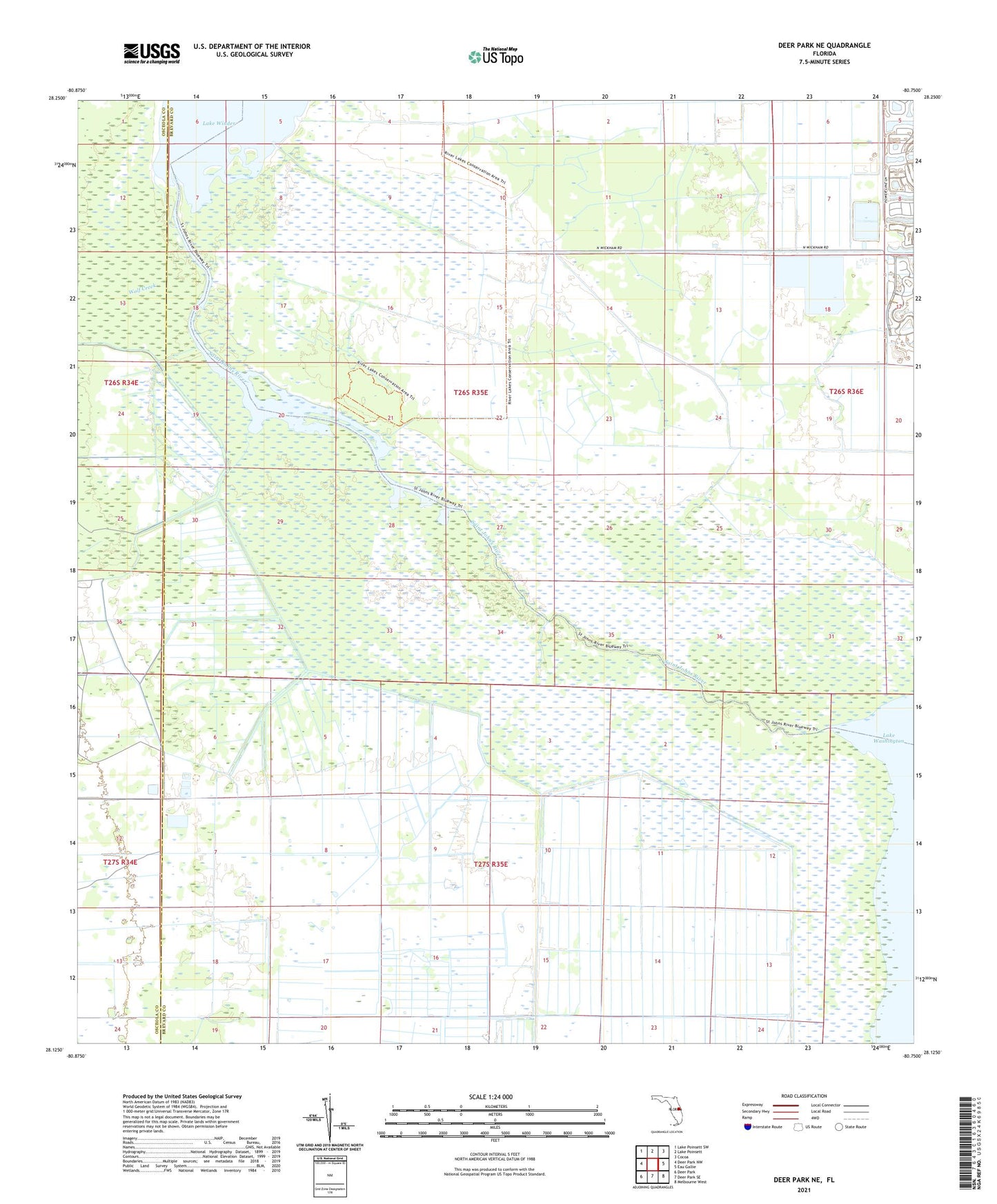
2024 topographic map quadrangle Deer Park NE in the state of Florida. Scale: 1:24000. Based on the newly updated USGS 7.5' US Topo map series, this map is in the following counties: Brevard, Osceola. The map contains contour data, water features, and other items you are used to seeing on USGS maps, but also has updated roads and other features. This is the next generation of topographic maps. Printed on high-quality waterproof paper with UV fade-resistant inks.
Quads adjacent to this one:
West: Deer Park NW
Northwest: Lake Poinsett SW
North: Lake Poinsett
Northeast: Cocoa
East: Eau Gallie
Southeast: Melbourne West
South: Deer Park SE
Southwest: Deer Park
This map covers the same area as the classic USGS quad with code o28080b7.
Contains the following named places: Brevard County Utilities Department South Central Regional Wastewater Treatment Plant, Pennywash Creek, Wolf Creek, ZIP Code: 32940