
MyTopo
Lake Tohopekaliga Florida US Topo Map
Couldn't load pickup availability
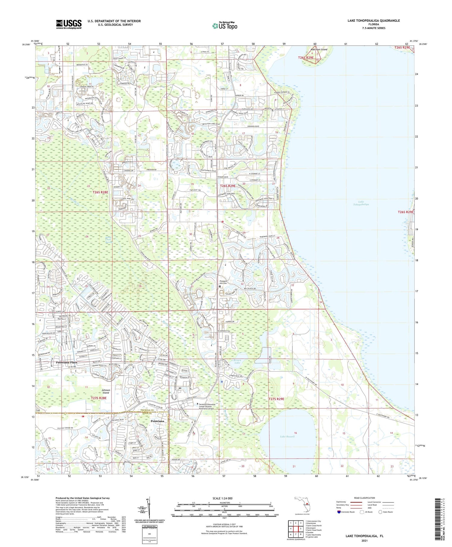
2024 topographic map quadrangle Lake Tohopekaliga in the state of Florida. Scale: 1:24000. Based on the newly updated USGS 7.5' US Topo map series, this map is in the following counties: Osceola, Polk. The map contains contour data, water features, and other items you are used to seeing on USGS maps, but also has updated roads and other features. This is the next generation of topographic maps. Printed on high-quality waterproof paper with UV fade-resistant inks.
Quads adjacent to this one:
West: Davenport
Northwest: Intercession City
North: Kissimmee
Northeast: Saint Cloud North
East: Saint Cloud South
Southeast: Cypress Lake
South: Lake Hatchineha
Southwest: Dundee
This map covers the same area as the classic USGS quad with code o28081b4.
Contains the following named places: Brown Lake, Cypress Cove Mobile Home Park, Indian Springs Golf and Tennis Club, Johnson, Kissimmee Division, Lake Russell, Lake Toho Resort Mobile Home Park, Lake Tohopekaliga, Makinson Island, Osceola County Fire Rescue and Emergency Medical Services Department Station 64, Osceola County Sheriff's Office South, Osceola Department of Fire and Emergency Medical Services Station 65, Pleasant Hill Cemetery, Pleasant Hill Village Mobile Home Park, Poinciana, Poinciana Library, Poinciana Place, Poinciana Post Office, Poinciana Utilities Sewage Treatment Plant Number 3, Polk County Fire Rescue Station 670 Solvita, Saint Rose of Lima Catholic Church, Savanna Club Golf Course, The New Jerusalem Church, ZIP Codes: 34746, 34758


