MyTopo
Davenport Florida US Topo Map
Couldn't load pickup availability
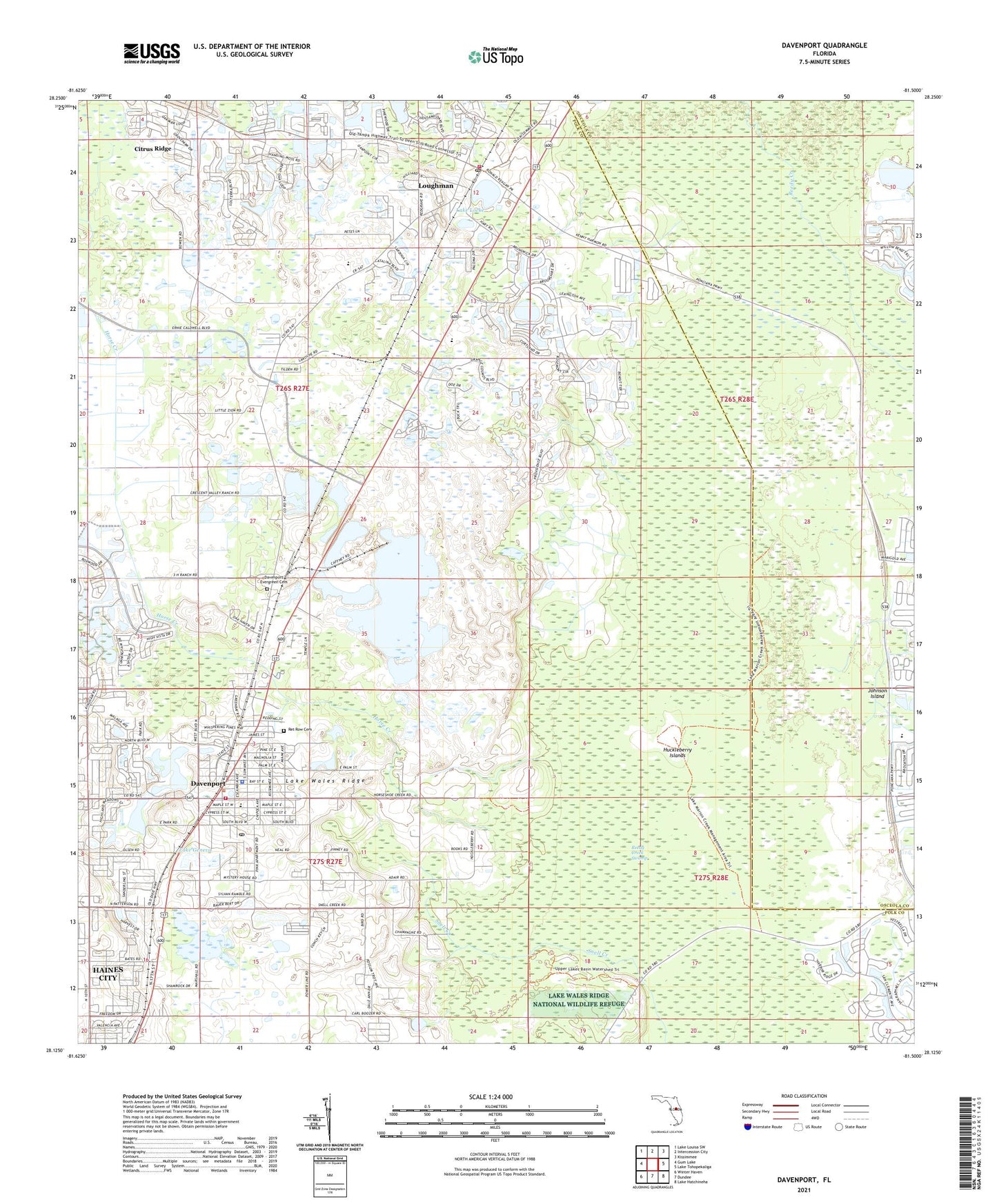
2024 topographic map quadrangle Davenport in the state of Florida. Scale: 1:24000. Based on the newly updated USGS 7.5' US Topo map series, this map is in the following counties: Polk, Osceola. The map contains contour data, water features, and other items you are used to seeing on USGS maps, but also has updated roads and other features. This is the next generation of topographic maps. Printed on high-quality waterproof paper with UV fade-resistant inks.
Quads adjacent to this one:
West: Gum Lake
Northwest: Lake Louisa SW
North: Intercession City
Northeast: Kissimmee
East: Lake Tohopekaliga
Southeast: Lake Hatchineha
South: Dundee
Southwest: Winter Haven
This map covers the same area as the classic USGS quad with code o28081b5.
Contains the following named places: Belyew Trailer Park, City of Davenport, Cobblestone Country Club, Davenport, Davenport City Hall, Davenport Elementary School, Davenport Evergreen Cemetery, Davenport Fire Department, Davenport Mobile Estates, Davenport Police Department, Davenport Post Office, Gator Airpark, Hilliard Mobile Home Park, Horse Creek, Huckleberry Islands, Lake Davenport, Lake Geneva, Lake Locke, Lewis W Mathews Memorial Sports Complex, Little Zion Church, Loughman, Loughman Census Designated Place, Loughman Post Office, Oak Haven Mobile Home Park, Polk County Fire Department Station 230 Loughman, Polk County Sheriff's Office Community Policing Unit Loughman, Reedy Creek Swamp, Ret Row Cemetery, Spring Lake Mobile Home Park, Sunlake Terrace Estates Mobile Home Park, Three Worlds Mobile Home Resort, Vertagreen Railroad Station, WPCV-FM (Winter Haven), ZIP Code: 33837