MyTopo
Matlacha Florida US Topo Map
Couldn't load pickup availability
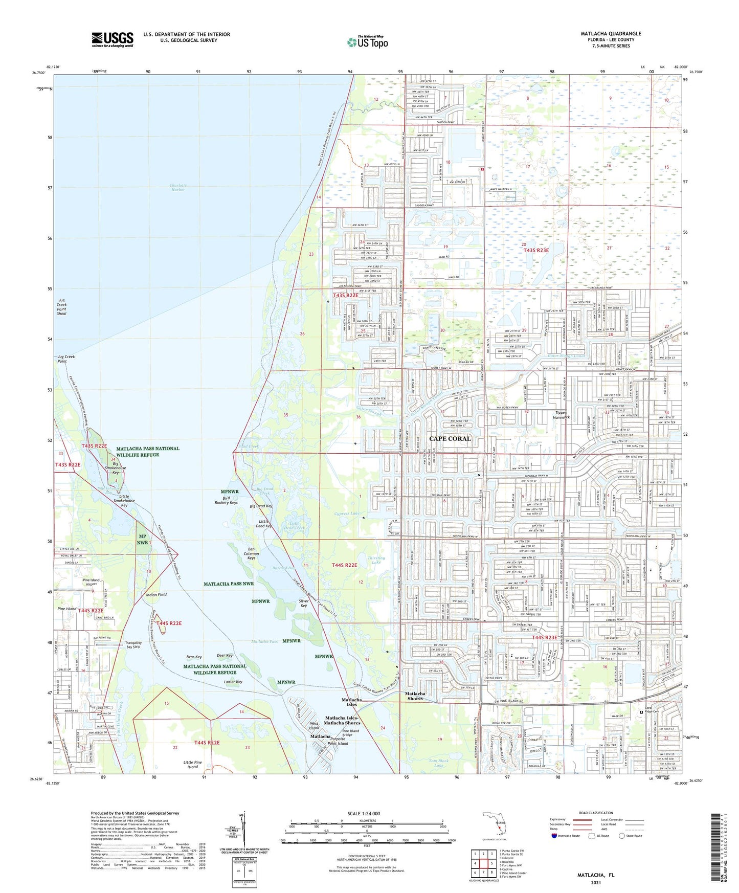
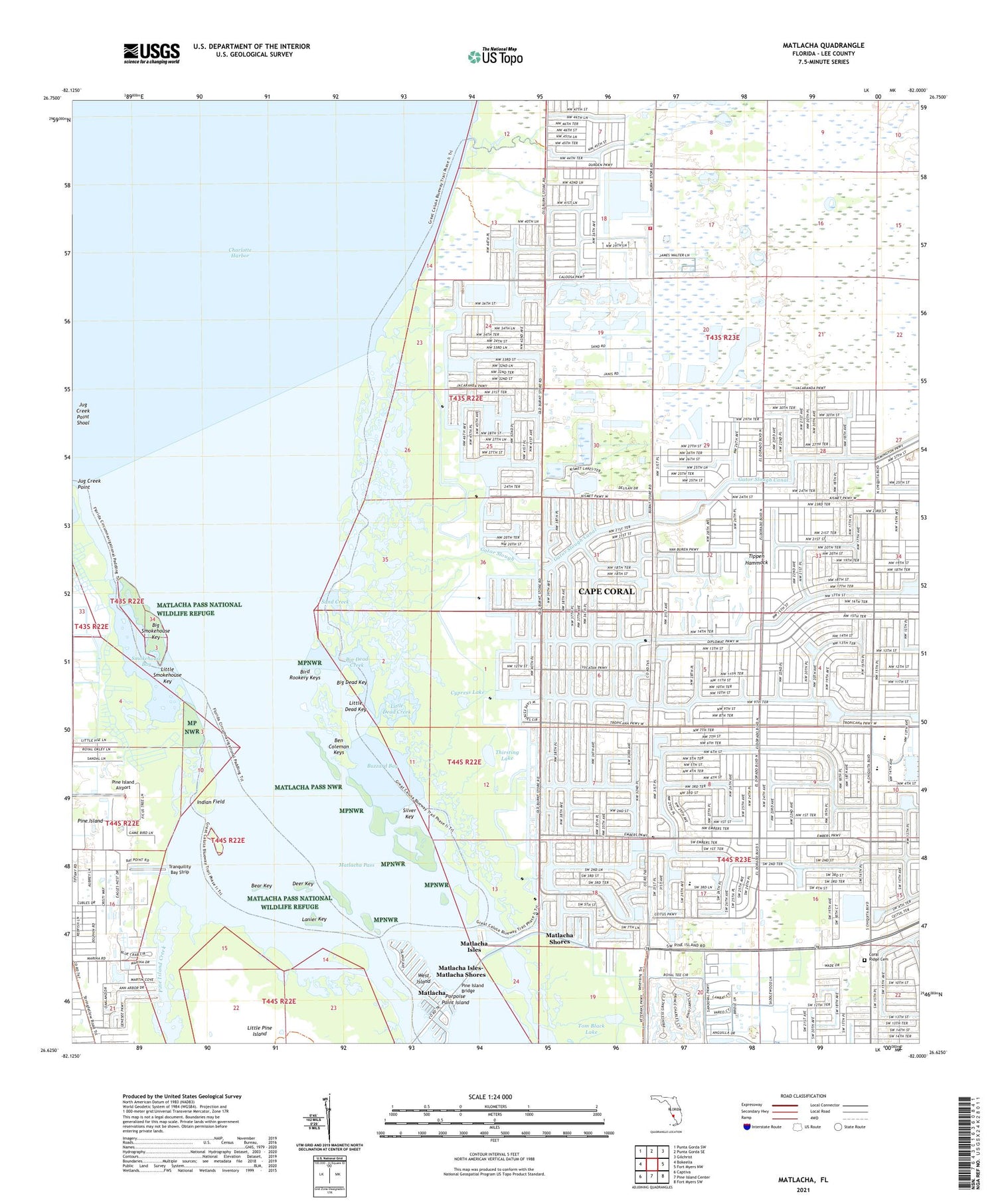
2024 topographic map quadrangle Matlacha in the state of Florida. Scale: 1:24000. Based on the newly updated USGS 7.5' US Topo map series, this map is in the following counties: Lee. The map contains contour data, water features, and other items you are used to seeing on USGS maps, but also has updated roads and other features. This is the next generation of topographic maps. Printed on high-quality waterproof paper with UV fade-resistant inks.
Quads adjacent to this one:
West: Bokeelia
Northwest: Punta Gorda SW
North: Punta Gorda SE
Northeast: Gilchrist
East: Fort Myers NW
Southeast: Fort Myers SW
South: Pine Island Center
Southwest: Captiva
This map covers the same area as the classic USGS quad with code o26082f1.
Contains the following named places: Bear Key, Ben Coleman Keys, Big Dead Creek, Big Dead Key, Big Smokehouse Key, Bird Rookery Keys, Broken Woods Country Club, Buzzard Bay, Cape Coral Church of Christ, Cape Coral Division, Cape Coral Fire Department Station 7, Coral Gate Shopping Center, Coral Pointe Shopping Center, Cypress Lake, Deer Key, First Baptist Church of Matlacha, Gator Slough, Indian Field, Jug Creek Point, Lanier Key, Little Cypress Golf Club, Little Dead Creek, Little Dead Key, Little Smokehouse Key, Matlacha, Matlacha Census Designated Place, Matlacha Isles, Matlacha Isles-Matlacha Shores Census Designated Place, Matlacha Pass Aquatic Preserve, Matlacha Post Office, Matlacha Shores, Pine Island Airport, Pine Island Bridge, Pine Island Church, Pine Island Lookout Tower, Porpoise Point Island, Sand Creek, Silver Key, Smokehouse Bay, The Church of Jesus Christ of Latter Day Saints, Thirsting Lake, Tippen Hammock, Tom Black Lake, Tranquility Bay Strip, WAKS-FM (Cape Coral), WDCQ-AM (Pine Island Center), West Island, ZIP Codes: 33991, 33993