MyTopo
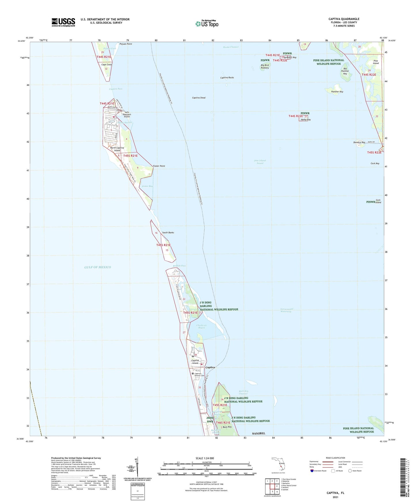
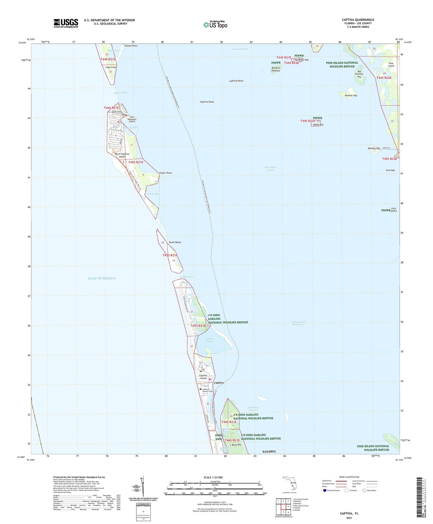
Captiva Florida US Topo Map
Couldn't load pickup availability
2025 topographic map quadrangle Captiva in the state of Florida. Scale: 1:24000. Based on the newly updated USGS 7.5' US Topo map series, this map is in the following counties: Lee. The map contains contour data, water features, and other items you are used to seeing on USGS maps, but also has updated roads and other features. This is the next generation of topographic maps. Printed on high-quality waterproof paper with UV fade-resistant inks.
Quads adjacent to this one:
Northwest: Port Boca Grande
North: Bokeelia
Northeast: Matlacha
East: Pine Island Center
Southeast: Sanibel
South: Wulfert
This map covers the same area as the classic USGS quad with code o26082e2.
Contains the following named places: Benedict Key, Big Bird Rookery, Big Panther Key, Braynerd Bayou, Buck Key, Buck Key Channel, Captiva, Captiva Fire Control District Fire Station, Captiva Helistop, Captiva Island, Captiva Pass, Captiva Post Office, Captiva Rocks, Captiva Shoal, Cayo Costa, Chadwick Bayou, Chapel by the Sea, Cork Island, Cork Key, Demere Key, Demere Landing, Foster Bay, Foster Point, Hemp Key, Henderson Heliport, North Captiva Island, Panther Key, Pejuan Cove, Pejuan Point, Pine Island Division, Pine Island Sound, Redfish Pass, Roosevelt Channel, Safety Harbor, Salty Approach Airport, Sanibel Island Division, South Banks, Upper Captiva, Upper Captiva Fire and Rescue District, White Rock Shoal, ZIP Codes: 33924, 33945, 33956