
MyTopo
Punta Gorda SW Florida US Topo Map
Couldn't load pickup availability
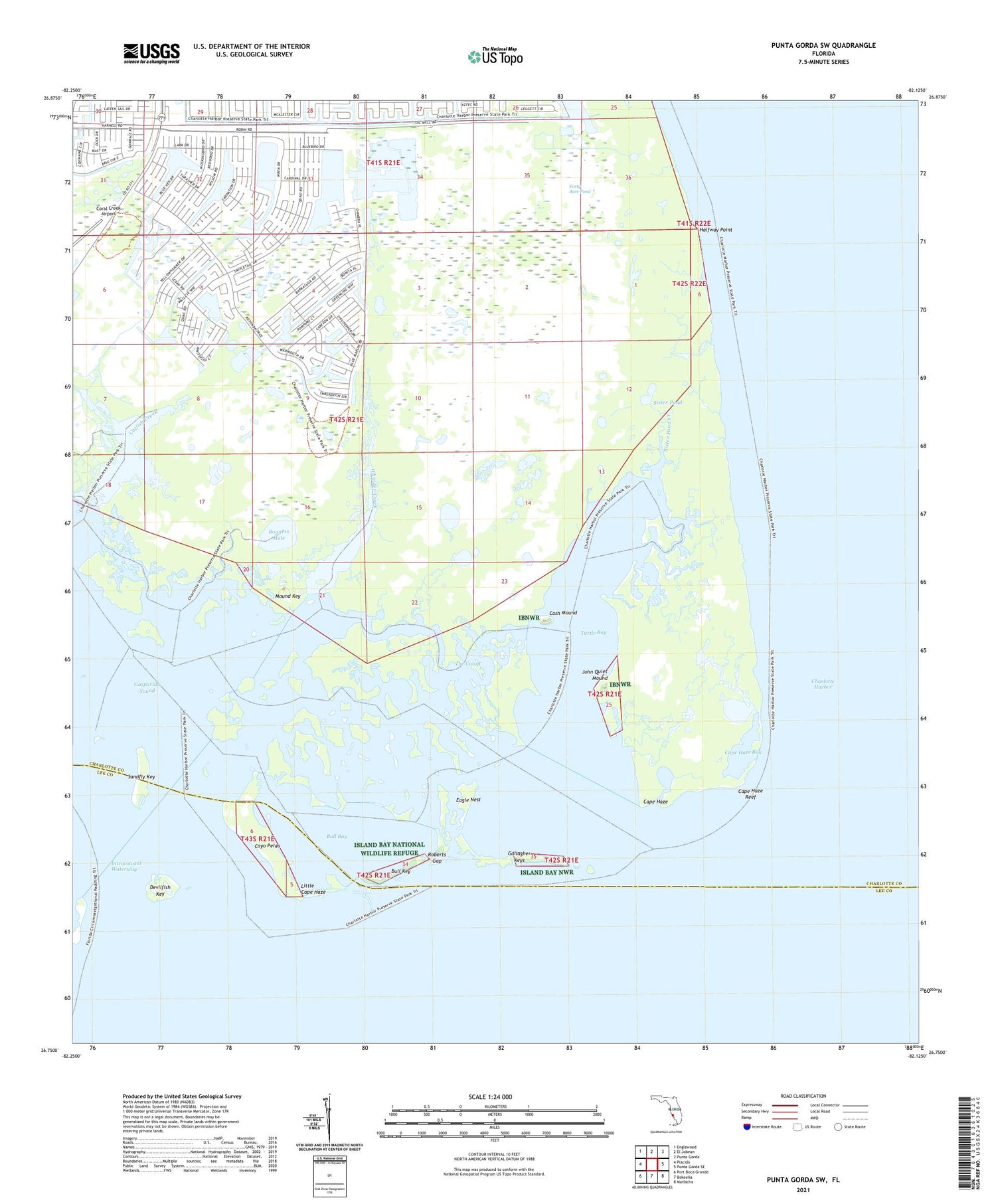
2024 topographic map quadrangle Punta Gorda SW in the state of Florida. Scale: 1:24000. Based on the newly updated USGS 7.5' US Topo map series, this map is in the following counties: Charlotte, Lee. The map contains contour data, water features, and other items you are used to seeing on USGS maps, but also has updated roads and other features. This is the next generation of topographic maps. Printed on high-quality waterproof paper with UV fade-resistant inks.
Quads adjacent to this one:
West: Placida
Northwest: Englewood
North: El Jobean
Northeast: Punta Gorda
East: Punta Gorda SE
Southeast: Matlacha
South: Bokeelia
Southwest: Port Boca Grande
This map covers the same area as the classic USGS quad with code o26082g2.
Contains the following named places: Boggess Hole, Bull Bay, Bull Key, Cape Haze, Cape Haze Bay, Cape Haze Reef, Cape Haze-Gasparilla Sound Aquatic Preserve, Cash Mound, Catfish Creek, Cayo Pelau, Charlotte Harbor, Devilfish Key, Eagle Nest, Forty Acre Pond, Gallagher Keys, Halfway Point, Island Bay National Wildlife Refuge, Island Bay Wilderness, John Quiet Mound, Little Cape Haze, Mound Key, Roberts Gap, Sandfly Key, Sister Pond, Sister Pond Creek, The Cutoff, Three Sisters Island, Turtle Bay, WEEJ-FM (Port Charlotte), Whidden Creek


