MyTopo
Mayport Florida US Topo Map
Couldn't load pickup availability
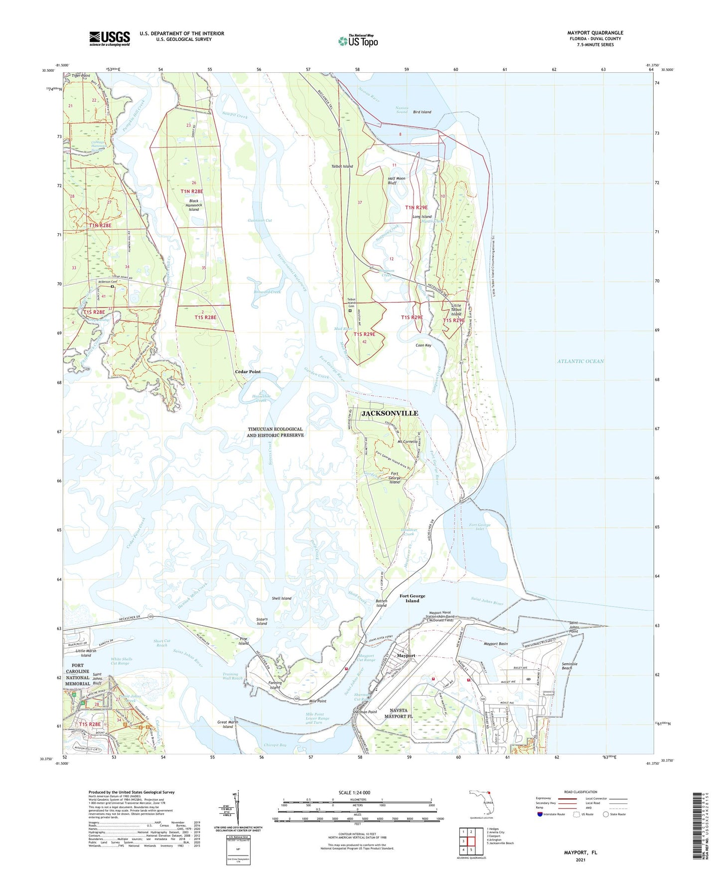
2024 topographic map quadrangle Mayport in the state of Florida. Scale: 1:24000. Based on the newly updated USGS 7.5' US Topo map series, this map is in the following counties: Duval. The map contains contour data, water features, and other items you are used to seeing on USGS maps, but also has updated roads and other features. This is the next generation of topographic maps. Printed on high-quality waterproof paper with UV fade-resistant inks.
Quads adjacent to this one:
West: Eastport
Northwest: Hedges
North: Amelia City
South: Jacksonville Beach
Southwest: Arlington
This map covers the same area as the classic USGS quad with code o30081d4.
Contains the following named places: Anderson Cemetery, Andrew Dewees Grant, Atlantic Marine Pier, Batten Island, Big Talbot Island State Park, Bird Island, Broward Creek, Cabbage Hammock Swamp, Cedar Point, Cedar Point Creek, Chicopit Bay, Colorinda Creek, Coon Key, Deep Creek, East Mayport, Fanning Island, Fort Caroline National Memorial, Fort George Inlet, Fort George Island, Fort George Island Cultural State Park, Fort George River, Fulton, Garden Creek, Gerald Peck Wharf, Great Marsh Island, Greys Swamp, Gunnison Cut, Half Moon Bluff, Hannah Mills Creek, Haulover Creek, Horseshoe Creek, Huguenot Memorial Park, Jacksonville Fire and Rescue Department Station 40, John F Brown Grant, Kingsley Plantation State Historical Site, Little Marsh Island, Little Talbot Island, Little Talbot Island State Park, Long Island, Marine Science Education Center, Mayport, Mayport Basin, Mayport Basin Range Front Light, Mayport Cut Range, Mayport Naval Station (Adm David L McDonald Field), Mayport Naval Station Post Office, Mayport Yacht Basin and Wharves, Mile Point, Mile Point Lower Range and Turn, Montys Marina Wharf, Mosquito Control Heliport, Mount Cornelia, Mud River, Muncillia House, Myrtle Creek, Naval Station Mayport, Naval Station Mayport Fire Department, Naval Station Mayport Fire Department Station 2 Crash, Naval Station Mayport Fire Prevention and Training, Naval Station Mayport Firefighting School, Navy Fuel Pier Light, North Jetty, Pine Island, Ribault Monument, Round Pond, Saint George Church, Saint Johns Bluff, Saint Johns Creek, Saint Johns Light, Saint Johns Point, Saint Johns River, Seminole Beach, Shad Creek, Shell Island, Sherman Cut Range, Sherman Point, Short Cut Reach, Simpson Creek, Sisters Creek, Sisters Island, South Jetty, Talbot Island, Talbot Island Cemetery, Timucuan Ecological and Historical Preserve, Training Wall Reach, United States Coast Guard Base Mayport Wharf, Wards Bank, White Shells Cut Range, William Berrie Grant, William Fitzpatrick Grant, Zephaniah Kingsley Grant, ZIP Codes: 32227, 32228


