MyTopo
McDavid Florida US Topo Map
Couldn't load pickup availability
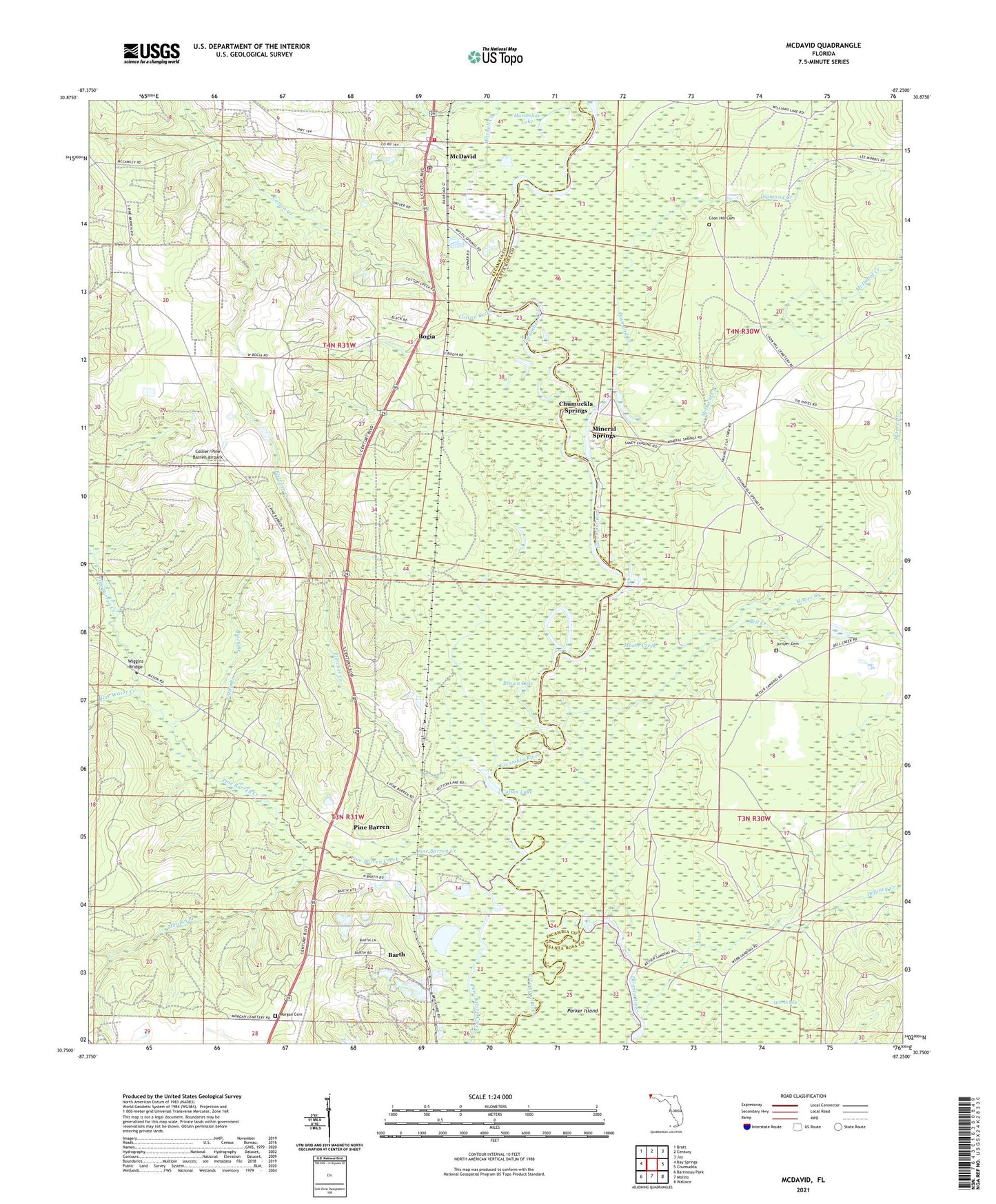
2024 topographic map quadrangle McDavid in the state of Florida. Scale: 1:24000. Based on the newly updated USGS 7.5' US Topo map series, this map is in the following counties: Escambia, Santa Rosa. The map contains contour data, water features, and other items you are used to seeing on USGS maps, but also has updated roads and other features. This is the next generation of topographic maps. Printed on high-quality waterproof paper with UV fade-resistant inks.
Quads adjacent to this one:
West: Bay Springs
Northwest: Bratt
North: Century
Northeast: Jay
East: Chumuckla
Southeast: Wallace
South: Molino
Southwest: Barrineau Park
This map covers the same area as the classic USGS quad with code o30087g3.
Contains the following named places: Andrew Mitchell Grant, Barth, Bell Creek, Black Branch, Blue Water Creek, Bogia, Brown Lake, Canoe Creek, Celestino Gonzalez Grant, Chumuckla Springs, Chumuckla Springs Post Office, Collier/Pine Barren Airpark, Coon Hill Cemetery, Cotton Creek, Cotton Lake, Delaney Creek, Diamond Creek, Escambia River State Wildlife Management Area, Fletcher Creek, Gully Branch, Henry Michalet Grant, Henry O'Neal Grant, Horseshoe Lake, John Ruiz Grant, Juniper Cemetery, Juniper Church, Mc David Post Office, McDavid, McDavid Church, McDavid Creek, McDavid School, McDavid Volunteer Fire Department, Mineral Springs, Moore Creek, Morgan Branch, Morgan Cemetery, Pine Barren, Rays Chapel, Thomas Thrifts Grant, V Ordosgoity Grant, Wiggins Bridge, WKGT-FM (Century)