MyTopo
Jay Florida US Topo Map
Couldn't load pickup availability
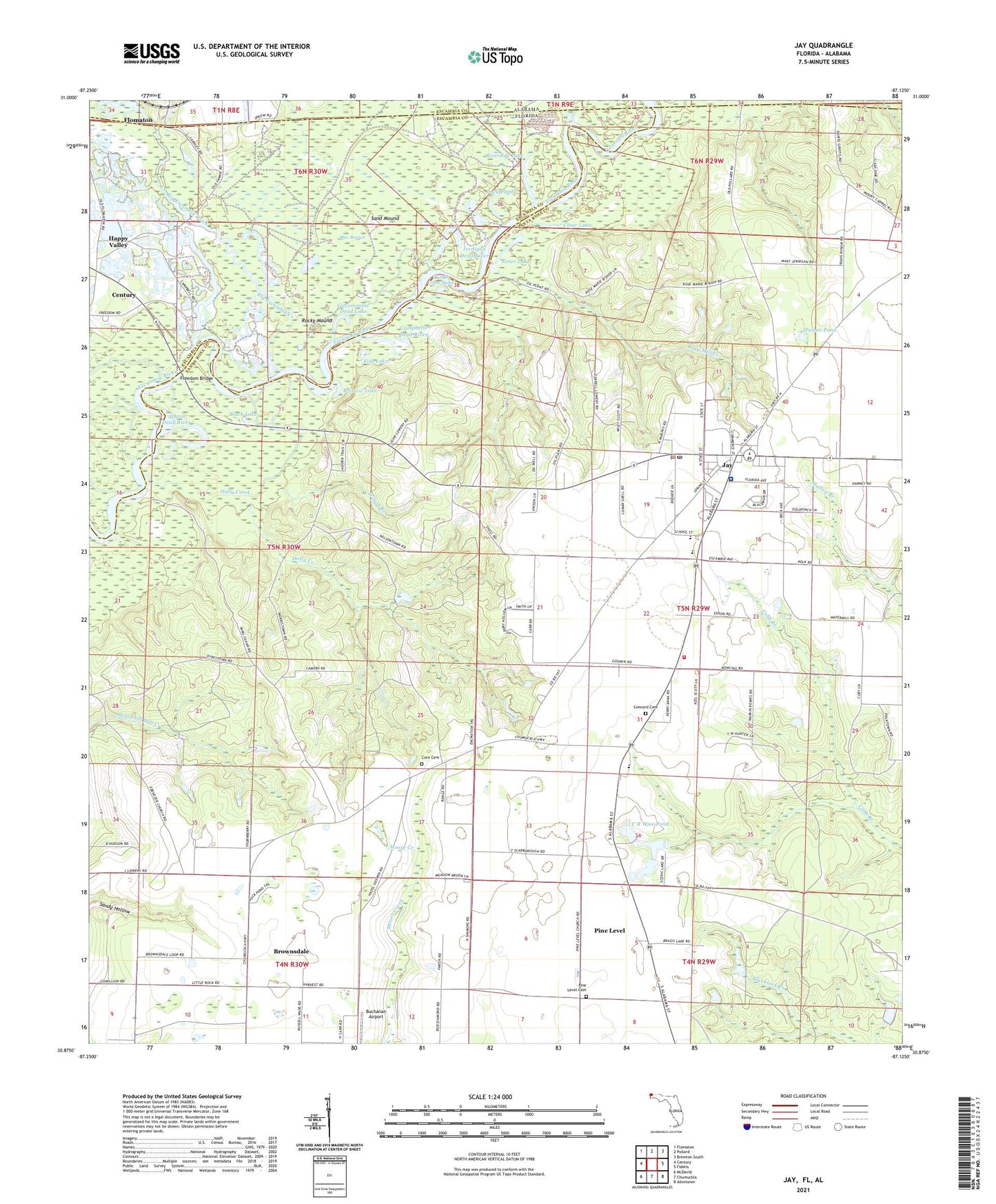
2024 topographic map quadrangle Jay in the state of Florida. Scale: 1:24000. Based on the newly updated USGS 7.5' US Topo map series, this map is in the following counties: Santa Rosa, Escambia. The map contains contour data, water features, and other items you are used to seeing on USGS maps, but also has updated roads and other features. This is the next generation of topographic maps. Printed on high-quality waterproof paper with UV fade-resistant inks.
Quads adjacent to this one:
West: Century
Northwest: Flomaton
North: Pollard
Northeast: Brewton South
East: Fidelis
Southeast: Allentown
South: Chumuckla
Southwest: McDavid
This map covers the same area as the classic USGS quad with code o30087h2.
Contains the following named places: Allen Lookout Tower, Ashton Dead River, Big Escambia Creek, Black Lake, Blue Branch, Bray Mill Creek, Bristow Lake, Brownsdale, Brownsdale Census Designated Place, Buchanan Airport, C R Wise Pond, Campbells Dead River, Clear Lake, Concord Church, Concord Primitive Baptist Church Cemetery, Conecuh River, Cora Baptist Church Cemetery, Cora Church, Douglas Odoms Flying Service Airport, Duck Pond, Ebenezer Church, Fish Lake, Freedom Bridge, Government Dead Lake, Happy Valley, Holly Creek, Hutson Pond, Jay, Jay Airport, Jay Division, Jay Elementary School, Jay Fire Department Station 27, Jay High School, Jay Hospital, Jay Post Office, Jernigan Dead River, Jones Lake, Little Escambia Creek, Littleburg Mason Grant, New Testament Church, Oyster Lodge, Pine Level Cemetery, Pine Level Census Designated Place, Pine Level Church, R V Jordan Airport, Riverside Lake, Rocky Mound, Sand Mound, Santa Rosa County Sheriff's Office - District 5, Smith Mill Pond, Town of Jay, Turtle Cove Lake, Wilson Branch, ZIP Code: 32565