MyTopo
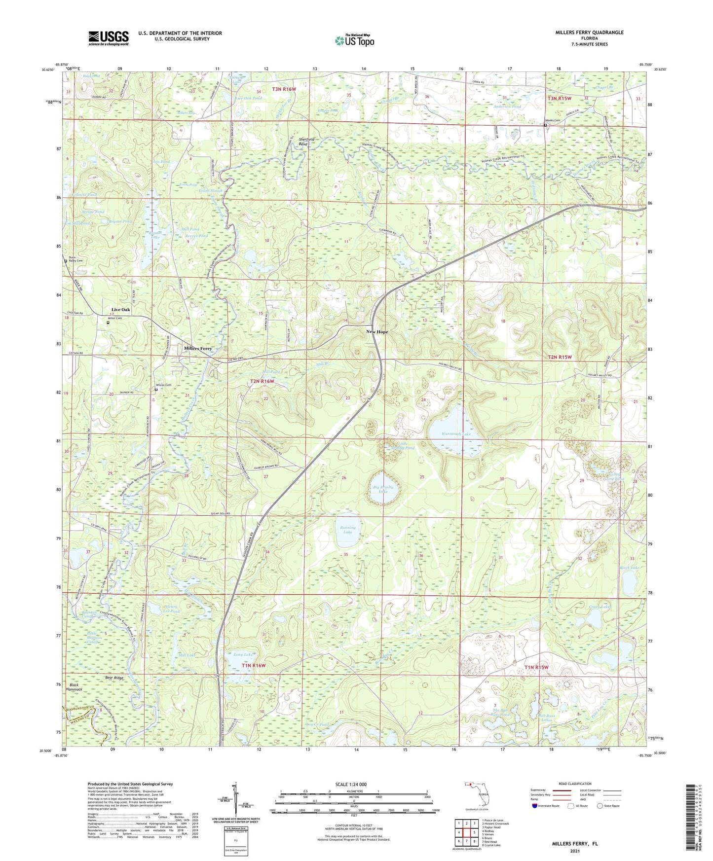
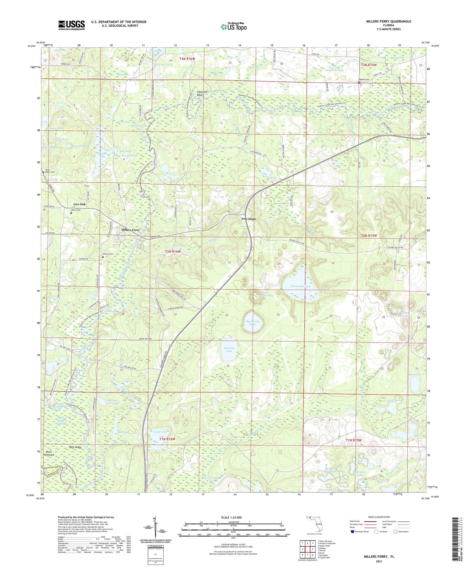
Millers Ferry Florida US Topo Map
Couldn't load pickup availability
2024 topographic map quadrangle Millers Ferry in the state of Florida. Scale: 1:24000. Based on the newly updated USGS 7.5' US Topo map series, this map is in the following counties: Washington, Walton. The map contains contour data, water features, and other items you are used to seeing on USGS maps, but also has updated roads and other features. This is the next generation of topographic maps. Printed on high-quality waterproof paper with UV fade-resistant inks.
Quads adjacent to this one:
West: Redbay
Northwest: Ponce de Leon
North: Hinsons Crossroads
Northeast: Poplar Head
East: Vernon
Southeast: Crystal Lake
South: Red Head
Southwest: Bruce
This map covers the same area as the classic USGS quad with code o30085e7.
Contains the following named places: Anderson Pond, Bear Bay Creek, Bear Ridge, Big Brushy Lake, Black Hammock, Black Lake, Bob Russ Lakes, Bonnet Lake, Boynton Cutoff, Brink Hill School, Bryant Pond, Bunker Donation, Chapel Branch, Cravy Lakes, Cypress Pond, Deep Edge Lake, Dunn - Raley Cemetery, Evans Pond, Evans Slough, Fortune Lake, Henry Lee Pond, Hogpen Pond, Jim Pond, Kolmetz Pond, Liberty Church, Little Boynton Cutoff, Little Brushy Pond, Live Oak, Live Oak Pond, Log Creek Pond, Long Lake, Menge Pond, Mill Branch, Mill Lake, Mill Pond, Miller Cemetery, Millers Bay, Millers Ferry, Millers Ferry Post Office, New Hope, Norum, Raley Pond, Reedy Branch, Reeves Pond, Running Lake, Saint Lukes Church, Saint Lukes School, Shaky Joe Branch, Shell Ferry Landing, Sherfield Bend, Spring Run Landing, Still Pond, The Bob Russ Pond, Valley Long Pond, Warmouth Lake, Weeks Cemetery, Wilcox Cemetery, Williams Branch, ZIP Code: 32462