MyTopo
Bruce Florida US Topo Map
Couldn't load pickup availability
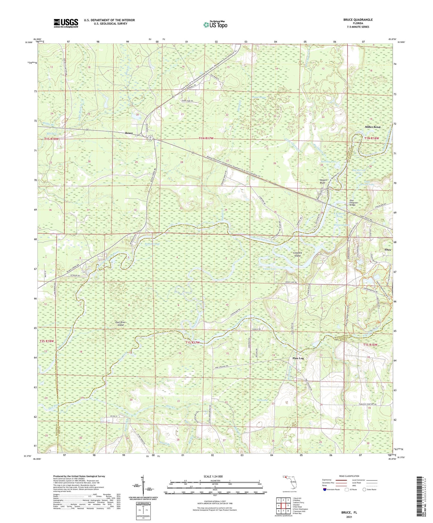
2024 topographic map quadrangle Bruce in the state of Florida. Scale: 1:24000. Based on the newly updated USGS 7.5' US Topo map series, this map is in the following counties: Walton, Washington, Bay. The map contains contour data, water features, and other items you are used to seeing on USGS maps, but also has updated roads and other features. This is the next generation of topographic maps. Printed on high-quality waterproof paper with UV fade-resistant inks.
Quads adjacent to this one:
West: Bunker
Northwest: Rock Hill
North: Redbay
Northeast: Millers Ferry
East: Red Head
Southeast: West Bay
South: Seminole Hills
Southwest: Point Washington
This map covers the same area as the classic USGS quad with code o30085d8.
Contains the following named places: Big Cypress Creek, Big Morrell Lake, Boston Cutoff, Boutwell Branch, Bridge Branch, Bruce, Cedar Tree Landing, Cowford Ferry, Cowford Island, Crews Lake, Dismal Creek, Dismal Swamp, East River Island, Ebro School, Howell Bluff, Little Black Creek, Little Cypress Creek, Little Morrell Lake, Mill Branch, Miller Bend, Miller Landing, Morrow Lake, Nobleknob Camp, Oakledge Camp, Olan Ferguson Bridge, Otter Creek, Pine Log, Pine Log Creek, R B Spires Pond, Reason Lakes, Reddick Camp, Rooks Bluff Camp, Sewell Branch, Stealing Lake, Strickland Landing, Threemile Branch, Titi Swamp, Town of Ebro, Wise Bluff, Wise Camp, ZIP Code: 32437