MyTopo
Mims Florida US Topo Map
Couldn't load pickup availability
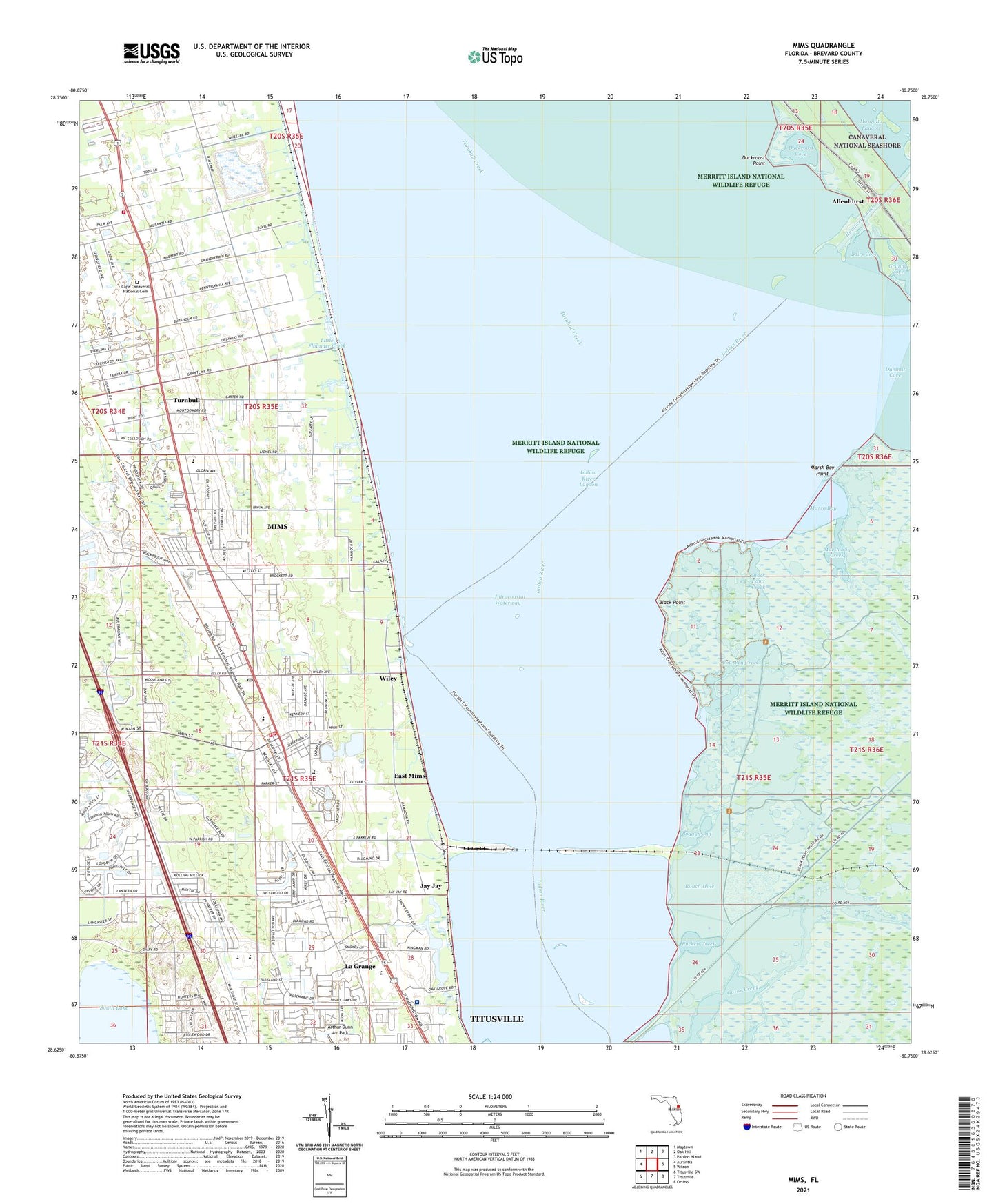
2024 topographic map quadrangle Mims in the state of Florida. Scale: 1:24000. Based on the newly updated USGS 7.5' US Topo map series, this map is in the following counties: Brevard. The map contains contour data, water features, and other items you are used to seeing on USGS maps, but also has updated roads and other features. This is the next generation of topographic maps. Printed on high-quality waterproof paper with UV fade-resistant inks.
Quads adjacent to this one:
West: Aurantia
Northwest: Maytown
North: Oak Hill
Northeast: Pardon Island
East: Wilson
Southeast: Orsino
South: Titusville
Southwest: Titusville SW
This map covers the same area as the classic USGS quad with code o28080f7.
Contains the following named places: Allenhurst, Astronaut High School, Bairs Cove, Black Point, Black Point Creek, Boggy Pond, Bradley Reserve Post Light, Brevard Community College, Brevard Community College - Titusville Campus, Brevard Community College Titusville Campus Library Resource Center, Brevard Community College Titusville Campus Maintenance Building, Brevard Community College Titusville Campus N Earl Jones Building, Brevard Community College Titusville Campus Student Center, Brevard County Fire Rescue Station 21, Brevard County Fire Rescue Station 22, Cow Pen Creek, Crack of Dawn Mobile Home Park, Domingo Acosta Grant, Duckroost Cove, Duckroost Point, East Mims, Faith Baptist Church, First Baptist Church of Melbourne, First Baptist Church of Mims, Greater Saint James Missionary Baptist Church, Haulover Canal, Holiday Village Travel Park, Holy Name of Jesus Catholic School, Holy Spirit Catholic Church, Hosanna Mims Church of God, Hospital Heliport, Inter-City Christian Academy, Intercoastal Estates Mobile Home Park, Islander Alliance Church, James Madison Middle School, Jay Jay, La Grange, Learning Tree School, Little Flounder Creek, Marsh Bay, Marsh Bay Creek, Marsh Bay Point, Mayacoo Lakes Country Club, Mims, Mims Census Designated Place, Mims Elementary School, Mims Post Office, Mims United Methodist Church, Mims Volunteer Fire Department, Minnear's Mobile Home Park, Missile View Mobile Home Park, Mount Calvary Church of God in Christ, New Fellowship Baptist Church, Normandy School, Northgate Mobile Home Park, Northside Baptist Church, Oak Park Elementary School, Paces Landing, Parrish Medical Center, Pinewood Elementary School, Pinewood Mobile Village, Puckett Creek, Roach Hole, Saint Andrews United Methodist Church, Saint John Primitive Baptist Church, Saint Mary Baptist Church, Saint Marys Catholic School, Seventh Day Adventist Church, Shiloh African Methodist Episcopal Church, Southway Plaza, Tabernacle Baptist Church, Temple Baptist Church, Titusville Division, Turnbull, Valencia Golf Course, Way of Life Baptist Church, Westwood Mobile Park, Wiley, Woodlands Park Mobile Home Park, ZIP Code: 32796