MyTopo
Monteocha Florida US Topo Map
Couldn't load pickup availability
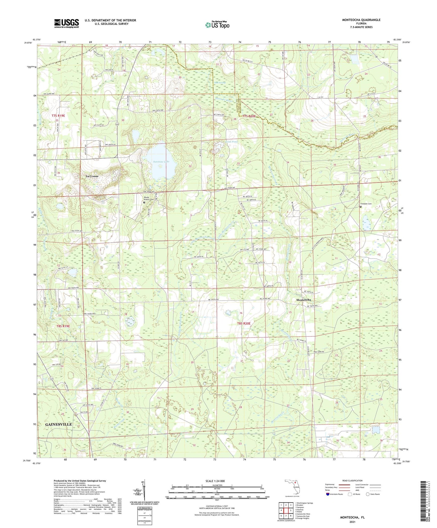
2024 topographic map quadrangle Monteocha in the state of Florida. Scale: 1:24000. Based on the newly updated USGS 7.5' US Topo map series, this map is in the following counties: Alachua, Bradford. The map contains contour data, water features, and other items you are used to seeing on USGS maps, but also has updated roads and other features. This is the next generation of topographic maps. Printed on high-quality waterproof paper with UV fade-resistant inks.
Quads adjacent to this one:
West: Alachua
Northwest: Worthington Springs
North: Brooker
Northeast: Sampson
East: Waldo
Southeast: Orange Heights
South: Gainesville East
Southwest: Gainesville West
This map covers the same area as the classic USGS quad with code o29082g3.
Contains the following named places: Apostolic Church, Atlas African Methodist Episcopal Church, Calvary Church, Country Crossroads Baptist Church, Freedom Cemetery, Freedom United Methodist Church, Gainesville Raceway, Greater Bell United Methodist Church, Jerusalem Church of God by Faith, Little Monteocha Creek, Monteocha, Monteocha Creek, Monteocha Park, Mud Swamp, New Jerusalem Church, New Life Christian Center Church, Old Jerusalem Baptist Church, Rhuda Branch, Rhuda Branch Cemetery, Rock Baptist Church, Sunshine Lake, Trout Pond, University of Florida Library, ZIP Code: 32609