MyTopo
Worthington Springs Florida US Topo Map
Couldn't load pickup availability
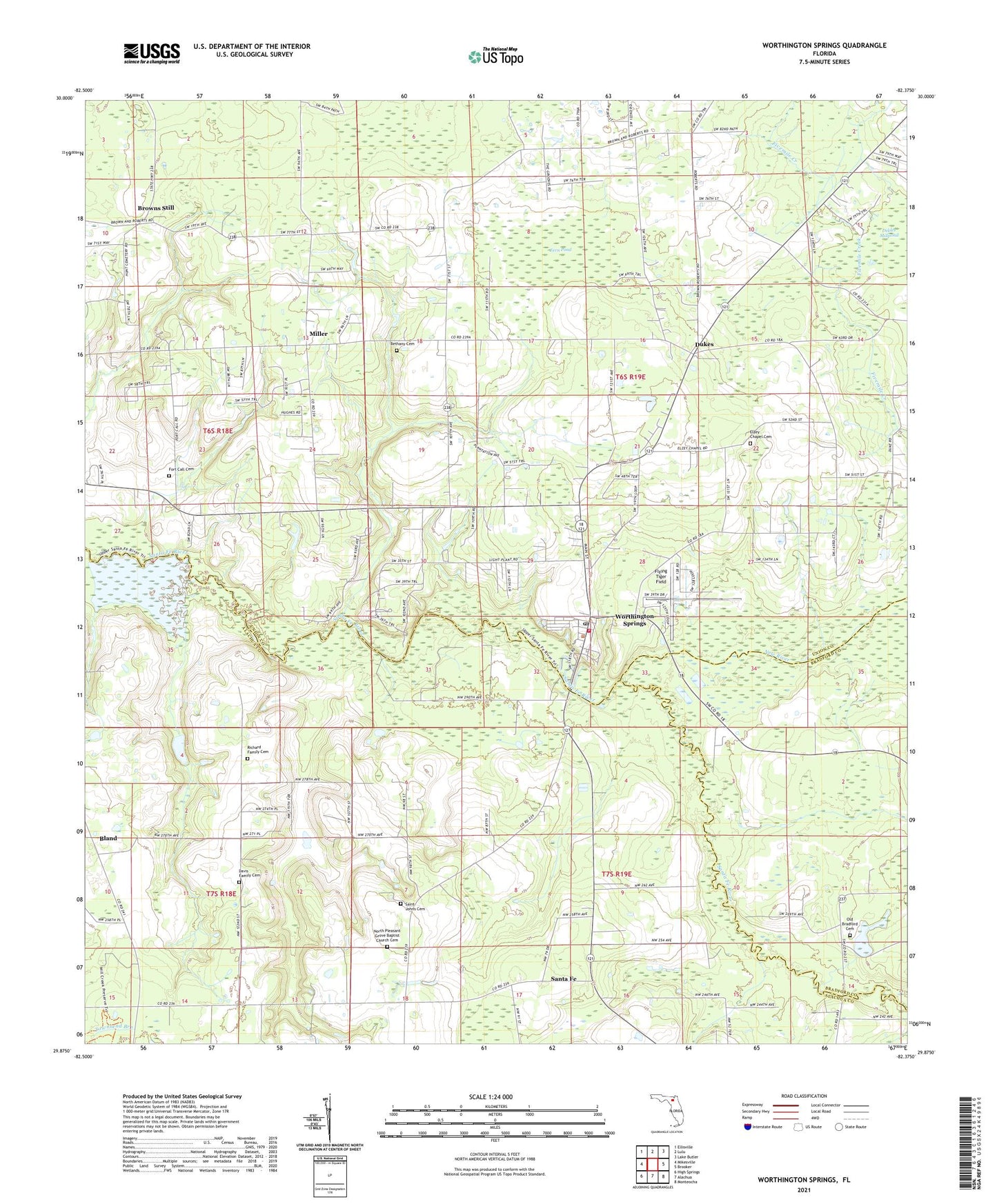
2024 topographic map quadrangle Worthington Springs in the state of Florida. Scale: 1:24000. Based on the newly updated USGS 7.5' US Topo map series, this map is in the following counties: Union, Alachua, Bradford. The map contains contour data, water features, and other items you are used to seeing on USGS maps, but also has updated roads and other features. This is the next generation of topographic maps. Printed on high-quality waterproof paper with UV fade-resistant inks.
Quads adjacent to this one:
West: Mikesville
Northwest: Ellisville
North: Lulu
Northeast: Lake Butler
East: Brooker
Southeast: Monteocha
South: Alachua
Southwest: High Springs
This map covers the same area as the classic USGS quad with code o29082h4.
Contains the following named places: Bethany Cemetery, Bland, Brown, Browns Still, Camp Chipola, Chastain-Seay Park, Dana, Davis Family Cemetery, Dekles Millpond, Dukes, Elzey Chapel Cemetery, Fern Pond, First United Methodist Church, Flying Tiger Field, Fort Call Cemetery, Harmony Free Will Baptist Church, J L Sanchez and Others Grant, Little Springs Primitive Baptist Church, Miller, Mount Pisgah Church, New Hope Church, New River, North Pleasant Grove Baptist Church, North Pleasant Grove Baptist Church Cemetery, Oak Grove Church, Old Bradford Cemetery, Richard Family Cemetery, Saint Johns Cemetery, Santa Fe, Santa Fe Baptist Church, Santa Fe River Ranch Airport, Sardis Baptist Church, St. Johns United Methodist Church, Timber Village Mobile Home Park, Town of Worthington Springs, Union County EMS/Fire Station 3, Worthington Springs, Worthington Springs Division, Worthington Springs Post Office, ZIP Code: 32697