MyTopo
Navarre Florida US Topo Map
Couldn't load pickup availability
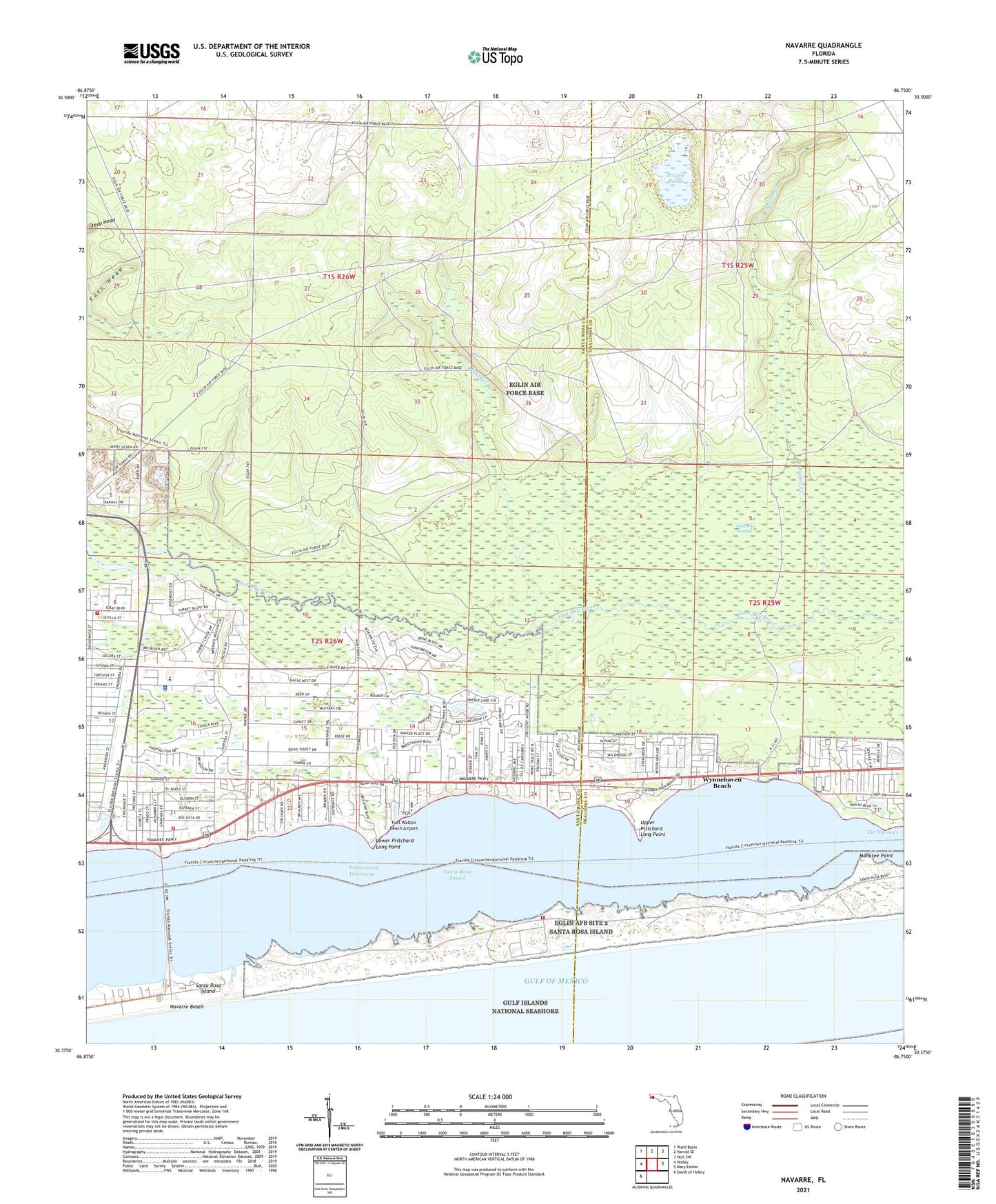
2025 topographic map quadrangle Navarre in the state of Florida. Scale: 1:24000. Based on the newly updated USGS 7.5' US Topo map series, this map is in the following counties: Santa Rosa, Okaloosa. The map contains contour data, water features, and other items you are used to seeing on USGS maps, but also has updated roads and other features. This is the next generation of topographic maps. Printed on high-quality waterproof paper with UV fade-resistant inks.
Quads adjacent to this one:
West: Holley
Northwest: Ward Basin
North: Harold SE
Northeast: Holt SW
East: Mary Esther
Southwest: South of Holley
This map covers the same area as the classic USGS quad with code o30086d7.
Contains the following named places: Eglin Air Force Base Fire Station Santa Rosa Island, Fort Walton Beach Airport, Holley Navarre Fire District Station 43, Holley Navarre Fire District Station 45, Lower Pritchard Long Point, Manatee Point, Navarre, Navarre Beach, Navarre Beach State Park, Panther Creek, Prairie Creek, Prairie Ponds, Pullum Pad Heliport, Santa Rosa County Sheriff's Office - District 2 Navarre, Santa Rosa Island, Upper Pritchard Long Point, Wynnehaven Beach