MyTopo
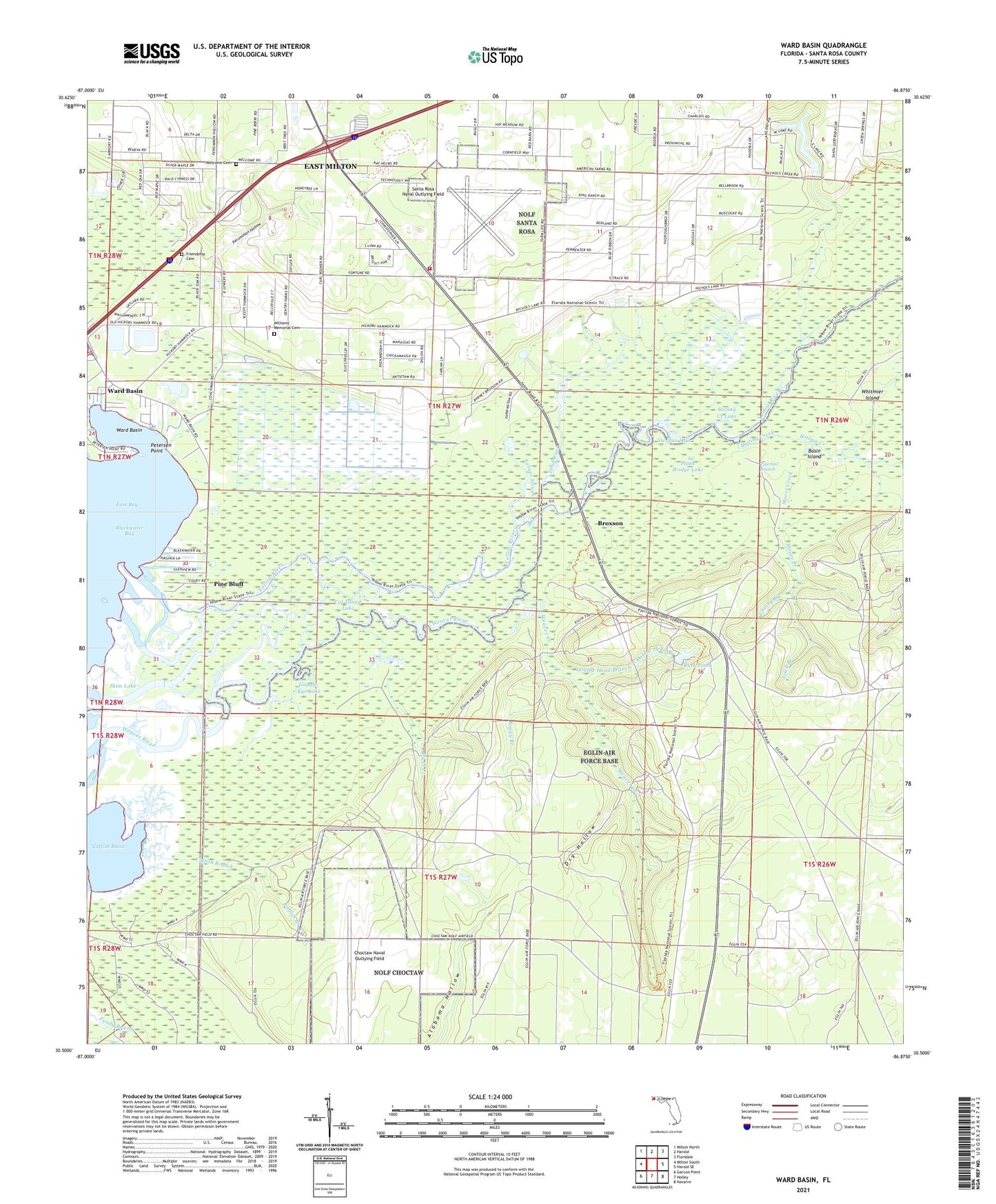
Ward Basin Florida US Topo Map
Couldn't load pickup availability
2024 topographic map quadrangle Ward Basin in the state of Florida. Scale: 1:24000. Based on the newly updated USGS 7.5' US Topo map series, this map is in the following counties: Santa Rosa. The map contains contour data, water features, and other items you are used to seeing on USGS maps, but also has updated roads and other features. This is the next generation of topographic maps. Printed on high-quality waterproof paper with UV fade-resistant inks.
Quads adjacent to this one:
West: Milton South
Northwest: Milton North
North: Harold
Northeast: Floridale
East: Harold SE
Southeast: Navarre
South: Holley
Southwest: Garcon Point
This map covers the same area as the classic USGS quad with code o30086e8.
Contains the following named places: Basin Island, Boggy Branch, Boiling Creek, Boiling Creek Lake, Broxson, Buck Pond, Cat Island Lake, Catfish Basin, Catfish Branch, Cherry Branch, Choctaw Naval Outlying Field, Dead River, Double Head Branch, Dry Hollow, East Milton Census Designated Place, East Milton Division, East Milton Volunteer Fire Department Station 2, Faulks Ferry Landing, Fitch Branch, Friendship Cemetery, Goggle-Eye Lake, Gulf Breeze-Harold Division, Hickory Hammock Church, Hicks Creek, Lewis Williams Memorial Cemetery, Moore Creek, Old Land Place, Palmer Slough, Persimmon Hollow, Petersen Point, Pine Bluff, Plank Bridge Lake, Rattlesnake Bayou, Santa Rosa Naval Outlying Field, Skim Lake, Stergan Lake, Ward Basin, Weaver Creek, Weaver Creek Lookout Tower, Welcome Cemetery, Welcome Church, Yellow River, ZIP Code: 32583