MyTopo
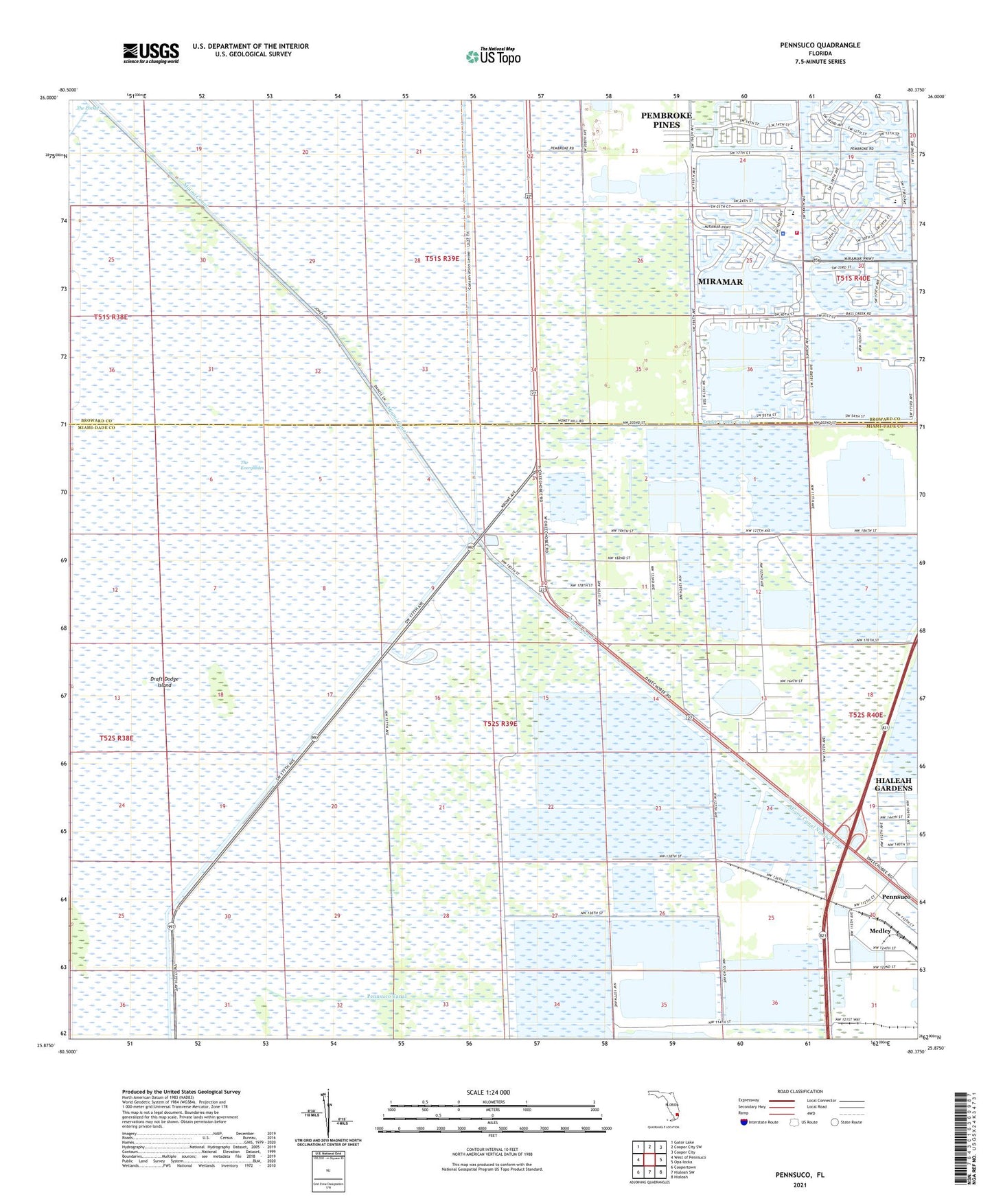
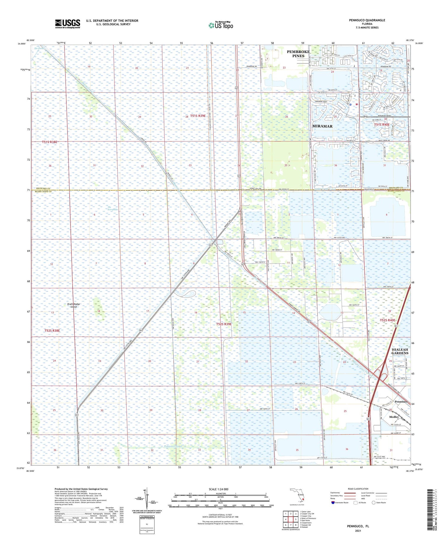
Pennsuco Florida US Topo Map
Couldn't load pickup availability
2024 topographic map quadrangle Pennsuco in the state of Florida. Scale: 1:24000. Based on the newly updated USGS 7.5' US Topo map series, this map is in the following counties: Miami-Dade, Broward. The map contains contour data, water features, and other items you are used to seeing on USGS maps, but also has updated roads and other features. This is the next generation of topographic maps. Printed on high-quality waterproof paper with UV fade-resistant inks.
Quads adjacent to this one:
West: West of Pennsuco
Northwest: Gator Lake
North: Cooper City SW
Northeast: Cooper City
East: Opa-locka
Southeast: Hialeah
South: Hialeah SW
Southwest: Coopertown
This map covers the same area as the classic USGS quad with code o25080h4.
Contains the following named places: Draft Dodge Island, Everglades Wildlife Management Area Conservation Area Number 3, Happy Day Nursery, Jones Fishing Camp, Levee 30, Levee Number 33, Miami Canal Number C-6, Miramar Fire Rescue Station 100, Miramar Police Department West District Station, Opa Locka West Airport, Palm Plaza, Pembroke Pines Charter Middle School, Pembroke Pines Elementary Charter School West, Pembroke Pines Recycling Center, Pennsuco, Pennsuco Canal, Silver Lakes Elementary School, Sunset Lakes Elementary School, Thompson Park, Thompson Park Campground, WAQI-AM (Miami), ZIP Codes: 33018, 33029