MyTopo
Polk City Florida US Topo Map
Couldn't load pickup availability
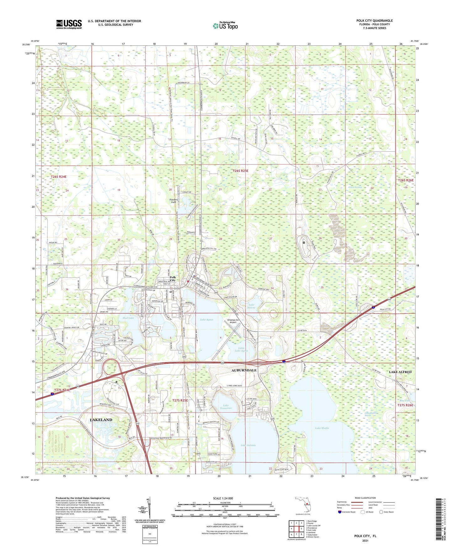
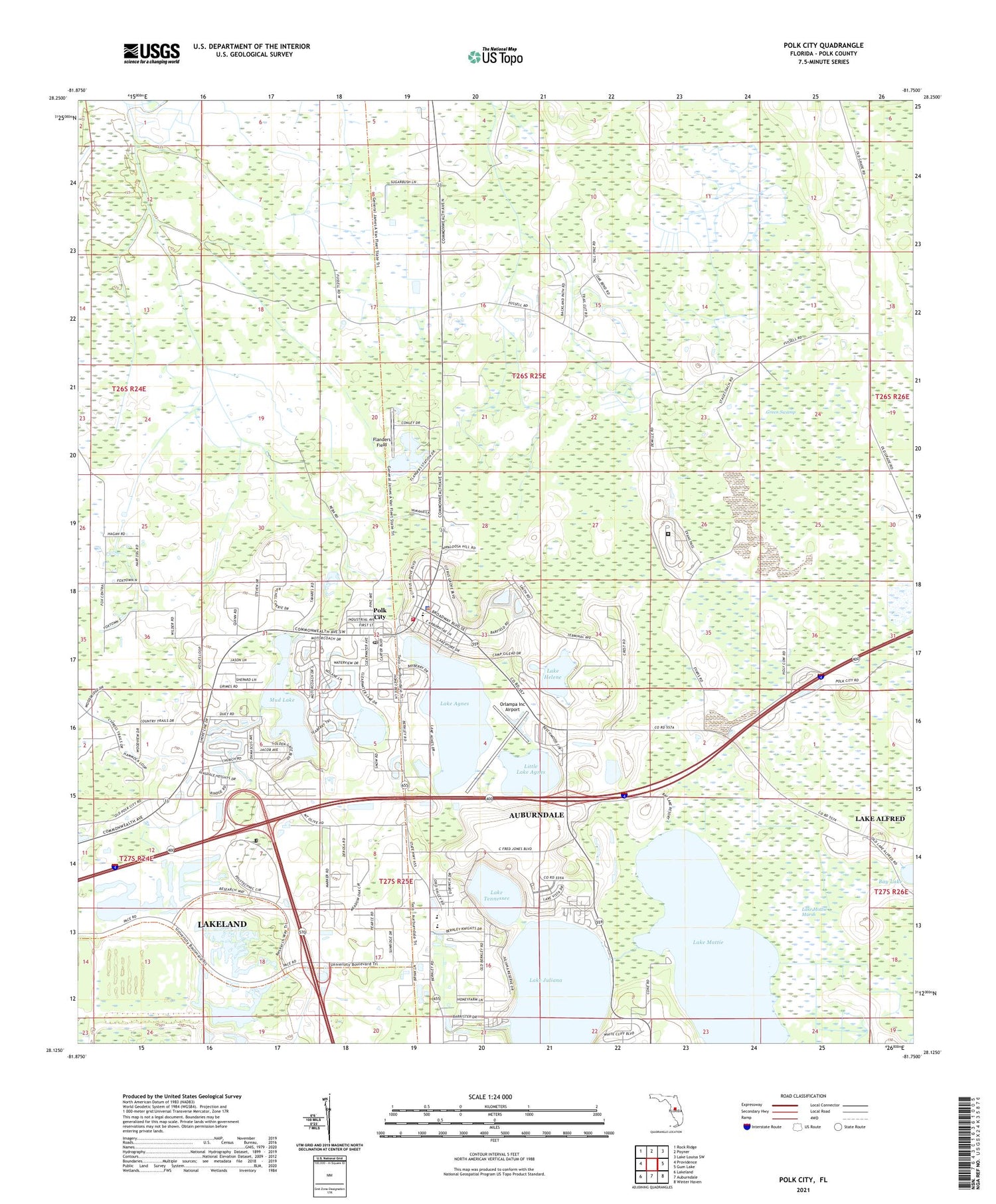
2024 topographic map quadrangle Polk City in the state of Florida. Scale: 1:24000. Based on the newly updated USGS 7.5' US Topo map series, this map is in the following counties: Polk. The map contains contour data, water features, and other items you are used to seeing on USGS maps, but also has updated roads and other features. This is the next generation of topographic maps. Printed on high-quality waterproof paper with UV fade-resistant inks.
Quads adjacent to this one:
West: Providence
Northwest: Rock Ridge
North: Poyner
Northeast: Lake Louisa SW
East: Gum Lake
Southeast: Winter Haven
South: Auburndale
Southwest: Lakeland
This map covers the same area as the classic USGS quad with code o28081b7.
Contains the following named places: Camp Gilead, Cherokee Ranch Airport, Clearwater Lake, Fantasy of Flight, Flanders Field, Florida Polytechnic University, Grant Estates Mobile Home Park, Lake Agnes, Lake Helene, Lake Juliana, Lake Juliana Landings Mobile Home Estates, Lake Mattie, Lake Mattie Marsh, Lake Mattie Mobile Home Park, Lake Tennessee, Little Lake Agnes, Marker Road Mobile Home Park, Mount Olive Church, Mud Lake, Orlampa Inc Airport, Pok City Post Office, Polk City, Polk City Community Center, Polk City Elementary School, Polk Correctional Institution, Polk County Fire Department Station 130 Polk City, Polk County Rescue Station 131 Polk City, Polk County Sheriff's Office Substation, Town of Polk City, ZIP Code: 33868