MyTopo
Lake Louisa SW Florida US Topo Map
Couldn't load pickup availability
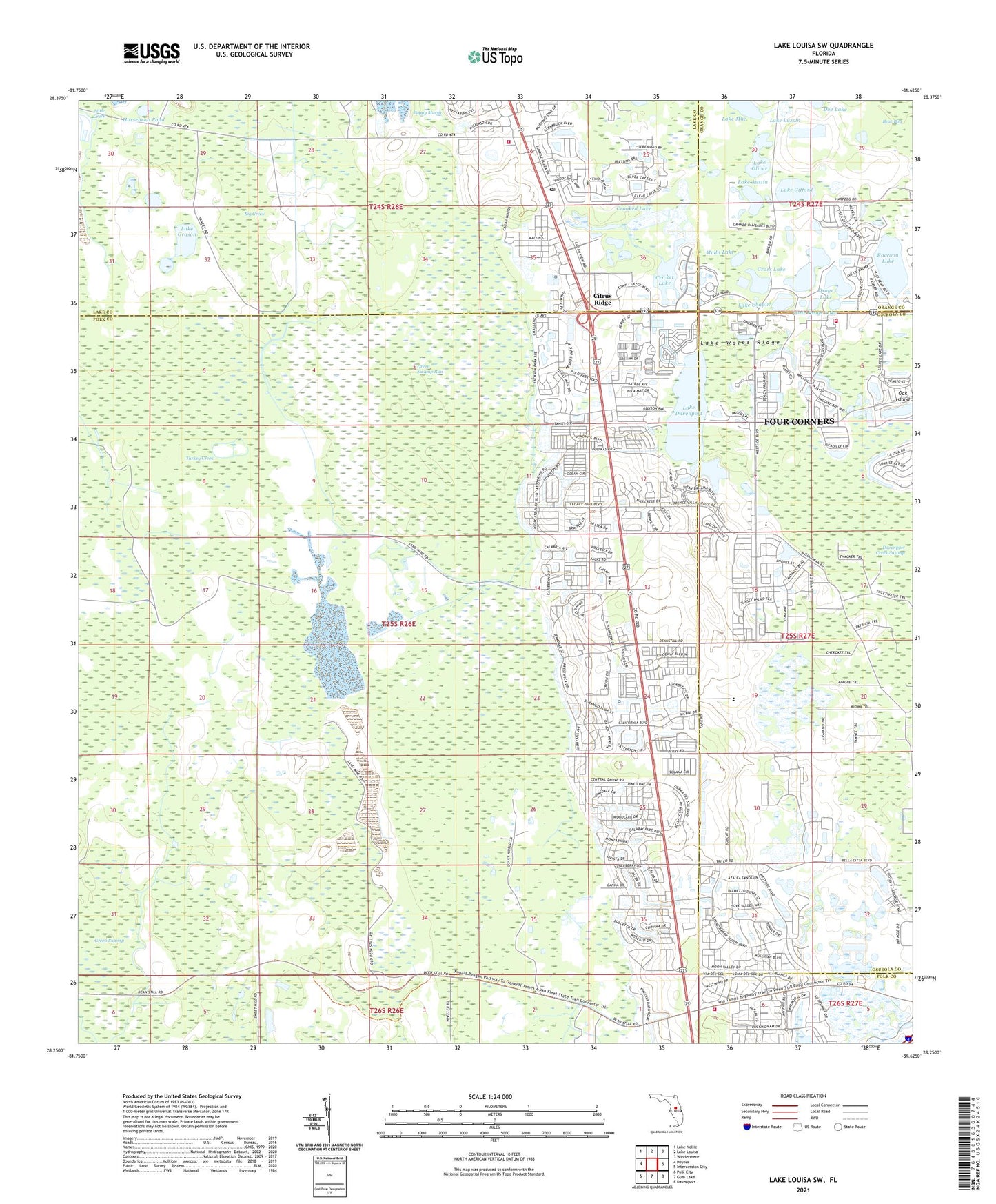
2024 topographic map quadrangle Lake Louisa SW in the state of Florida. Scale: 1:24000. Based on the newly updated USGS 7.5' US Topo map series, this map is in the following counties: Polk, Osceola, Lake, Orange. The map contains contour data, water features, and other items you are used to seeing on USGS maps, but also has updated roads and other features. This is the next generation of topographic maps. Printed on high-quality waterproof paper with UV fade-resistant inks.
Quads adjacent to this one:
West: Poyner
Northwest: Lake Nellie
North: Lake Louisa
Northeast: Windermere
East: Intercession City
Southeast: Davenport
South: Gum Lake
Southwest: Polk City
This map covers the same area as the classic USGS quad with code o28081c6.
Contains the following named places: Big Creek, Chapel Baptist Church, Citrus Ridge, Cricket Lake, Crooked Lake, Davenport Creek Swamp, Fishers Island, Four Corners Census Designated Place, Grass Lake, Green Swamp, Green Swamp Run, Horsehead Pond, Lake Austin, Lake Chapin, Lake County Fire Rescue Station 112, Lake County Library System Citrus Ridge Branch Library, Lake Davenport, Lake Emergency Medical Services Station 331, Lake Gifford, Lake Grason, Lake Luzom, Lake Mac, Lake Oliver, Little Osage Lake, Mudd Lake, Oak Island, Osage Lake, Osceola County Fire Rescue Station 71, Polk County Emergency Medical Services Station 19 Davenport, Polk County Fire Rescue Station 33, Raccoon Lake, Rexford Lake, South Clermont Post Office, Vista del Lago Mobile Home Park, Worthington Country Club, ZIP Code: 33897