MyTopo
Gum Lake Florida US Topo Map
Couldn't load pickup availability
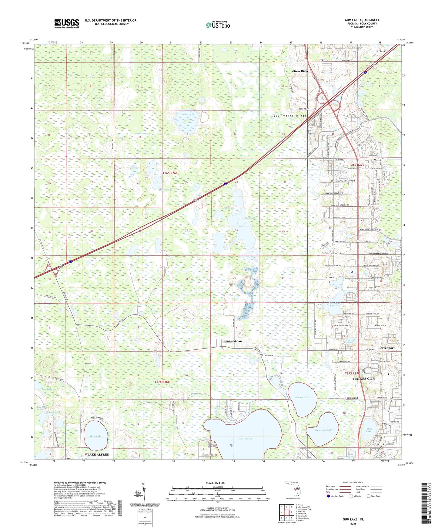
2024 topographic map quadrangle Gum Lake in the state of Florida. Scale: 1:24000. Based on the newly updated USGS 7.5' US Topo map series, this map is in the following counties: Polk. The map contains contour data, water features, and other items you are used to seeing on USGS maps, but also has updated roads and other features. This is the next generation of topographic maps. Printed on high-quality waterproof paper with UV fade-resistant inks.
Quads adjacent to this one:
West: Polk City
Northwest: Poyner
North: Lake Louisa SW
Northeast: Intercession City
East: Davenport
Southeast: Dundee
South: Winter Haven
Southwest: Auburndale
This map covers the same area as the classic USGS quad with code o28081b6.
Contains the following named places: Bay Lake, Blue Heron Bay Mobile Home Park, Bonnet Lake, Clair Mar Mobile Home Park, Crystal Lake, Davenport Fire Tower, Diamond Acres Mobile Park, Duck Pond, Emerald Lake Mobile Home Park, Fort Cummings, Glades Country Club, Gore Airport, Grass Lake, Gum Lake, Haines City Division, Hammock Lake, Heart of Florida Medical Center Heliport, Heart of Florida Regional Medical Center, Holiday Manor, Lake Hammock Village, Lake Lowery, Lake Saint Charles, Lost Lake, Oak Harbor Seaplane Base, Polk County Sheriff's Office - Northeast District, Saint Claire Lake, Sand Lake, Tangerine Lake, Tower Lake, Village of la Casa del Sol Mobile Home Park, WGTO-AM (Cypress Gardens), Windmill Village Mobile Home Park, WLVF-FM (Haines City)