MyTopo
Sanborn Florida US Topo Map
Couldn't load pickup availability
Also explore the Sanborn Forest Service Topo of this same quad for updated USFS data
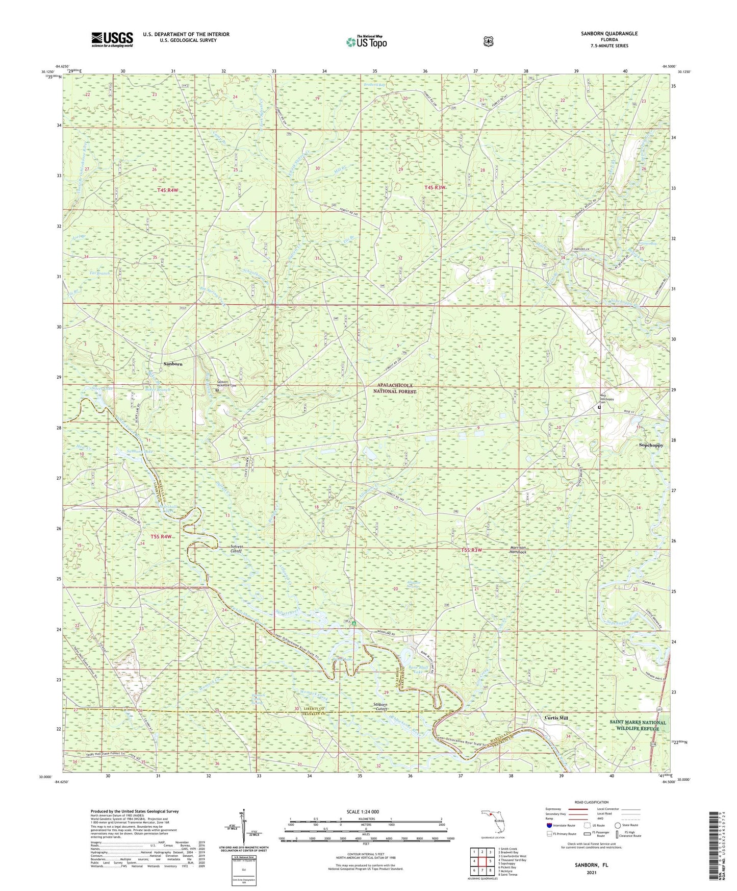
2024 topographic map quadrangle Sanborn in the state of Florida. Scale: 1:24000. Based on the newly updated USGS 7.5' US Topo map series, this map is in the following counties: Wakulla, Liberty, Franklin. The map contains contour data, water features, and other items you are used to seeing on USGS maps, but also has updated roads and other features. This is the next generation of topographic maps. Printed on high-quality waterproof paper with UV fade-resistant inks.
Quads adjacent to this one:
West: Thousand Yard Bay
Northwest: Smith Creek
North: Bradwell Bay
Northeast: Crawfordville West
East: Sopchoppy
Southeast: Saint Teresa
South: McIntyre
Southwest: Pickett Bay
This map covers the same area as the classic USGS quad with code o30084a5.
Contains the following named places: Alligator Creek, Alligator Swamp, Baker Branch, Big Spring Creek, Bone Bluff Lake, Bostick Branch, Bumpy Creek, Camp Branch, Cow Creek, Curtis Mill, Davis Camp, Deep Branch, Duval Branch, East Fork Syfrett Creek, Haw Creek, Joel Branch, Marshall Lakes, Mill Creek, Morrison Hammock, Morrison Hammock Scenic Area, Mount Beeser Church, Sanborn, Sanborn Cutoff, Sanborn Lake, Sanborn Lookout Tower, Sanborn McKenzie Cemetery, Sanborn School, Schoolhouse Branch, Silver Lake, Sufrett Cutoff, Syfrett Creek, Titi Branch, West Fork Syfrett Creek, West Sopchoppy Cemetery, Womack Creek, Womack Creek Swamp, Wood Lake, Wood Lake Campground, ZIP Code: 32358