MyTopo
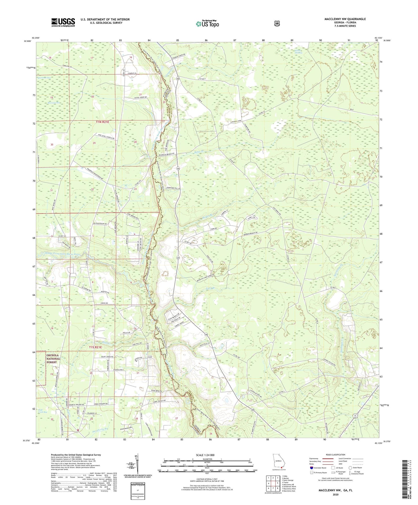
Macclenny NW Georgia US Topo Map
Couldn't load pickup availability
Also explore the Macclenny NW Forest Service Topo of this same quad for updated USFS data
2024 topographic map quadrangle Macclenny NW in the states of Georgia, Florida. Scale: 1:24000. Based on the newly updated USGS 7.5' US Topo map series, this map is in the following counties: Charlton, Baker. The map contains contour data, water features, and other items you are used to seeing on USGS maps, but also has updated roads and other features. This is the next generation of topographic maps. Printed on high-quality waterproof paper with UV fade-resistant inks.
Quads adjacent to this one:
West: Taylor
Northwest: Eddy
North: Moniac
Northeast: Saint George
East: Macclenny NE
Southeast: Macclenny East
South: Macclenny West
Southwest: Sanderson North
This map covers the same area as the classic USGS quad with code o30082d2.
Contains the following named places: Baker Branch, Baker County Fire Department Station 30 Cuyler, Barber Branch, Baxter Church, Bluff Creek, Canaday School, Joaquin Creek, Middle Prong Saint Marys River, Moccasin Bay, Moniac Church, North Prong Church, North Prong Saint Marys River, Pine Level Church, Sandusky School, Taylor School, Tiger Branch, ZIP Code: 31562