MyTopo
Sanibel Florida US Topo Map
Couldn't load pickup availability
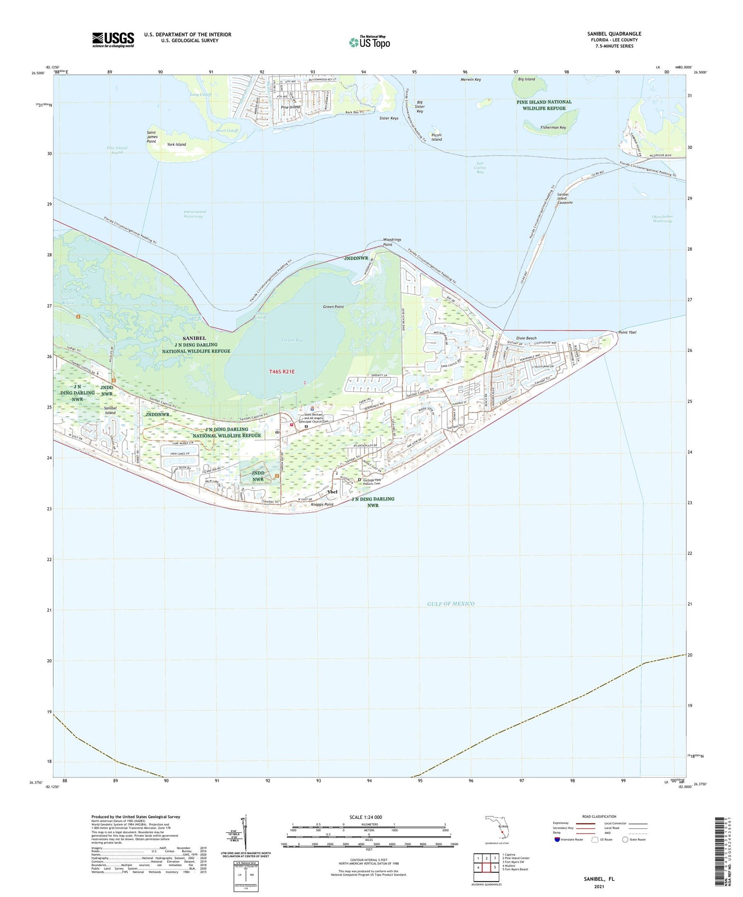
2025 topographic map quadrangle Sanibel in the state of Florida. Scale: 1:24000. Based on the newly updated USGS 7.5' US Topo map series, this map is in the following counties: Lee. The map contains contour data, water features, and other items you are used to seeing on USGS maps, but also has updated roads and other features. This is the next generation of topographic maps. Printed on high-quality waterproof paper with UV fade-resistant inks.
Quads adjacent to this one:
West: Wulfert
Northwest: Captiva
North: Pine Island Center
Northeast: Fort Myers SW
East: Fort Myers Beach
This map covers the same area as the classic USGS quad with code o26082d1.
Contains the following named places: Baileys Center, Big Island, Big Sister Key, Bigelow Shopping Center, City of Sanibel, Dixie Beach, First Baptist Church Sanibel, Fisherman Key, Green Point, Gulfside Park Historic Cemetery, Henley Canal, J N "Ding" Darling Wilderness, J N Ding Darling National Wildlife Refuge, James Cipriani Heliport, Knapps Point, Ladyfinger Lake, Lee County Emergency Medical Services, Long Cutoff, McIntyre Creek, Periwinkle Place Shopping Center, Phillips Canal, Picnic Island, Plaza Central, Point Ybel, Punta Rassa, Punta Rassa Cove, Saint James City, Saint James City Mobile Home Park, Saint James Point, San Carlos Bay, Sanibel, Sanibel Bayou, Sanibel Bayous, Sanibel Community Church, Sanibel Congregational United Church of Christ, Sanibel Fire Department Station 171, Sanibel Island, Sanibel Island Causeway, Sanibel Island Lighthouse, Sanibel Police Department, Sanibel Post Office, Sanibel School, Shallow Cutoff, Shallow Mouth, Shangri La Mobile Home Park, Short Cutoff, Sister Keys, Tahitian Garden Shopping Center, Tarpon Bay, Tropic Isles Baptist Church, Woodrings Point, Ybel, York Island, ZIP Code: 33957