MyTopo
Welaka SE Florida US Topo Map
Couldn't load pickup availability
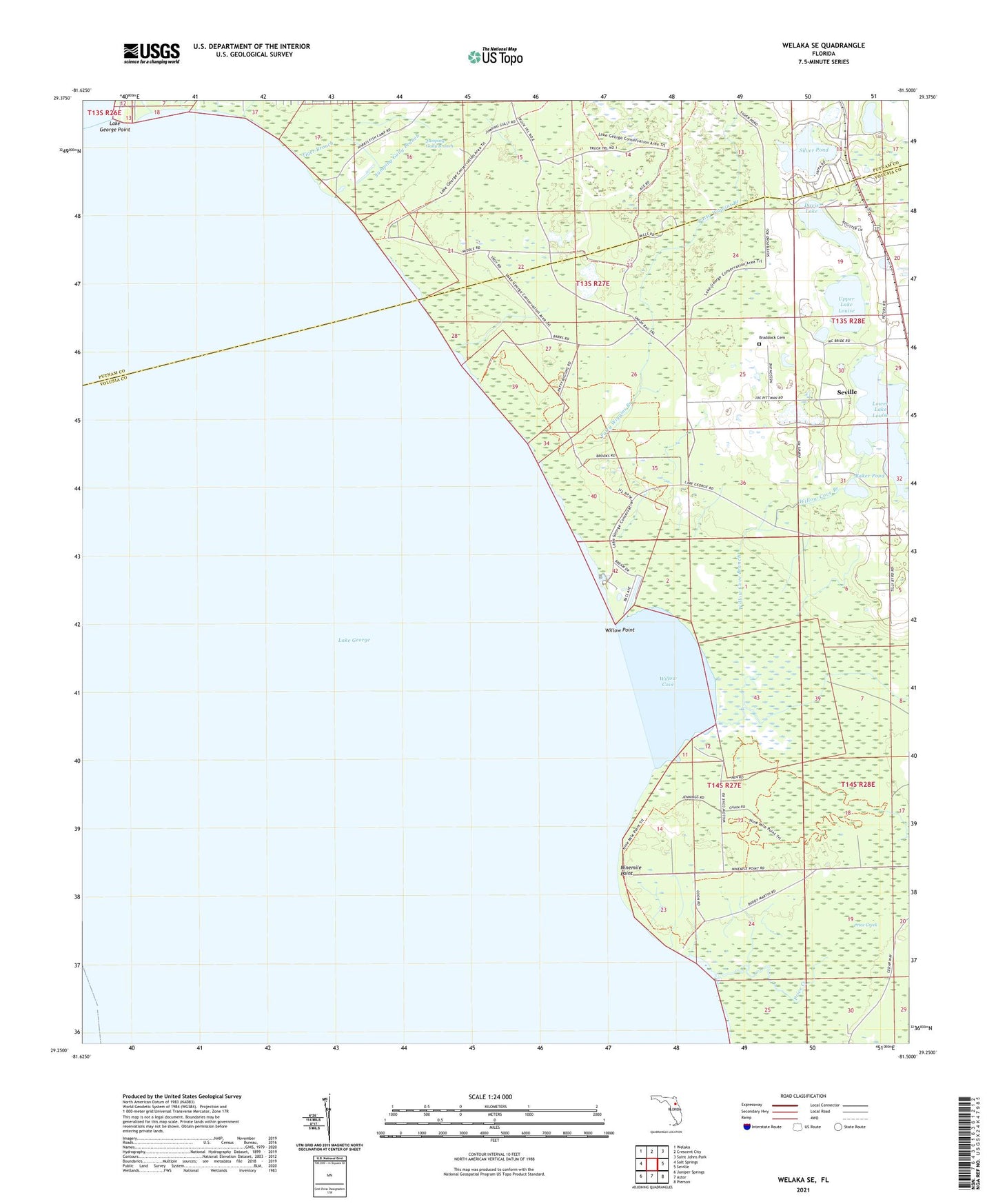
2024 topographic map quadrangle Welaka SE in the state of Florida. Scale: 1:24000. Based on the newly updated USGS 7.5' US Topo map series, this map is in the following counties: Volusia, Putnam. The map contains contour data, water features, and other items you are used to seeing on USGS maps, but also has updated roads and other features. This is the next generation of topographic maps. Printed on high-quality waterproof paper with UV fade-resistant inks.
Quads adjacent to this one:
West: Salt Springs
Northwest: Welaka
North: Crescent City
Northeast: Saint Johns Park
East: Seville
Southeast: Pierson
South: Astor
Southwest: Juniper Springs
This map covers the same area as the classic USGS quad with code o29081c5.
Contains the following named places: Andrew Storrs Grant, Baker Pond, Barrs Landing, Braddock Cemetery, C W Clarke Grant, Davis Lake, Deadman Landing, Heirs of Wiggins Grant, Hendersons Landing, Jumping Gully Branch, Lake George, Lake George Point, Lower Lake Louise, Ninemile Point, Patty Wiggins Branch, Pine Island Landing, Pine Island Marina, Price Creek, Seville Census Designated Place, Silver Pond, Upper Lake Louise, Willow Cove, Willow Cove Branch, Willow Point, ZIP Code: 32139