MyTopo
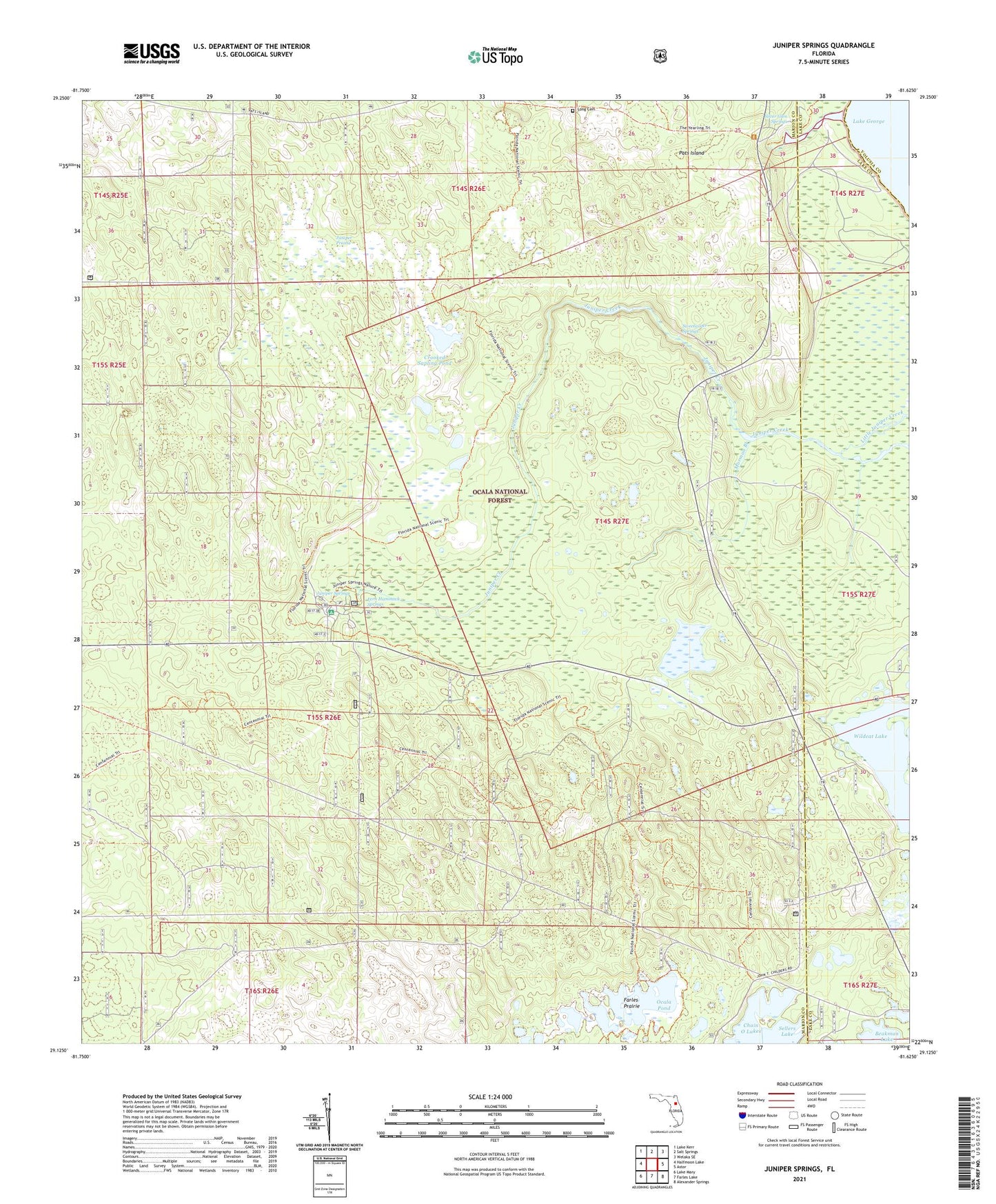
Juniper Springs Florida US Topo Map
Couldn't load pickup availability
Also explore the Juniper Springs Forest Service Topo of this same quad for updated USFS data
2024 topographic map quadrangle Juniper Springs in the state of Florida. Scale: 1:24000. Based on the newly updated USGS 7.5' US Topo map series, this map is in the following counties: Marion, Lake, Volusia. The map contains contour data, water features, and other items you are used to seeing on USGS maps, but also has updated roads and other features. This is the next generation of topographic maps. Printed on high-quality waterproof paper with UV fade-resistant inks.
Quads adjacent to this one:
West: Halfmoon Lake
Northwest: Lake Kerr
North: Salt Springs
Northeast: Welaka SE
East: Astor
Southeast: Alexander Springs
South: Farles Lake
Southwest: Lake Mary
This map covers the same area as the classic USGS quad with code o29081b6.
Contains the following named places: Crooked Sapling Pond, F M Arredondo Grant, Fern Hammock Springs, George I F Clarke Grant, Juniper Creek Boating Site, Juniper Prairie, Juniper Prairie Wilderness, Juniper Springs, Juniper Springs Campground, Juniper Springs Recreation Area, Long Cemetery, Morman Branch, Ocala National Forest, Ocala National Recreation Trail, Ocala Pond, Pats Island, Silver Glen Springs, Silver Glen Springs Recreation Area, Silver Glen Springs Run, Sweetwater Springs, Thomas Forbes Grant, Wildcat Lake, Wildcat Lake Boat Ramp