MyTopo
Rood Florida US Topo Map
Couldn't load pickup availability
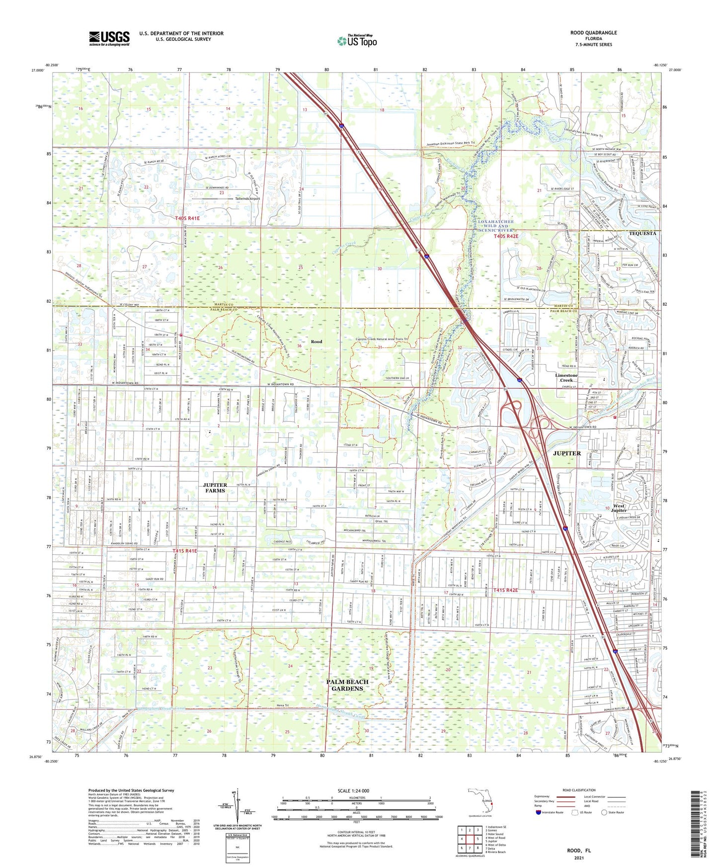
2024 topographic map quadrangle Rood in the state of Florida. Scale: 1:24000. Based on the newly updated USGS 7.5' US Topo map series, this map is in the following counties: Palm Beach, Martin. The map contains contour data, water features, and other items you are used to seeing on USGS maps, but also has updated roads and other features. This is the next generation of topographic maps. Printed on high-quality waterproof paper with UV fade-resistant inks.
Quads adjacent to this one:
West: West of Rood
Northwest: Indiantown SE
North: Gomez
Northeast: Hobe Sound
East: Jupiter
Southeast: Riviera Beach
South: Delta
Southwest: West of Delta
This map covers the same area as the classic USGS quad with code o26080h2.
Contains the following named places: BR Ranch Airport, Church of God, Cypress Creek, Fire Station Number 14, Fire Station Number 19, Flying H Heliport, Hillsboro Pines Golf Course, Hobe Sound Golf Club, Hungryland Slough Canal, John D MacArthur Campus, Jupiter Farms Census Designated Place, Jupiter Farms Elementary School, Jupiter School, Kitching Creek, Limestone Creek, Limestone Creek Census Designated Place, Limestone Creek Elementary School, Loxahatchee River Aquatic Preserve, Loxahatchee River Bend Park, Loxahatchee Wild and Scenic River, Mount Carmel Church, North Palm Beach Heights, Palm Beach County Fire Rescue Department Station 19, Palm Beach County Fire Rescue Station 14, Rood, Tailwinds Airport, Tanah Keeta Scout Reservation, Tequesta, Trappers Zoo, West Jupiter, West Jupiter Camping Resort, ZIP Codes: 33458, 33478