
MyTopo
Woodville Florida US Topo Map
Couldn't load pickup availability
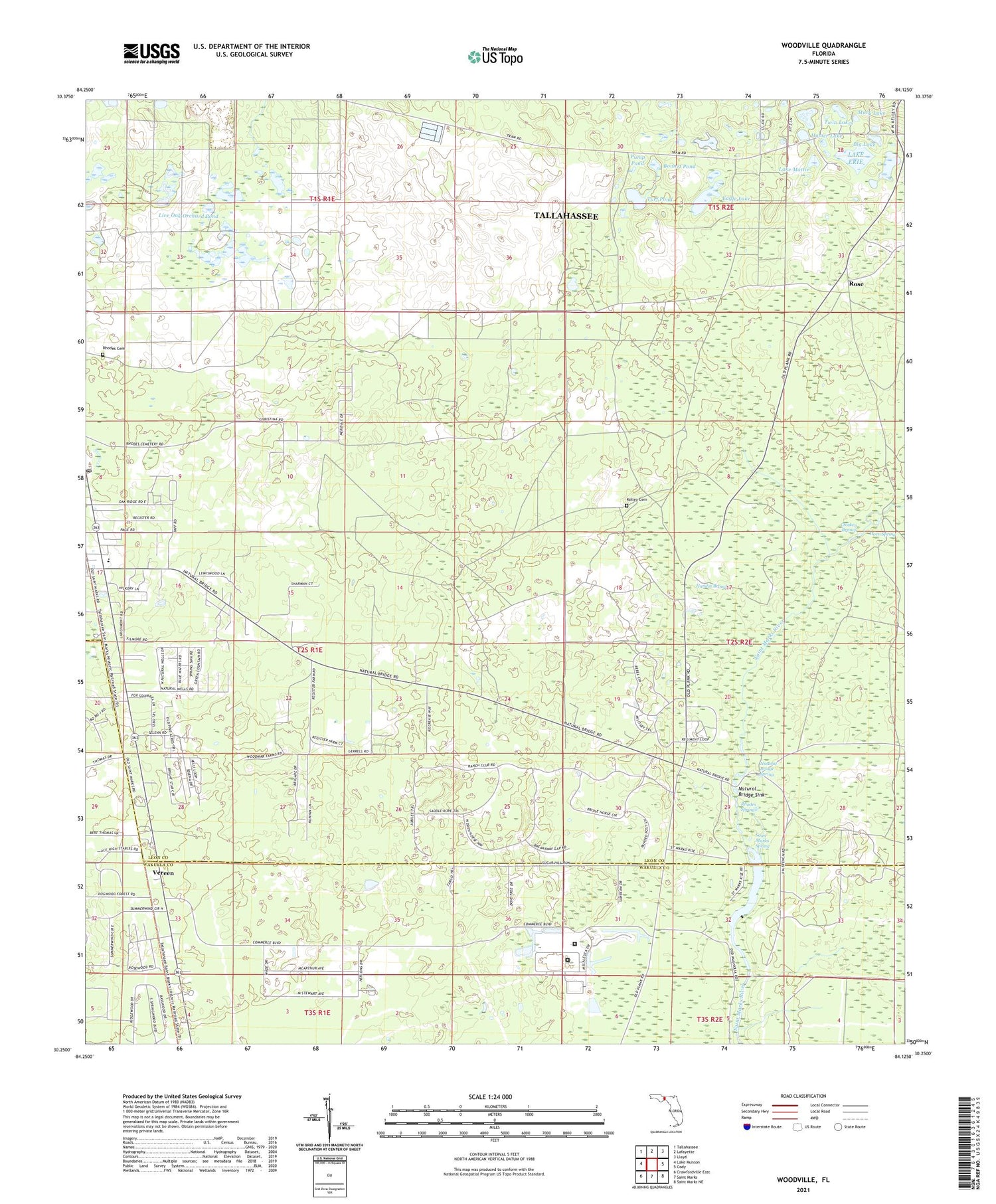
2024 topographic map quadrangle Woodville in the state of Florida. Scale: 1:24000. Based on the newly updated USGS 7.5' US Topo map series, this map is in the following counties: Leon, Wakulla. The map contains contour data, water features, and other items you are used to seeing on USGS maps, but also has updated roads and other features. This is the next generation of topographic maps. Printed on high-quality waterproof paper with UV fade-resistant inks.
Quads adjacent to this one:
West: Lake Munson
Northwest: Tallahassee
North: Lafayette
Northeast: Lloyd
East: Cody
Southeast: Saint Marks NE
South: Saint Marks
Southwest: Crawfordville East
This map covers the same area as the classic USGS quad with code o30084c2.
Contains the following named places: Big Lake, Bonnet Pond, Corey, Eagle Lake, Hamlin Branch, Homer Lake, Horn Spring, Kelley Cemetery, Lake Erie, Lake Mattie, Live Oak Orchard Pond, Lutterloh Pond, Mary Lake, Natural Bridge Battlefield Historic State Park, Natural Bridge Sink, Natural Bridge Spring, Pump Pond, Rhodes Cemetery, Rhodes Springs, Rose, Saint Marks Spring, Saint Phillip Primitive Baptist Church of Christ, Southeast Leon Division, Tallahassee Southeast Division, Turf Pond, Twin Lakes, Vereen, Wakulla Correctional Institution, Wakulla Correctional Institution Annex, Woodville, Woodville Elementary School, Woodville Post Office, WTWF-AM (Woodville)


