
MyTopo
Lloyd Florida US Topo Map
Couldn't load pickup availability
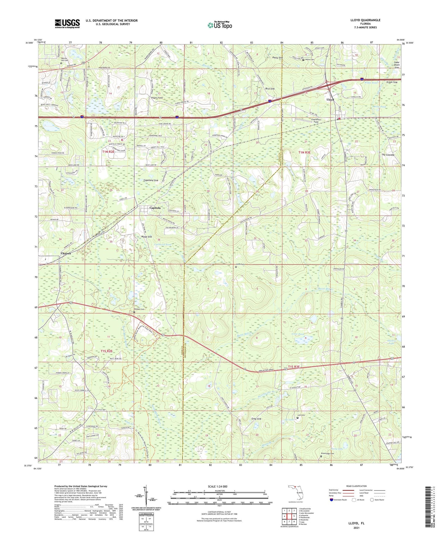
2024 topographic map quadrangle Lloyd in the state of Florida. Scale: 1:24000. Based on the newly updated USGS 7.5' US Topo map series, this map is in the following counties: Jefferson, Leon. The map contains contour data, water features, and other items you are used to seeing on USGS maps, but also has updated roads and other features. This is the next generation of topographic maps. Printed on high-quality waterproof paper with UV fade-resistant inks.
Quads adjacent to this one:
West: Lafayette
Northwest: Bradfordville
North: Miccosukee
Northeast: Lake Miccosukee
East: Waukeenah
Southeast: Wacissa
South: Cody
Southwest: Woodville
This map covers the same area as the classic USGS quad with code o30084d1.
Contains the following named places: Alfred Branch, Angel's Field, Barrow Hill Cemetery, Bird Sink, Black Creek, Brice Pond, Broomsage Cemetery, Burnt Mill Creek, Capitola, Capitola Census Designated Place, Chaires, Chaires Elementary School, Charlotte's Field, Chires Capitola Volunteer Fire Department and Emergency Medical Services, Copeland Sink, Creek Sink, Crow Pond, Elizabeth Church, First Baptist Church of Lloyd, Galilee Church, Gray Sink, Hall Branch, Jefferson County Fire District Lloyd Volunteer Fire Department, Jones Cemetery, Lake Drain, Lake Drain Sink, Lloyd, Lloyd Census Designated Place, Lloyd Creek, Lloyd Post Office, Lott Cemetery, Ox Lake, Patty Sink, Pine Grove Church, Polar Branch, Saint Lukes Church, Saint Peters Church, Saint Rilla Missionary Baptist Church, Skipper Cemetery, Springfield Church, Still Creek, Story Lake, Sweetwater Branch, The Cascade, Union Branch Church, Upchurch Pond, Washington Crossing Creek, WGLF-FM (Tallahassee), Willie Cemetery, Willie Pond, Wood Sink, ZIP Code: 32317


