MyTopo
Yankeetown SE Florida US Topo Map
Couldn't load pickup availability
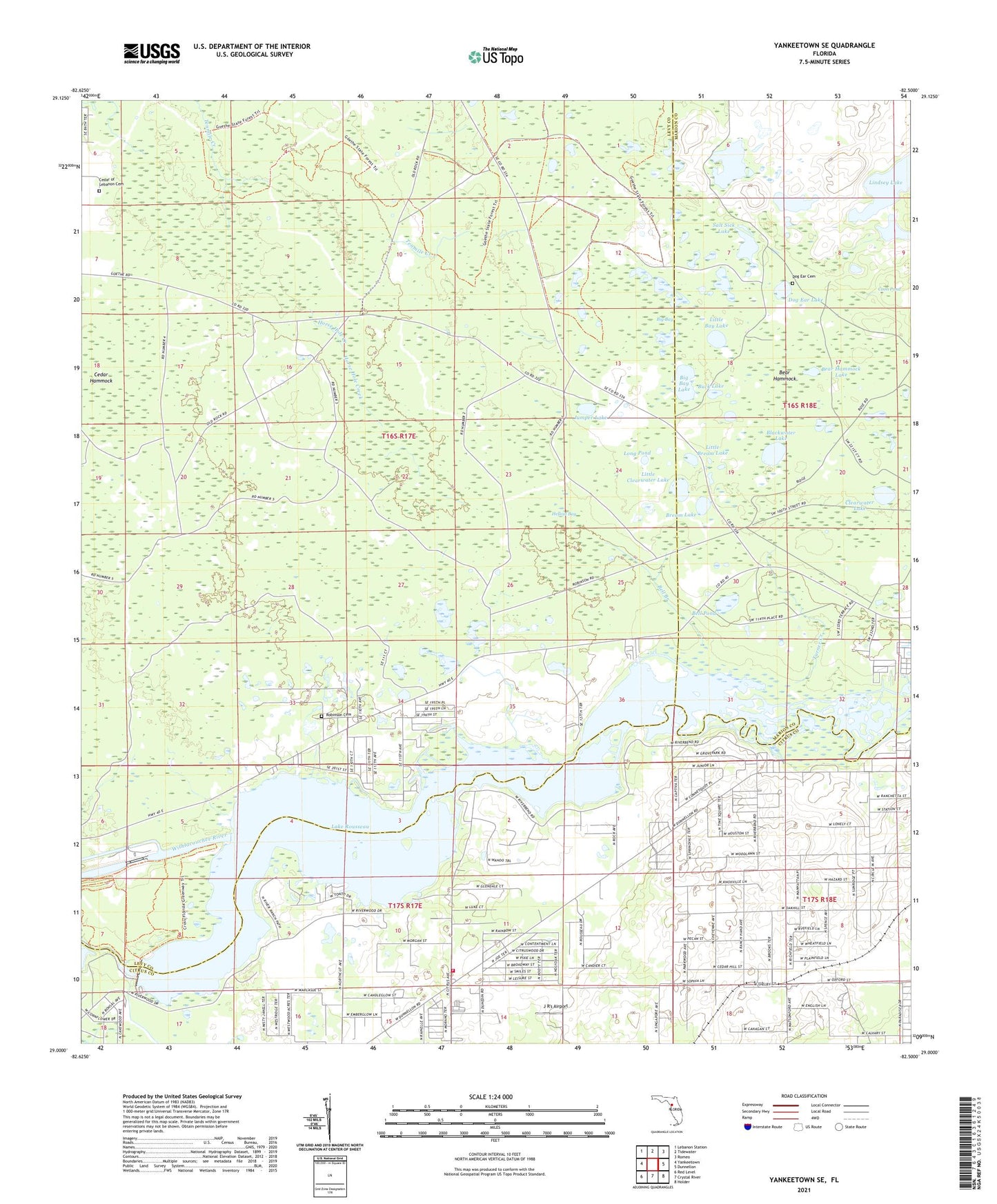
2024 topographic map quadrangle Yankeetown SE in the state of Florida. Scale: 1:24000. Based on the newly updated USGS 7.5' US Topo map series, this map is in the following counties: Levy, Citrus, Marion. The map contains contour data, water features, and other items you are used to seeing on USGS maps, but also has updated roads and other features. This is the next generation of topographic maps. Printed on high-quality waterproof paper with UV fade-resistant inks.
Quads adjacent to this one:
West: Yankeetown
Northwest: Lebanon Station
North: Tidewater
Northeast: Romeo
East: Dunnellon
Southeast: Holder
South: Crystal River
Southwest: Red Level
This map covers the same area as the classic USGS quad with code o29082a5.
Contains the following named places: Bear Hammock, Bear Hammock Lake, Bell Branch, Bell Pond, Big Bay, Big Bay Lake, Blackwater Lake, Bream Lake, Buck Lake, Cedar Hammock, Cedar of Lebanon Cemetery, Citrus County Fire Rescue Station 9, Clearwater Lake, Crystal Manor, Dog Ear Cemetery, Dog Ear Lake, Hellcat Bay, Inglis Dam, Inglis Lock, J R's Airport, Jumper Lake, Lake Rousseau, Lindsey Lake, Little Bay Lake, Little Bream Lake, Little Cedar Hammock, Little Clearwater Lake, Long Pond, Red Level Substation Number 1, Robinson Cemetery, Salt Sick Lake, South Levy Volunteer Fire Station - District 1, Turner Creek, ZIP Code: 34433