MyTopo
Red Level Florida US Topo Map
Couldn't load pickup availability
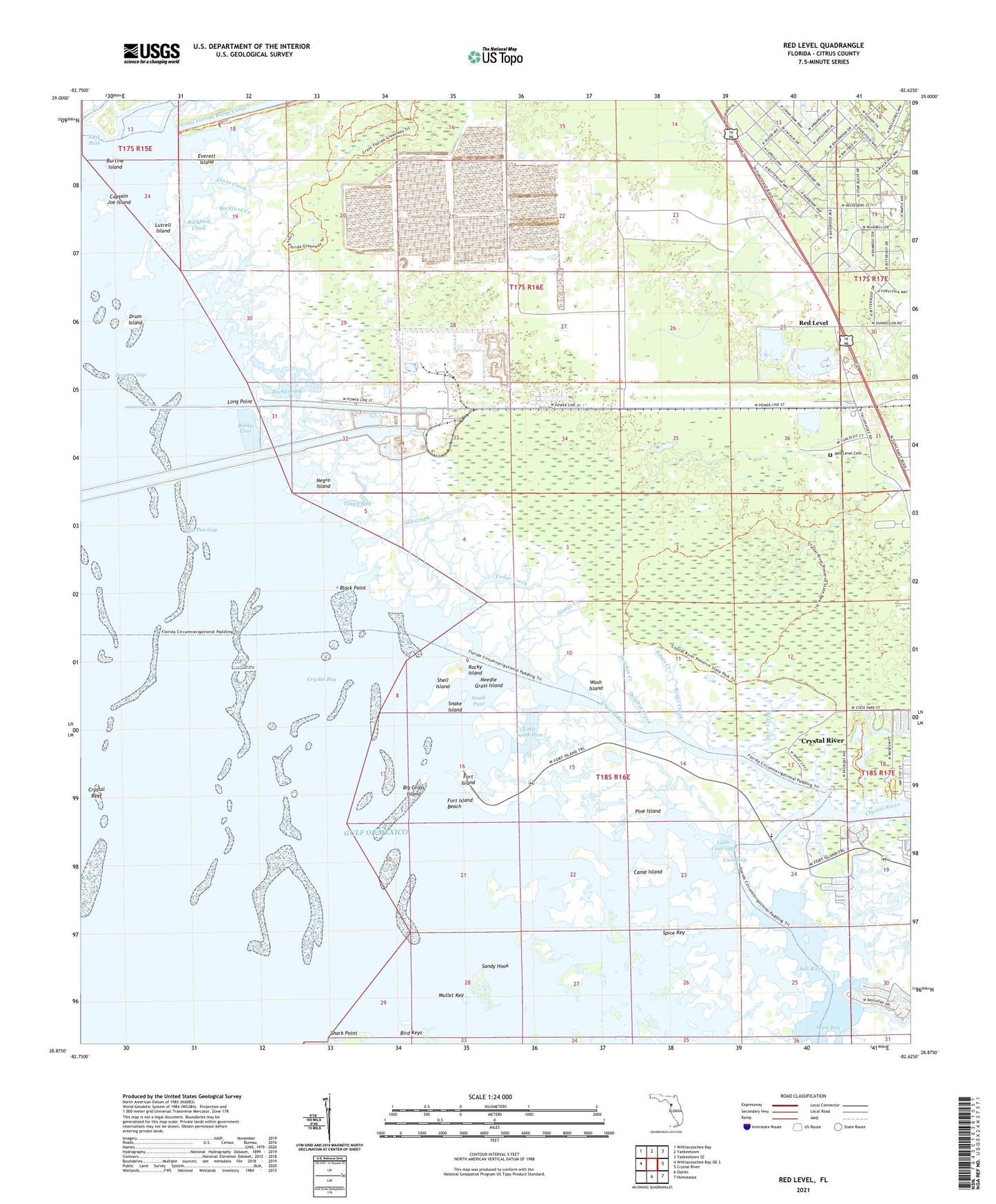
2025 topographic map quadrangle Red Level in the state of Florida. Scale: 1:24000. Based on the newly updated USGS 7.5' US Topo map series, this map is in the following counties: Citrus. The map contains contour data, water features, and other items you are used to seeing on USGS maps, but also has updated roads and other features. This is the next generation of topographic maps. Printed on high-quality waterproof paper with UV fade-resistant inks.
Quads adjacent to this one:
West: Withlacoochee Bay OE S
Northwest: Withlacoochee Bay
North: Yankeetown
Northeast: Yankeetown SE
East: Crystal River
Southeast: Homosassa
South: Ozello
This map covers the same area as the classic USGS quad with code o28082h6.
Contains the following named places: Bennetts Creek, Big Grass Island, Bird Keys, Black Point, Buckford Creek, Burtine Island, Camp Island, Captain Joe Island, Cedar Creek, Coon Gap, Crab Creek, Cross Creek, Crystal Bay, Crystal Reef, Crystal River, Crystal River Historic Memorial, Crystal River State Archaeological Site, Deer Creek, Demory Gap, Dixie Bay, Dolphin Creek, Double Barrel Creek, Drum Island, East Pass, Everett Island, Fort Island, Fort Island Beach, Gomez Creek, Johns Creek, Kings Creek, Little Coon Gap, Little Rocky Creek, Little South Pass, Long Point, Lutrell Island, Mount Olive Church, Mullet Key, Needle Grass Island, Negro Island, Pine Island, Red Level, Red Level Cemetery, Richardson Creek, Rocky Cove, Rocky Creek, Rocky Island, Salt Creek, Sandy Hook, Shark Point, Sheephead Creek, Shell Island, Snake Island, South Pass, Spice Key, The Rocks, Tin Pan Gap, Tony Creek, Trout Creek, Wash Island, West Fort Island Trail, ZIP Code: 34428