MyTopo
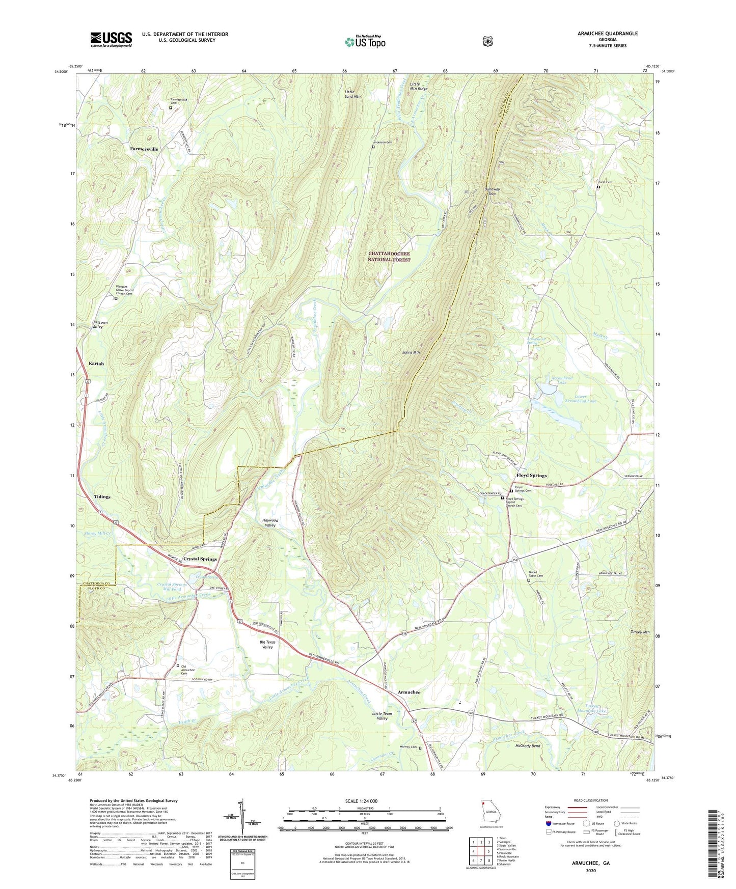
Armuchee Georgia US Topo Map
Couldn't load pickup availability
Also explore the Armuchee Forest Service Topo of this same quad for updated USFS data
2024 topographic map quadrangle Armuchee in the state of Georgia. Scale: 1:24000. Based on the newly updated USGS 7.5' US Topo map series, this map is in the following counties: Floyd, Chattooga. The map contains contour data, water features, and other items you are used to seeing on USGS maps, but also has updated roads and other features. This is the next generation of topographic maps. Printed on high-quality waterproof paper with UV fade-resistant inks.
Quads adjacent to this one:
West: Summerville
Northwest: Trion
North: Subligna
Northeast: Sugar Valley
East: Plainville
Southeast: Shannon
South: Rome North
Southwest: Rock Mountain
This map covers the same area as the classic USGS quad with code o34085d2.
Contains the following named places: Anderson Cemetery, Armuchee, Armuchee Church, Armuchee Division, Armunchee Middle School, Arrowhead Lake, Arrowhead Lake Dam, Arrowhead Spring, Bethel Church, Big Texas Valley, Crystal Spring, Crystal Springs, Crystal Springs Mill Pond, Dirttown Valley, Dunaway Gap, Earle Cemetery, East Armuchee Creek, Ebenezer Baptist Church, Farmersville, Farmersville Cemetery, Farmersville School, Floyd Springs, Floyd Springs Baptist Church, Floyd Springs Baptist Church Cemetery, Floyd Springs Cemetery, Floyd Springs Methodist Church, Haywood, Haywood Valley, Heath Creek, Kartah, Lavender Creek, Little Armuchee Creek, Little Sand Mountain, Little Sand Mountain Chapel Baptist Church, Little Sand Mountain Division, Little Texas Valley, Lower Arrowhead Lake, Lower Arrowhead Lake Dam, McGrady Bend, Midway Cemetery, Midway Church, Mount Tabor Cemetery, Mount Tabor Church, Old Armuchee Cemetery, Piney School, Pleasant Grove Baptist Church, Pleasant Grove Baptist Church Cemetery, Selman Creek, Storey Mill Creek, Tidings, Turkey Mountain Lake, Turkey Mountain Recreation Center, West Armuchee Creek, Zula, ZIP Code: 30105