
MyTopo
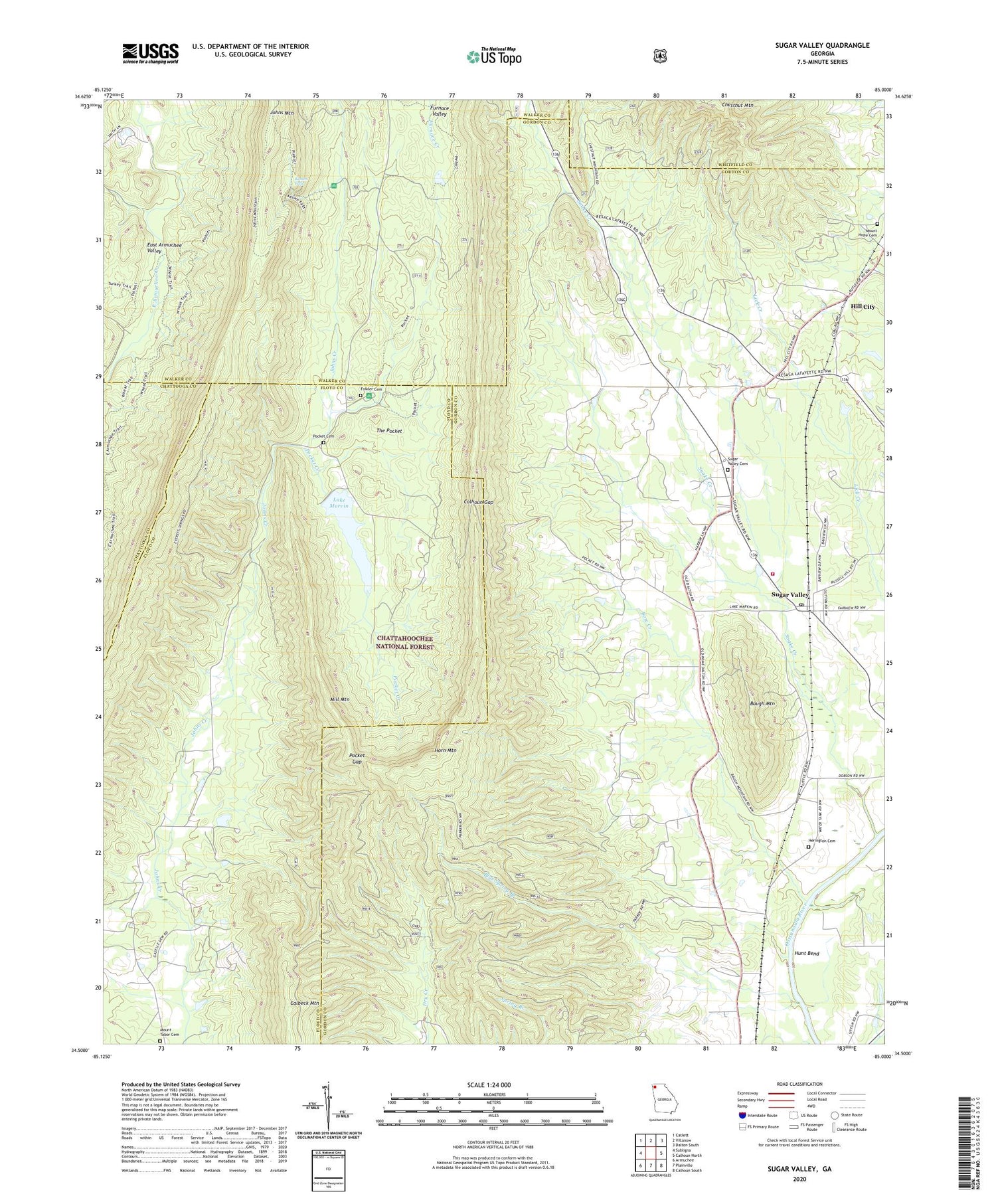
Sugar Valley Georgia US Topo Map
Couldn't load pickup availability
Also explore the Sugar Valley Forest Service Topo of this same quad for updated USFS data
2024 topographic map quadrangle Sugar Valley in the state of Georgia. Scale: 1:24000. Based on the newly updated USGS 7.5' US Topo map series, this map is in the following counties: Gordon, Floyd, Walker, Whitfield, Chattooga. The map contains contour data, water features, and other items you are used to seeing on USGS maps, but also has updated roads and other features. This is the next generation of topographic maps. Printed on high-quality waterproof paper with UV fade-resistant inks.
Quads adjacent to this one:
West: Subligna
Northwest: Catlett
North: Villanow
Northeast: Dalton South
East: Calhoun North
Southeast: Calhoun South
South: Plainville
Southwest: Armuchee
This map covers the same area as the classic USGS quad with code o34085e1.
Contains the following named places: Baugh Mountain, Blue Spring Branch, Bow Creek, Calbeck Mountain, Calhoun Gap, Calvary Church, Camp Gazelle Dew, Camp Marvin, Camp Sidney Dew, Chestnut Mountain, Fowler Cemetery, Friendship Church, Gordon County Fire and Rescue Department Station 7, Harrington Ferry, Herington Cemetery, Hidden Creek Recreation Area, Hill City, Hill City Baptist Church, Horn Mountain, Hunt Bend, John Creek Mill, Johns Mountain, Johns Mountain Lookout Tower, Johns Mountain Wildlife Management Area, Keown Falls, Keown Falls Recreation Area, Lake Marvin, Lake Marvin Dam, Lake Marvin Girl Scout Camp, Lays Ferry, Mill Mountain, Mount Hope Cemetery, Mount Horeb Primitive Baptist Church, Mount Tabor Cemetery, Mount Tabor Church, Pocket Cemetery, Pocket Creek, Pocket Gap, Pocket Recreation Area, Snake Creek, Sugar Valley, Sugar Valley Cemetery, Sugar Valley Church, Sugar Valley Methodist Church, Sugar Valley Post Office, Sugar Valley School, Sugar Valley-Resaca Division, The Pocket, Welcome Gap Church, ZIP Code: 30746


