MyTopo
Ashland Georgia US Topo Map
Couldn't load pickup availability
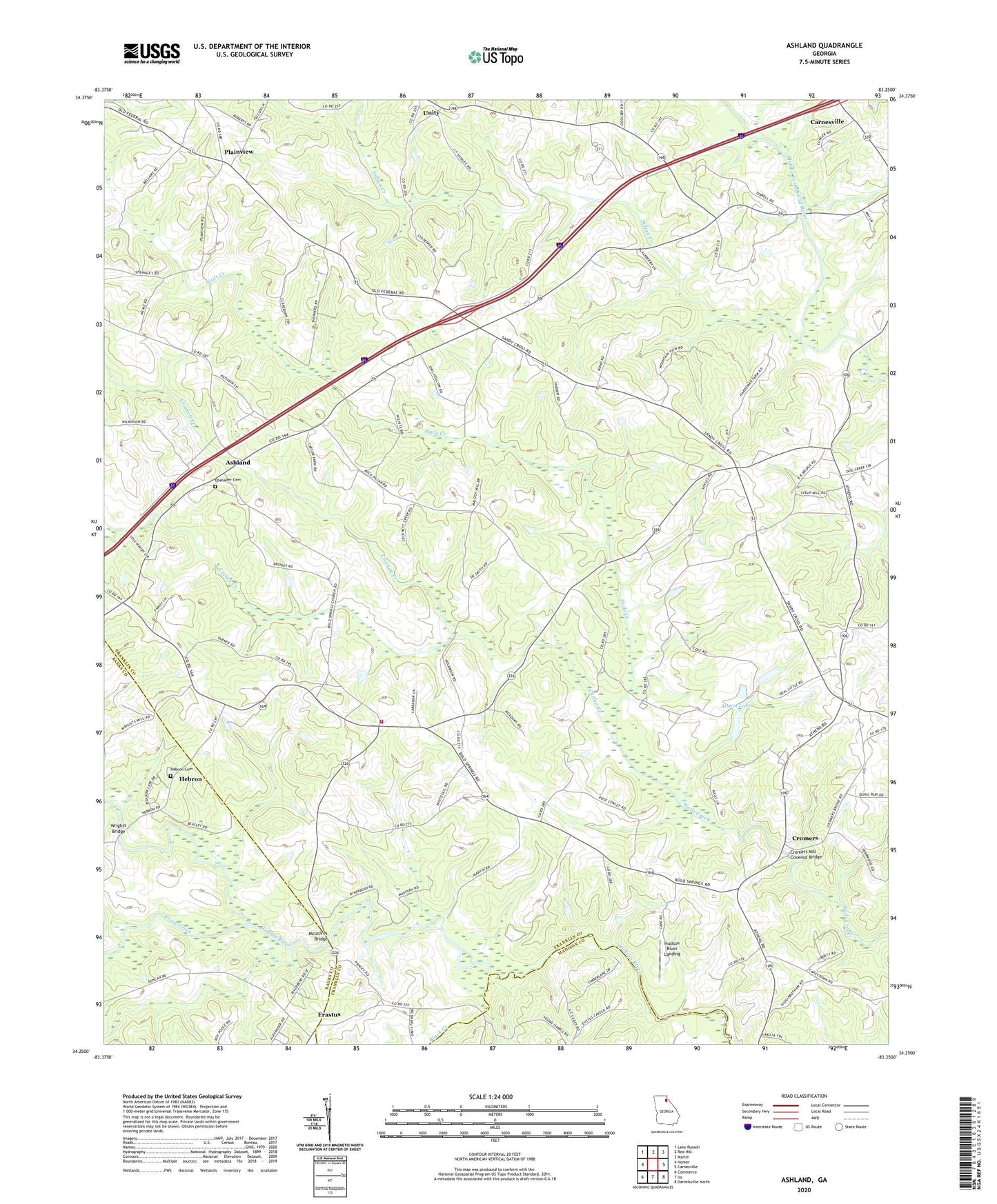
2024 topographic map quadrangle Ashland in the state of Georgia. Scale: 1:24000. Based on the newly updated USGS 7.5' US Topo map series, this map is in the following counties: Franklin, Banks, Madison. The map contains contour data, water features, and other items you are used to seeing on USGS maps, but also has updated roads and other features. This is the next generation of topographic maps. Printed on high-quality waterproof paper with UV fade-resistant inks.
Quads adjacent to this one:
West: Homer
Northwest: Lake Russell
North: Red Hill
Northeast: Martin
East: Carnesville
Southeast: Danielsville North
South: Ila
Southwest: Commerce
This map covers the same area as the classic USGS quad with code o34083c3.
Contains the following named places: Alston Dam, Alston Lake, Alston Lake Dam, Arnold Chapel, Ashland, Bald Springs Church, Black Creek, Bold Springs Fire Department, Carlan Creek, Crockett Creek, Cromers, Cromers Mill Covered Bridge, Ebenezer Cemetery, Ebenezer Church, Erastus, Gordon Church, Grove Creek, Hebron, Hebron Academy, Hebron Cemetery, Hebron Church, Hudson River Church, Hudson River Landing, Indian Creek, Indian Creek Church, McIntires Bridge, Melvin Hill Church, Middle River Church, Nails Creek Church, Plainview, Ragsdale Creek, Sandy Cross Division, Trinity Church, Union Grove Church, Walnut Hill, Wrights Bridge, ZIP Code: 30521