MyTopo
Red Hill Georgia US Topo Map
Couldn't load pickup availability
Also explore the Red Hill Forest Service Topo of this same quad for updated USFS data
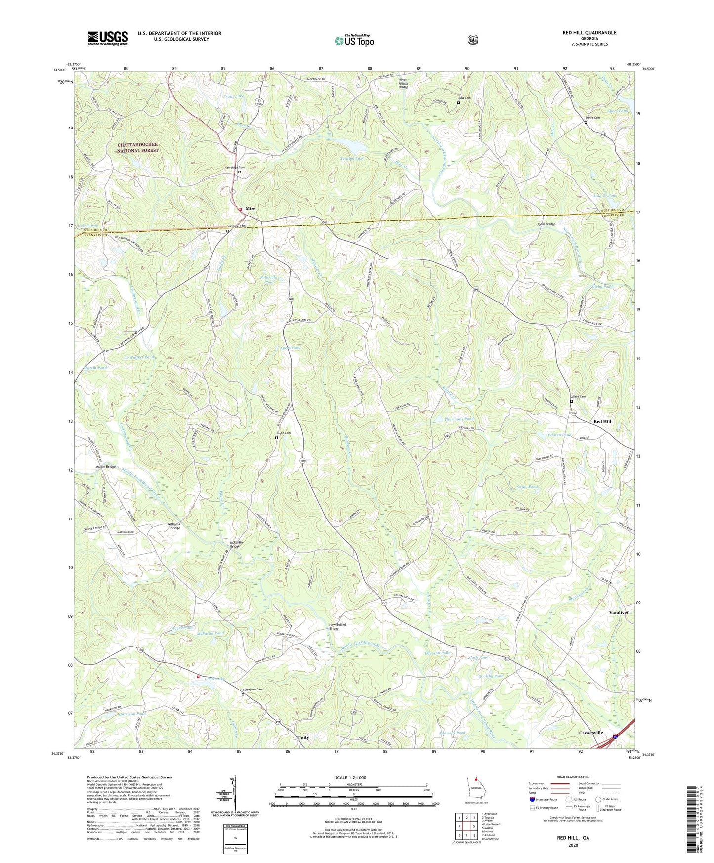
2024 topographic map quadrangle Red Hill in the state of Georgia. Scale: 1:24000. Based on the newly updated USGS 7.5' US Topo map series, this map is in the following counties: Franklin, Stephens. The map contains contour data, water features, and other items you are used to seeing on USGS maps, but also has updated roads and other features. This is the next generation of topographic maps. Printed on high-quality waterproof paper with UV fade-resistant inks.
Quads adjacent to this one:
West: Lake Russell
Northwest: Ayersville
North: Toccoa
Northeast: Avalon
East: Martin
Southeast: Carnesville
South: Ashland
Southwest: Homer
This map covers the same area as the classic USGS quad with code o34083d3.
Contains the following named places: Akins Bridge, Allen Church, Allens Cemetery, Andrews Pond, Ayers Pond, Bear Creek, Broad River Church, Cagle Lake, Cagle Lake Dam, Carnesville Division, Cash Pond, Cleveland Grove Church, Crawfords Store, Culpepper Cemetery, Double Churches Volunteer Fire Department, Eaveson Pond, Ellis Chapel, Fulbright Pond, Garrison Pond, Goolsby Pond, Hunters Creek, Hunters Creek Church, Kirby Pond, Leatherwood Creek, Mag Creek, Mag Creek Pond, Martin Bridge, Martin Pond, McDuffies Store, McFarlin Bridge, McFarlin Pond, Mize, Moss Cemetery, Mount Zion Church, New Bethel Bridge, New Bethel Church, New Hope Cemetery, New Hope Church, New Rohamah Church, North Fork Broad River Structure Five Dam, North Fork Broad River Structure Six Dam, Payne Cemetery, Payne Creek, Pentecost Church, Pruitt Lake, Red Hill, Red Hill Lodge, Shady Church, Silver Shoals Bridge, Sosby Pond, Stephens County Fire Department Station 3, Stowe Cemetery, Sunshine Cemetery, Sunshine Church, Teasley Lake, Thurmond Pond, Travelers Church, Union Ground Church, Unity, Vandiver, Walters Pond, Welcome Church, Whiten Creek, Whiten Pond, Williams Bridge