MyTopo
Benedict Georgia US Topo Map
Couldn't load pickup availability
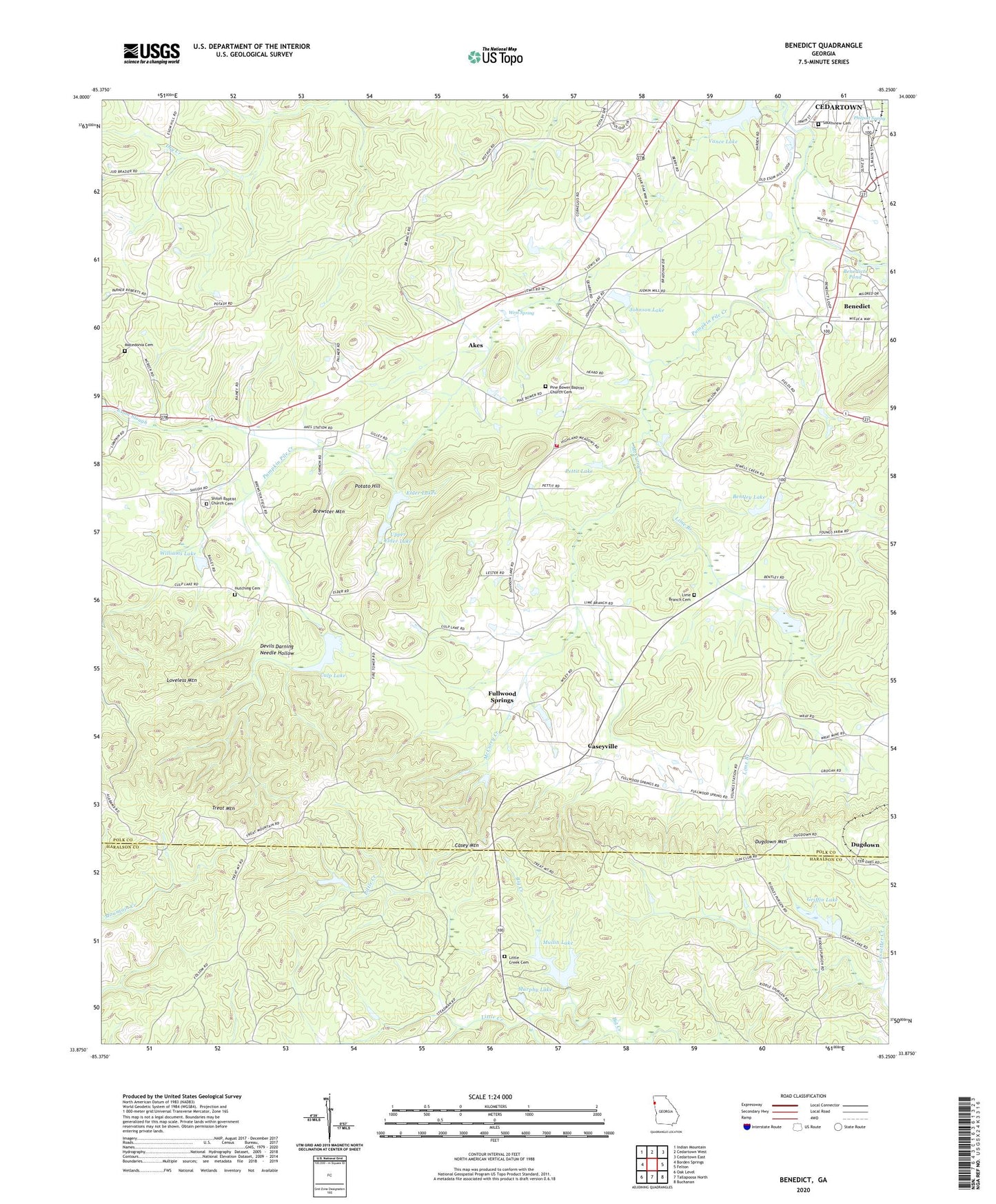
2024 topographic map quadrangle Benedict in the state of Georgia. Scale: 1:24000. Based on the newly updated USGS 7.5' US Topo map series, this map is in the following counties: Polk, Haralson. The map contains contour data, water features, and other items you are used to seeing on USGS maps, but also has updated roads and other features. This is the next generation of topographic maps. Printed on high-quality waterproof paper with UV fade-resistant inks.
Quads adjacent to this one:
West: Borden Springs
Northwest: Indian Mountain
North: Cedartown West
Northeast: Cedartown East
East: Felton
Southeast: Buchanan
South: Tallapoosa North
Southwest: Oak Level
This map covers the same area as the classic USGS quad with code o33085h3.
Contains the following named places: Akes, Benedict, Benedict Baptist Church, Benedict School, Benedicts Mill, Benedicts Pond, Bentley Lake, Berry Grove Church, Big Cedar Creek Structure Number 13 Dam, Blooming Grove Church, Brewster Mountain, Brewster School, Casey Mountain, Caseyville, Cedar Valley Country Club, Cedartown Division, Cleveland Chapel, Culp Lake, Culp Lake Dam, Devils Darning Needle Hollow, Dugdown, Dugdown Church, Dugdown Mountain, Elder Lakes, Fullwood Springs, Greenway, Griffin Lake, Griffin Lake Dam, Hutching Cemetery, Johnson Lake, Lake Ujihito, Lime Branch, Lime Branch Cemetery, Lime Branch Church, Little Creek, Little Creek Cemetery, Loveless Mountain, Lower Elder Lake, Lower Elder Lake Dam, Macedonia Cemetery, McCurry Creek, Mount Zion Church, Mullin Lake, Mullin Lake Dam, Murphy Lake, Old Brewster School, Pettit Lake, Pine Bower Baptist Church, Pine Bower Baptist Church Cemetery, Polk County Fire Department Blooming Grove Station, Potato Hill, Pumpkin Pile Creek, Shiloh Baptist Church, Shiloh Baptist Church Cemetery, Shiloh Lake, Southview Cemetery, Treat, Treat Mountain, Upper Elder Lake, Upper Elder Lake Dam, Valley View Church, Vance Lake Dam, Walthrall, Ware Grove Church, West Spring, Williams Lake, Williams Lake Dam, Woodward Mine