
MyTopo
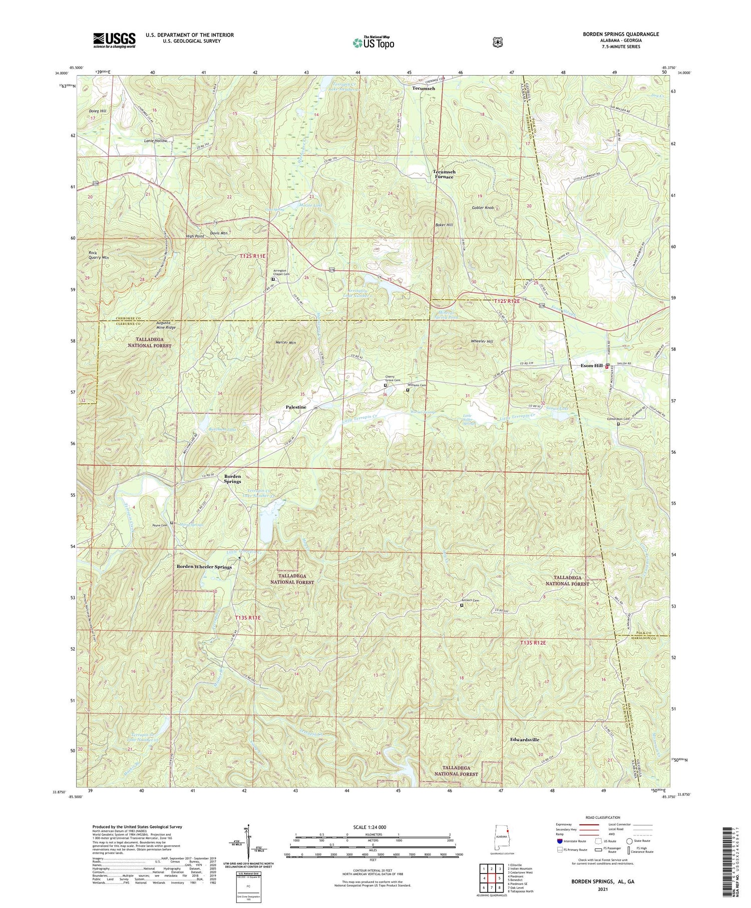
Borden Springs Alabama US Topo Map
Couldn't load pickup availability
Also explore the Borden Springs Forest Service Topo of this same quad for updated USFS data
2024 topographic map quadrangle Borden Springs in the states of Alabama, Georgia. Scale: 1:24000. Based on the newly updated USGS 7.5' US Topo map series, this map is in the following counties: Cleburne, Cherokee, Polk, Haralson. The map contains contour data, water features, and other items you are used to seeing on USGS maps, but also has updated roads and other features. This is the next generation of topographic maps. Printed on high-quality waterproof paper with UV fade-resistant inks.
Quads adjacent to this one:
West: Piedmont
Northwest: Ellisville
North: Indian Mountain
Northeast: Cedartown West
East: Benedict
Southeast: Tallapoosa North
South: Oak Level
Southwest: Piedmont SE
Contains the following named places: Advents Church, Antioch Cemetery, Arrington Chapel Cemetery, Arrington Chapel Congregational Methodist Church, Arrington Lake Number 1, Arrington Lake Number 2, Arrington Lakes, Arrington Number 1 Dam, Arrington Number 2 Dam, Augusta Mine, Baker Hill, Baker Hill Mines, Beecham Lake, Bentons Mill, Borden Springs, Borden Wheeler Springs, Camp Creek, Cherry Grove Original Church Cemetery, Corinth Church, Davis Mountain, Doieg Hill, Edmondson Cemetery, Esom Hill, Esom Hill Post Office, Esom Station, Gobler Knob, Goss Spring, Harmony Church, High Point, Hog Creek, Lanie Gap, Lanie Hollow, Little Sulfer Springs, Little Terrapin Creek, Mathis Branch, McGee Lake, Mercer Mountain, Mineral Spring Pond, Mountain Creek Church, Murry Springs, New Bethel Church, Palestine, Payne Cemetery, Polk County Volunteer Fire Department Esom Hill Station, Rock Quarry Mountain, Rock Run Station, Snows Dam, Snows Lake, Tecumseh, Tecumseh Furnace, Terrapin Creek Lake Number 15, Terrapin Creek Lake Number 17, Terrapin Creek Lake Number 22, Terrapin Creek Lake Number 33, Terrapin Creek Watershed Dam Number 14, Terrapin Creek Watershed Dam Number 15, Terrapin Creek Watershed Dam Number 22, Terrapin Creek Watershed Dam Number 33, Warner, Warner Swamp, Wheeler Hill, Williams Cemetery


