
MyTopo
Tallapoosa North Georgia US Topo Map
Couldn't load pickup availability
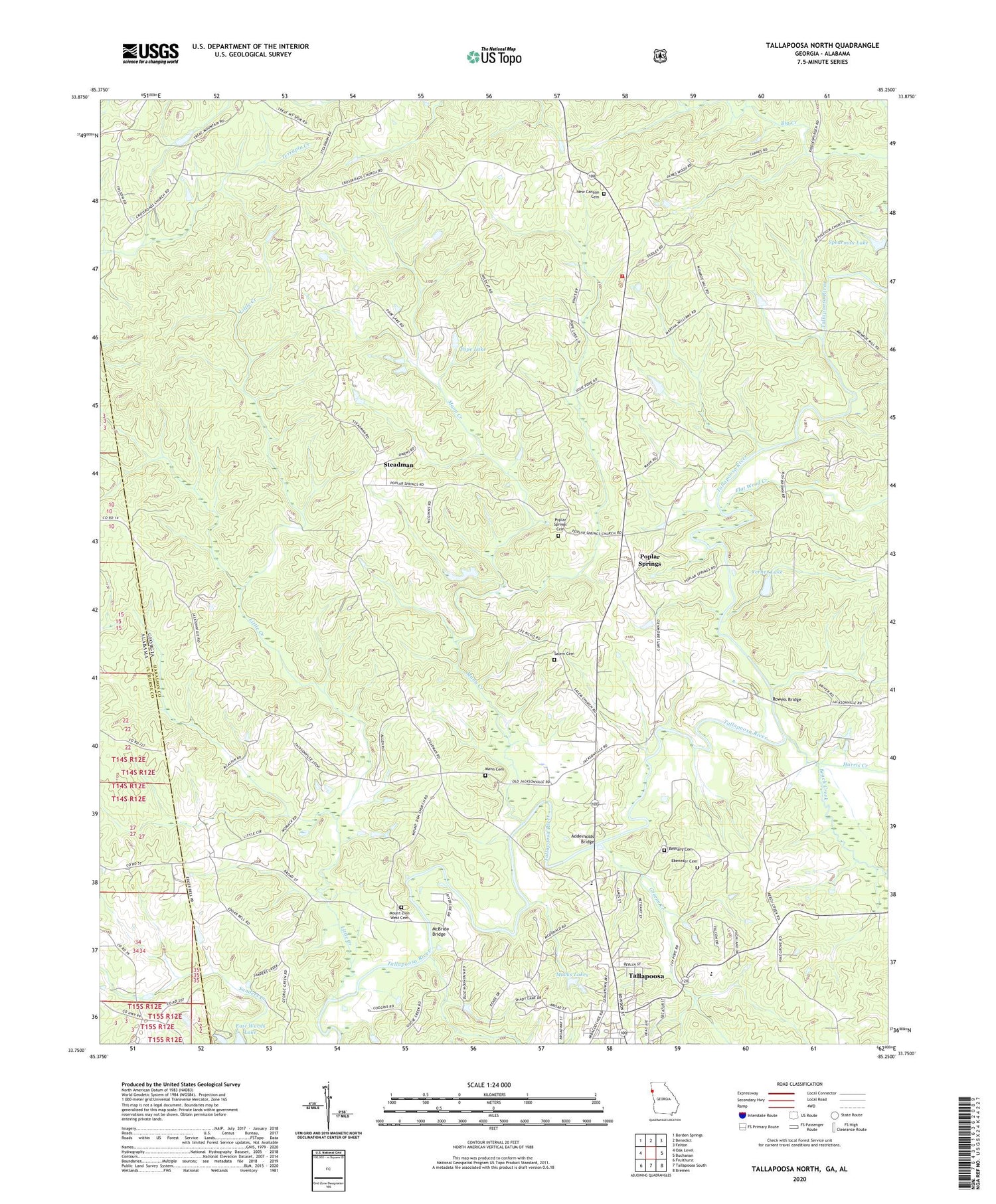
2024 topographic map quadrangle Tallapoosa North in the states of Georgia, Alabama. Scale: 1:24000. Based on the newly updated USGS 7.5' US Topo map series, this map is in the following counties: Haralson, Cleburne. The map contains contour data, water features, and other items you are used to seeing on USGS maps, but also has updated roads and other features. This is the next generation of topographic maps. Printed on high-quality waterproof paper with UV fade-resistant inks.
Quads adjacent to this one:
West: Oak Level
Northwest: Borden Springs
North: Benedict
Northeast: Felton
East: Buchanan
Southeast: Bremen
South: Tallapoosa South
Southwest: Fruithurst
This map covers the same area as the classic USGS quad with code o33085g3.
Contains the following named places: Adderholds Bridge, Beach Creek, Bethany Cemetery, Bethany Church, Christian Camp Home Mission, Crossroad Church, Ebenezer Cemetery, Ebenezer Church, Emmanuel Church, Flat Wood Creek, Greene Creek, Haralson County Fire Department Station 4, Harris Creek, Little Creek, Macks Lakes, Mann Cemetery, Mann Creek, McBride Bridge, Mount Sinai Baptist Church, Mount Zion West Cemetery, Mount Zion West Church, Munroe Mill, New Canaan Cemetery, New Canaan Church, Old Tallapoosa, Pleasant Hill Church, Pope Lake, Poplar Springs, Poplar Springs Cemetery, Poplar Springs Church, Rainwater Ford, Rowels Bridge, Salem Cemetery, Spearman Lake, Spearman Lake Dam, State Line Church, Steadman, Steadman Missionary Church, Tallapoosa Division, Tallapoosa Primary School, Verner Lake, Verner Lake Dam, West Haralson Elementary School, ZIP Code: 30176


