MyTopo
Bethel Georgia US Topo Map
Couldn't load pickup availability
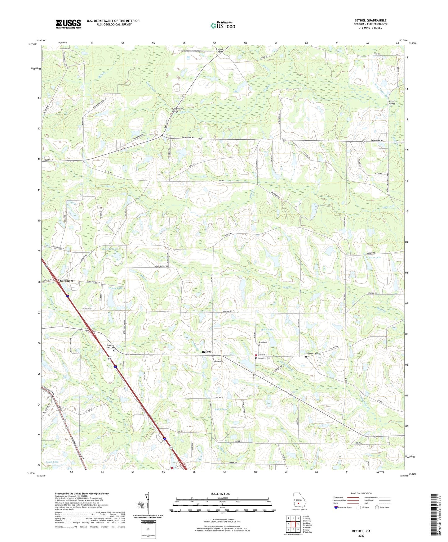
2024 topographic map quadrangle Bethel in the state of Georgia. Scale: 1:24000. Based on the newly updated USGS 7.5' US Topo map series, this map is in the following counties: Turner. The map contains contour data, water features, and other items you are used to seeing on USGS maps, but also has updated roads and other features. This is the next generation of topographic maps. Printed on high-quality waterproof paper with UV fade-resistant inks.
Quads adjacent to this one:
West: Ashburn
Northwest: Arabi
North: Amboy
Northeast: Rebecca
East: Irwinville
Southeast: Waterloo
South: Chula
Southwest: Sumner
This map covers the same area as the classic USGS quad with code o31083f5.
Contains the following named places: Bethel, Bethel Baptist Church, Bethel Cemetery, Bussey School, Busseys Pond, Carter Lake, Carter Lake Dam, Clements Cemetery, Deep Creek Church, Friendship School, Geoghagan Bridge, Gorday Ford, Henderson School, Jones Lake, Jones Lake Dam, Live Oak Church, Metcalf School, Mile Branch, New Hope Church, Newton Church, Pilgrims Home Church, Pleasant Hill Cemetery, Pleasant Hill Church, Prospect Church, Prospects Cemetery, Rainey Ford, Rebecca-Sycamore Division, Reinhardt Lake, Reinhardt Lake Dam, Richter Airpark, Ross Cemetery, Shivers Bridge, Smith Pond, Snap Finger Branch, Sycamore Division, Turner County, Turner County Fire and Rescue Bethel Station, Turner County Fire and Rescue Inaha Station, Union Grove Church, Wells Lake, Wells Lake Dam, West Fork Deep Creek, Wolf Creek, Wynne Lake, Wynne Lake Dam, ZIP Code: 31790