MyTopo
Rebecca Georgia US Topo Map
Couldn't load pickup availability
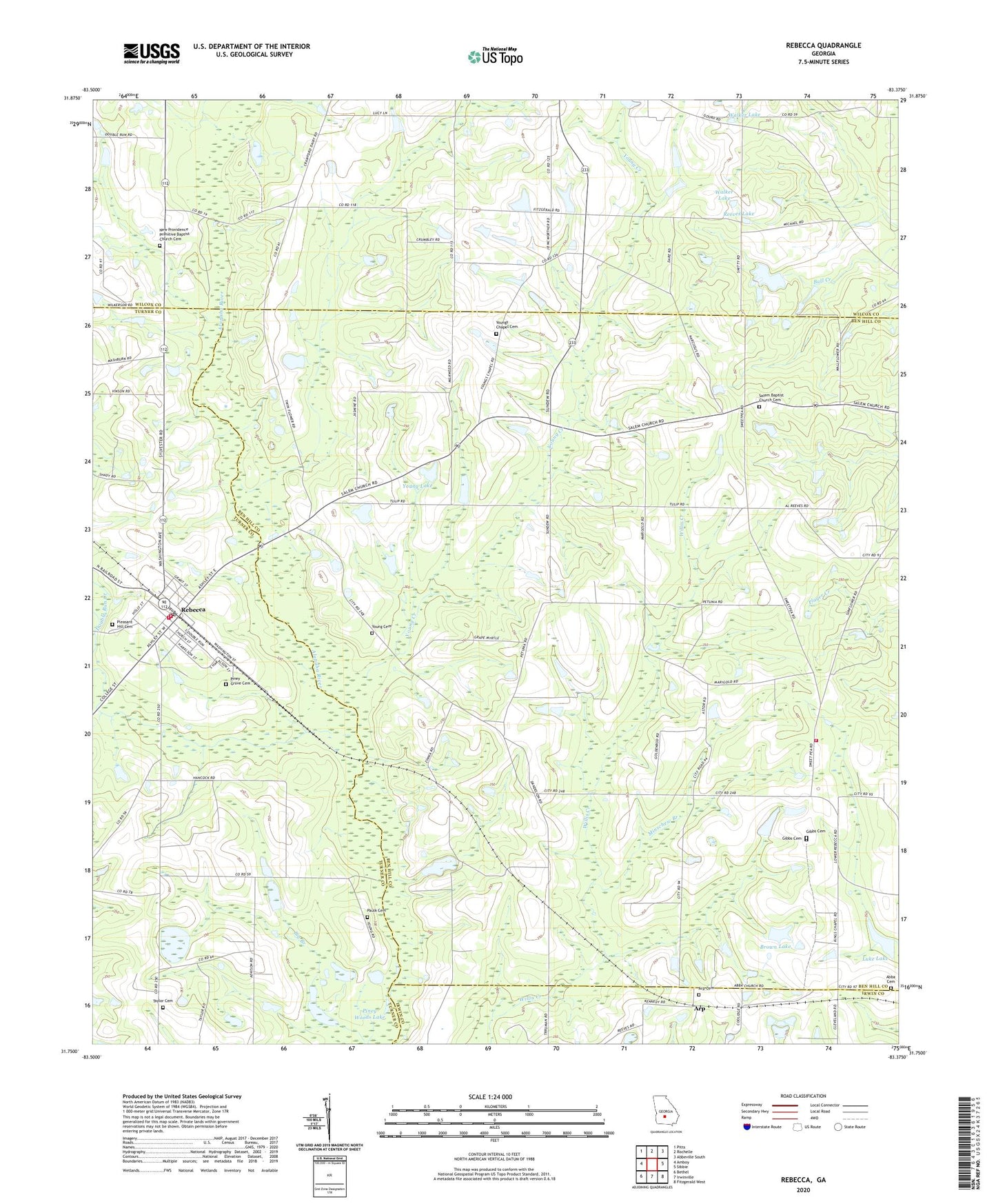
2024 topographic map quadrangle Rebecca in the state of Georgia. Scale: 1:24000. Based on the newly updated USGS 7.5' US Topo map series, this map is in the following counties: Ben Hill, Wilcox, Turner, Irwin. The map contains contour data, water features, and other items you are used to seeing on USGS maps, but also has updated roads and other features. This is the next generation of topographic maps. Printed on high-quality waterproof paper with UV fade-resistant inks.
Quads adjacent to this one:
West: Amboy
Northwest: Pitts
North: Rochelle
Northeast: Abbeville South
East: Sibbie
Southeast: Fitzgerald West
South: Irwinville
Southwest: Bethel
This map covers the same area as the classic USGS quad with code o31083g4.
Contains the following named places: Abba Cemetery, Arp, Arp Cemetery, Arp Missionary Baptist Church, Ben Hill County Volunteer Fire Department Station 6, Big Branch, Brown Lake, Brown Lake Dam, Cold Springs, Double Run Creek, Gibbs Cemetery, King Chapel, Luke Lake, Luke Lake Dam, Luke School, Minschew Branch, Mount Isiac Church, New Providence Church, New Providence Primitive Baptist Church Cemetery, Paulk Cemetery, Piney Grove Cemetery, Piney Woods Lake, Pleasant Hill Cemetery, Pleasant Hill Church, Rebecca, Rebecca Consolidated High School, Rebecca Post Office, Rebecca Volunteer Fire Department, Reeves Lake, Reeves Lake Dam, Salem Baptist Church, Salem Baptist Church Cemetery, Taylor Cemetery, Town of Rebecca, Turner County Fire and Rescue Rebecca Station, Walker Lake, Walker Lake Dam, Williamson Pond, Young Cemetery, Young Creek, Young Lake, Young Lake Dam, Youngs Chapel, Youngs Chapel Cemetery, ZIP Code: 31783