MyTopo
Arabi Georgia US Topo Map
Couldn't load pickup availability
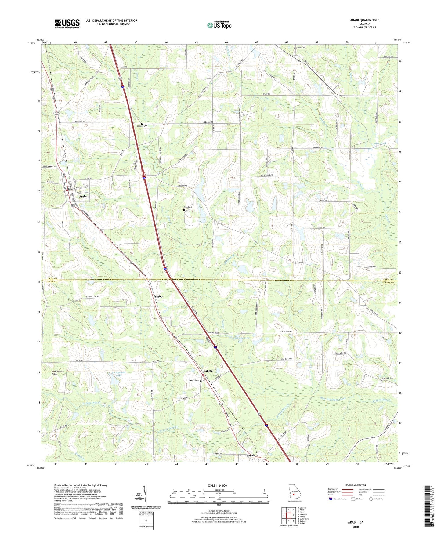
2024 topographic map quadrangle Arabi in the state of Georgia. Scale: 1:24000. Based on the newly updated USGS 7.5' US Topo map series, this map is in the following counties: Crisp, Turner. The map contains contour data, water features, and other items you are used to seeing on USGS maps, but also has updated roads and other features. This is the next generation of topographic maps. Printed on high-quality waterproof paper with UV fade-resistant inks.
Quads adjacent to this one:
West: Pateville
Northwest: Cordele
North: Penia
Northeast: Pitts
East: Amboy
Southeast: Bethel
South: Ashburn
Southwest: Cuffietown
This map covers the same area as the classic USGS quad with code o31083g6.
Contains the following named places: Arabi, Arabi - Antioch Cemetery, Arabi Division, Arabi Post Office, Bay Spring Church, Bay Spring School, Bedgood, Crisp County Fire Department Station 3, Dakota, Dakota Cemetery, Dakota Church, Dakota Consolidated School, Eldridge Branch, Haw Pond, Haw Pond Church, Haw Pond School, High Hill Church, Hopewell Cemetery, Hopewell Church, Jackson Cemetery, Lime Creek, Little Rock Church, Mount Bethel Youth Camp, Mount Orham Church, New Hope Church, Pine View Church, Pitts Cemetery, Rainey School, Rattlesnake Ridge, Reedy Branch, Sibley, Sink of the Creek, Smith Cemetery, Town of Arabi, Turner County Fire and Rescue Dakota Station, Worth, Youngblood Lake, Youngblood Lake Dam, ZIP Code: 31712