
MyTopo
Blakely South Georgia US Topo Map
Couldn't load pickup availability
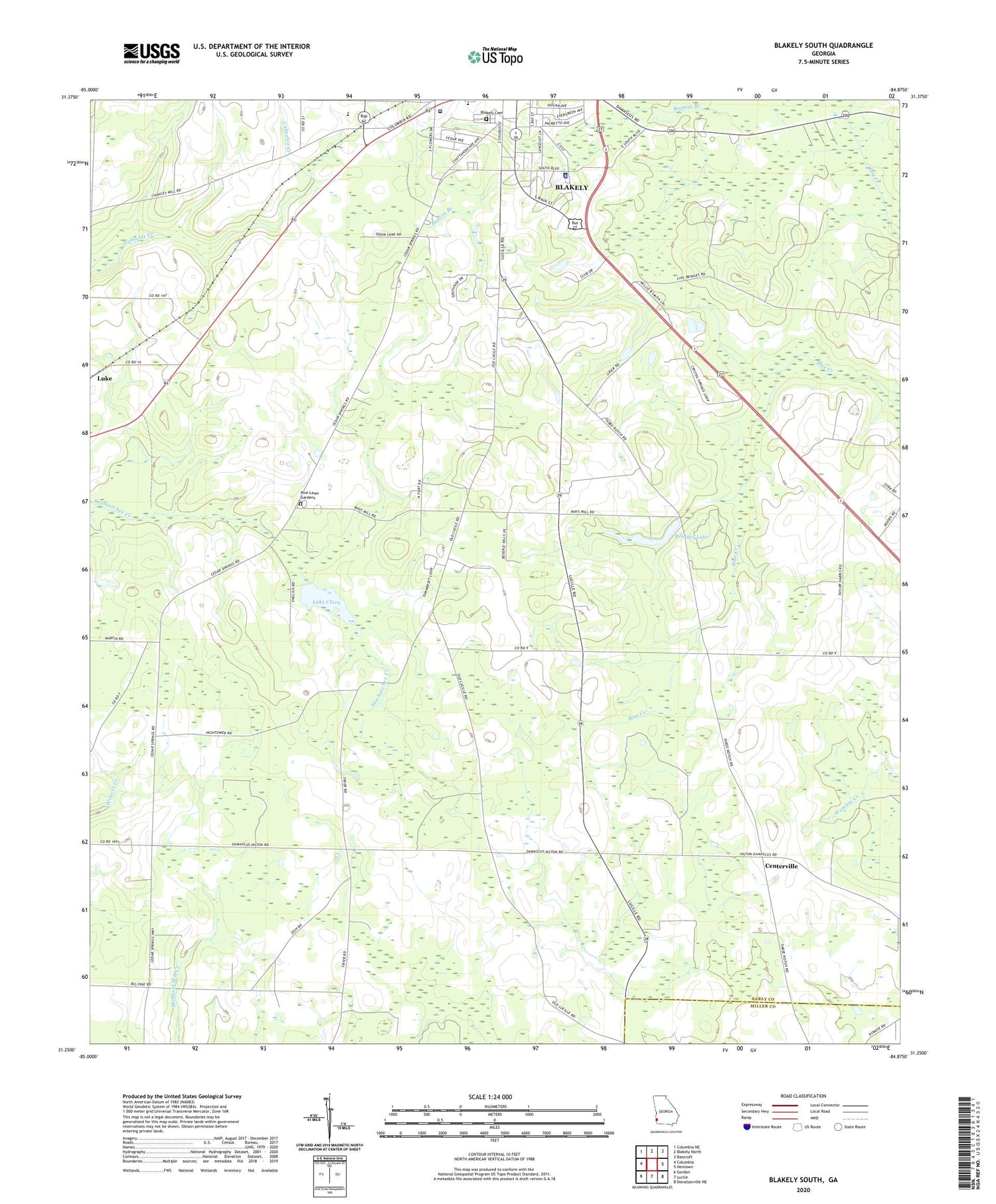
2024 topographic map quadrangle Blakely South in the state of Georgia. Scale: 1:24000. Based on the newly updated USGS 7.5' US Topo map series, this map is in the following counties: Early, Miller. The map contains contour data, water features, and other items you are used to seeing on USGS maps, but also has updated roads and other features. This is the next generation of topographic maps. Printed on high-quality waterproof paper with UV fade-resistant inks.
Quads adjacent to this one:
West: Columbia
Northwest: Columbia NE
North: Blakely North
Northeast: Bancroft
East: Hentown
Southeast: Donalsonville NE
South: Lucile
Southwest: Gordon
This map covers the same area as the classic USGS quad with code o31084c8.
Contains the following named places: Alex Howell Baseball Park, Baptist Branch, Bethlehem Church, Blakely - Early County Sheriff's Office, Blakely Cemetery, Blakely Regional Youth Development Center, Bridges Lake, Bridges Lake Dam, Byron School, Calvary Baptist Church, Centerville, Centerville Methodist Cemetery, Centerville Methodist Church, Church of Christ, Church of God, Early County, Early County High School, First Free Will Baptist Church, Friendship Church, Jerusalem Church, King Plaza Shopping Center, Lake Clara, Lake Clara Dam, Langston Chapel, LifeBrite Community Hospital of Early, Macedonia Church, Maddox Memorial Library, McLendon, New Prospect Church, New Prospect Church Cemetery, Pine Lawn Gardens, Pineview Church, Saint Johns Church, Saint Maryland Church, Saint Pauls Church, Sawhatchee Church, Southside Baptist Church, Standifer Field, Town and Country Club, Town and Country Golf Course, WBBK-AM (Blakely), ZIP Code: 39823


