MyTopo
Donalsonville NE Georgia US Topo Map
Couldn't load pickup availability
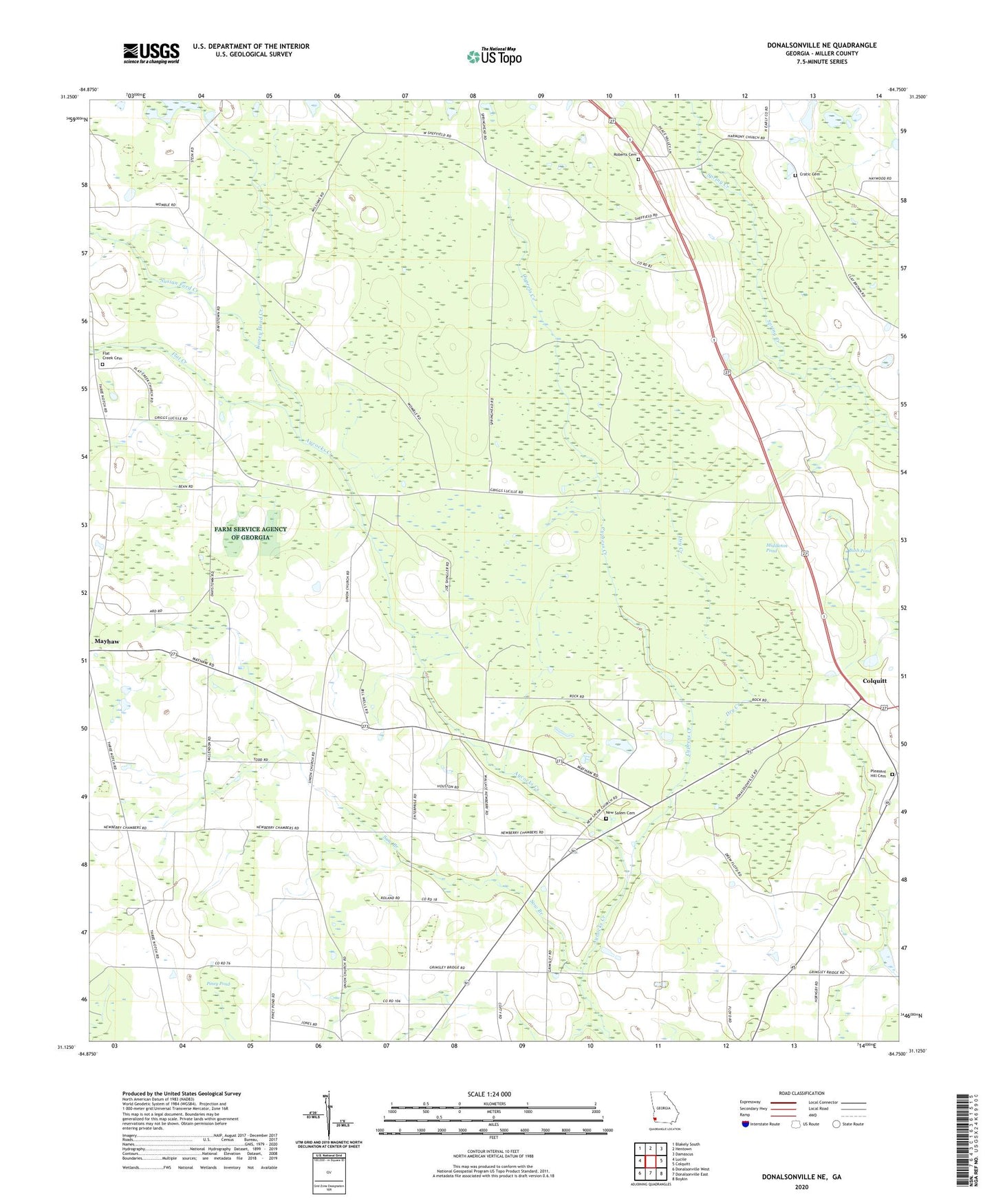
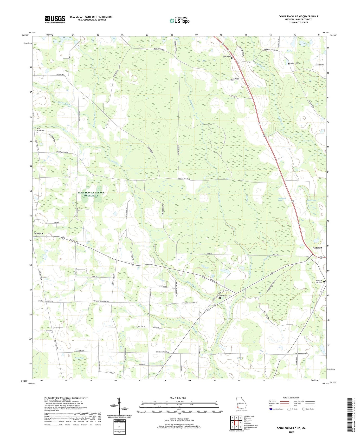
2024 topographic map quadrangle Donalsonville NE in the state of Georgia. Scale: 1:24000. Based on the newly updated USGS 7.5' US Topo map series, this map is in the following counties: Miller. The map contains contour data, water features, and other items you are used to seeing on USGS maps, but also has updated roads and other features. This is the next generation of topographic maps. Printed on high-quality waterproof paper with UV fade-resistant inks.
Quads adjacent to this one:
West: Lucile
Northwest: Blakely South
North: Hentown
Northeast: Damascus
East: Colquitt
Southeast: Boykin
South: Donalsonville East
Southwest: Donalsonville West
This map covers the same area as the classic USGS quad with code o31084b7.
Contains the following named places: Bush Pond, Cratic Cemetery, Cypress Creek, Dozier, Dry Creek, Flat Creek, Flat Creek Cemetery, Flat Creek Church, Floydtown, Joe Shingler, Kaney Head Creek, Kaney Head School, Mayhaw Division, Middleton Pond, Miller County Wildlife Management Area, New Salem Cemetery, New Salem Church, Newberry Family Cemetery, Newberry School, Oak Grove Free Will Baptist Church, Piney Pond, Pleasant Hill Cemetery, Porto Rico School, Roberts Cemetery, Shiloh Church, South Mount Zion Church, Sow Branch, Susian Ford Creek