MyTopo
Boykin Georgia US Topo Map
Couldn't load pickup availability
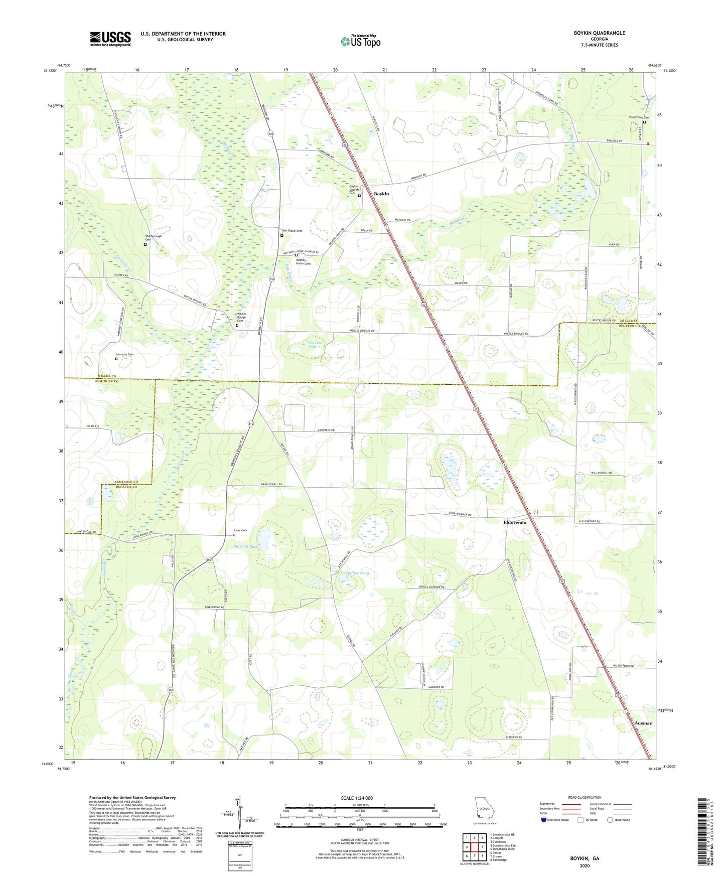
2024 topographic map quadrangle Boykin in the state of Georgia. Scale: 1:24000. Based on the newly updated USGS 7.5' US Topo map series, this map is in the following counties: Decatur, Miller, Seminole. The map contains contour data, water features, and other items you are used to seeing on USGS maps, but also has updated roads and other features. This is the next generation of topographic maps. Printed on high-quality waterproof paper with UV fade-resistant inks.
Quads adjacent to this one:
West: Donalsonville East
Northwest: Donalsonville NE
North: Colquitt
Northeast: Cooktown
East: Steadhams Store
Southeast: Bainbridge
South: Brinson
Southwest: Desser
This map covers the same area as the classic USGS quad with code o31084a6.
Contains the following named places: Aycocks Creek, Babcock, Big Drain, Boykin, Boykin Census Designated Place, Boykin Church Cemetery, Boykin Church of God, Church of Christ, Cowart Pond, Dry Creek, Durham Park, Eldorendo, Eldorendo Baptist Church, Evergreen Church, Full Ford Pond, Holder Pond, Hornsby Cemetery, Jones-Babcock School, Lane Cemetery, Miller County Volunteer Fire Department Station 2 Babcock Volunteer Fire Department, Morning Star Church, Mothers Home Cemetery, Mothers Home Church, Oak Grove Cemetery, Pilgrims Rest Church, Pine Grove Church, Pleasant Hill Church, Pond Town Cemetery, Scarborough Cemetery, Shiloh Church, Twilight, Whites Bridge Cemetery