MyTopo
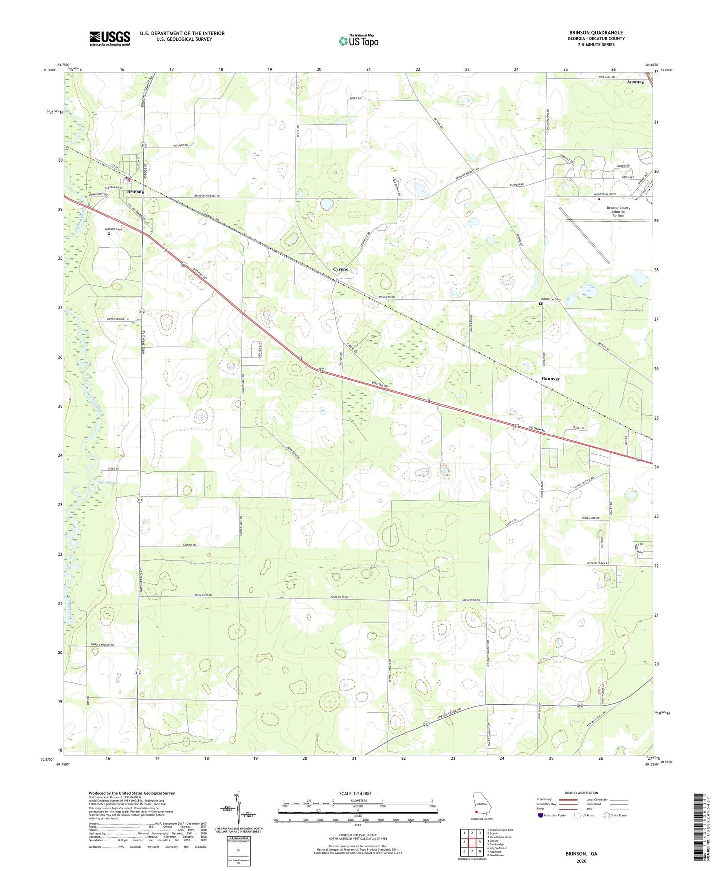
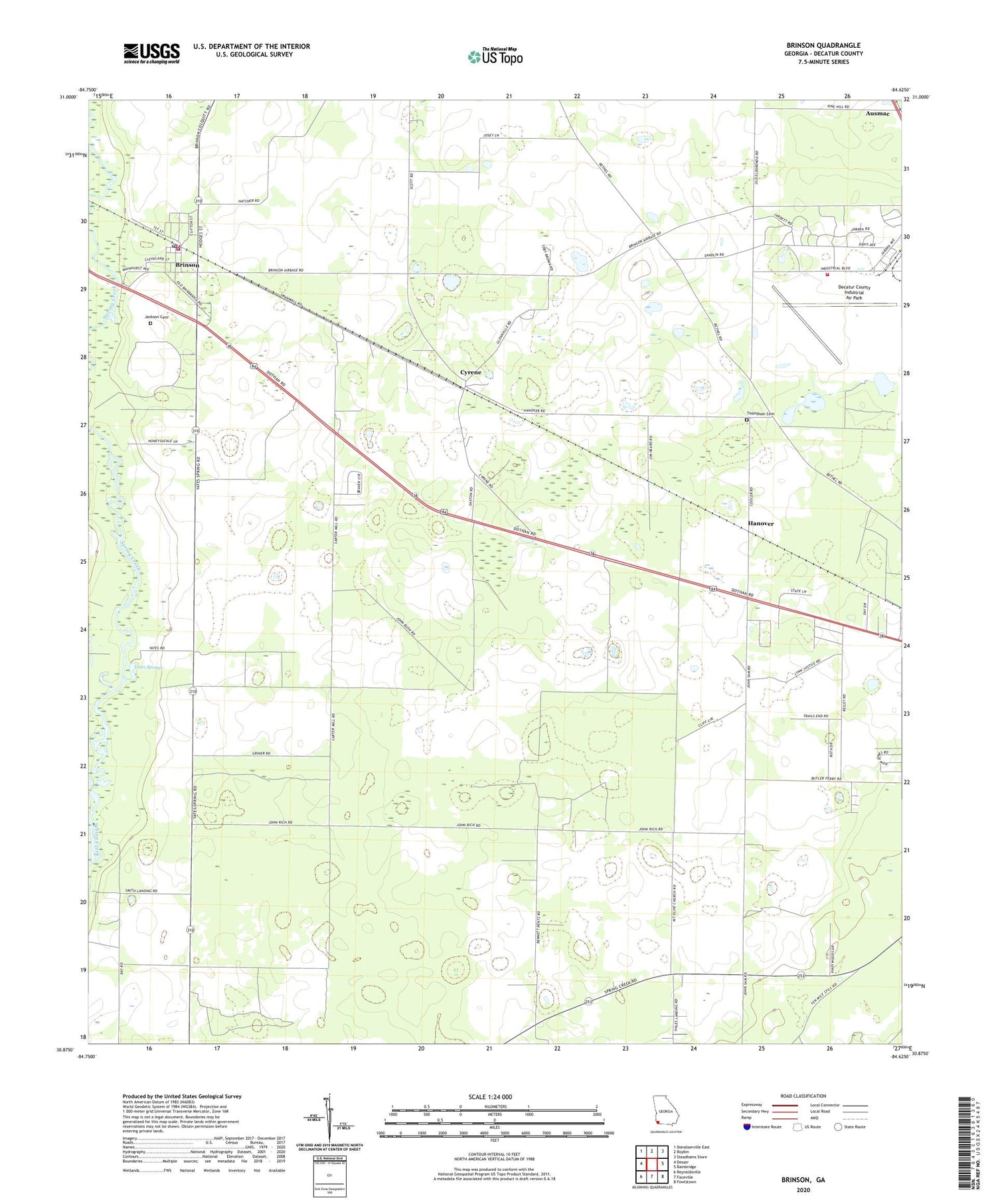
Brinson Georgia US Topo Map
Couldn't load pickup availability
2024 topographic map quadrangle Brinson in the state of Georgia. Scale: 1:24000. Based on the newly updated USGS 7.5' US Topo map series, this map is in the following counties: Decatur. The map contains contour data, water features, and other items you are used to seeing on USGS maps, but also has updated roads and other features. This is the next generation of topographic maps. Printed on high-quality waterproof paper with UV fade-resistant inks.
Quads adjacent to this one:
West: Desser
Northwest: Donalsonville East
North: Boykin
Northeast: Steadhams Store
East: Bainbridge
Southeast: Fowlstown
South: Faceville
Southwest: Reynoldsville
This map covers the same area as the classic USGS quad with code o30084h6.
Contains the following named places: Bainbridge Air Base Contract School, Bainbridge Army Air Field, Bainbridge State Hospital, Bainbridge Substance Abuse Treatment Center, Bethel Church, Bethel Church Cemetery, Brinson, Brinson Division, Brinson Family Historic District, Brinson Post Office, Buzzard Roost, Cyrene, Decatur County Fire and Rescue Department, Decatur County Fire and Rescue Station 250, Decatur County Industrial Air Park, Hanover, Highway Church, Jackson Cemetery, Kingdom Hall, Mount Olive Church, Mount Pleasant Church, Mount Zion Church, New Salem Church, Oak Academy, Simms Pond, Smiths Landing, Swanwall Church, Thompson Cemetery, Town of Brinson, Yates Springs, ZIP Code: 39825