MyTopo
Buena Vista NE Georgia US Topo Map
Couldn't load pickup availability
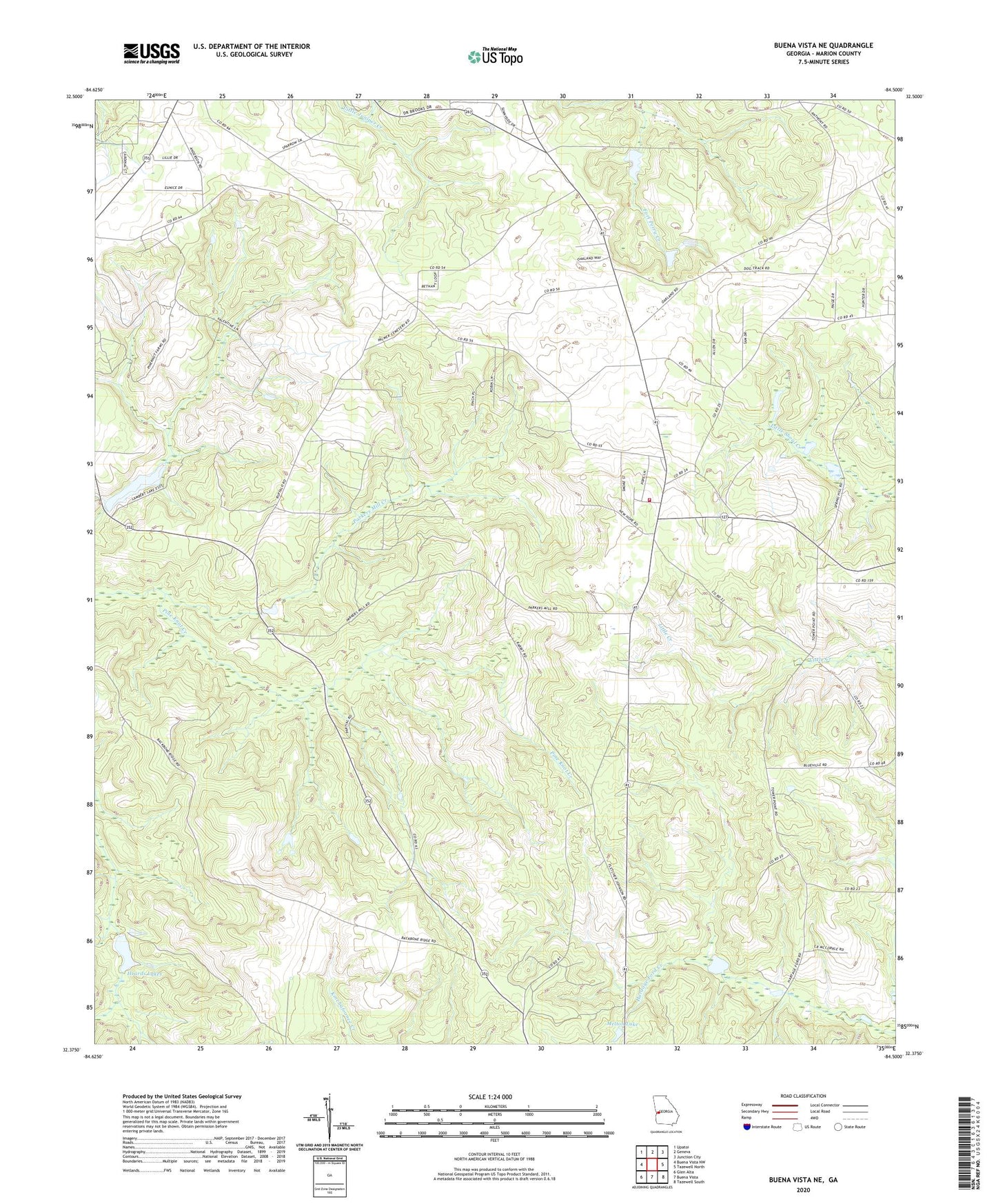
2024 topographic map quadrangle Buena Vista NE in the state of Georgia. Scale: 1:24000. Based on the newly updated USGS 7.5' US Topo map series, this map is in the following counties: Marion. The map contains contour data, water features, and other items you are used to seeing on USGS maps, but also has updated roads and other features. This is the next generation of topographic maps. Printed on high-quality waterproof paper with UV fade-resistant inks.
Quads adjacent to this one:
West: Buena Vista NW
Northwest: Upatoi
North: Geneva
Northeast: Junction City
East: Tazewell North
Southeast: Tazewell South
South: Buena Vista
Southwest: Glen Alta
This map covers the same area as the classic USGS quad with code o32084d5.
Contains the following named places: Bethany Church, Bethlehem Church, Church of the Living God, Fort Perry, Fort Perry Monument, Heards Lake Dam, Heards Lakes, Hickory Tree Church, Hilyard Church, Lambert Lake, Lambert Lake Dam, Living Water Church, Marion County Fire Department, Melton Dam, Melton Lake, Mount Olive Church, New Home Church, New Hope Church, North Marion Division, Oakland, Oakland Baptist Cemetery, Oakland Baptist Church, Oakland Church, Oakland Church of God Cemetery, Parkers Mill Creek, Spring Hill Church