MyTopo
Buena Vista Georgia US Topo Map
Couldn't load pickup availability
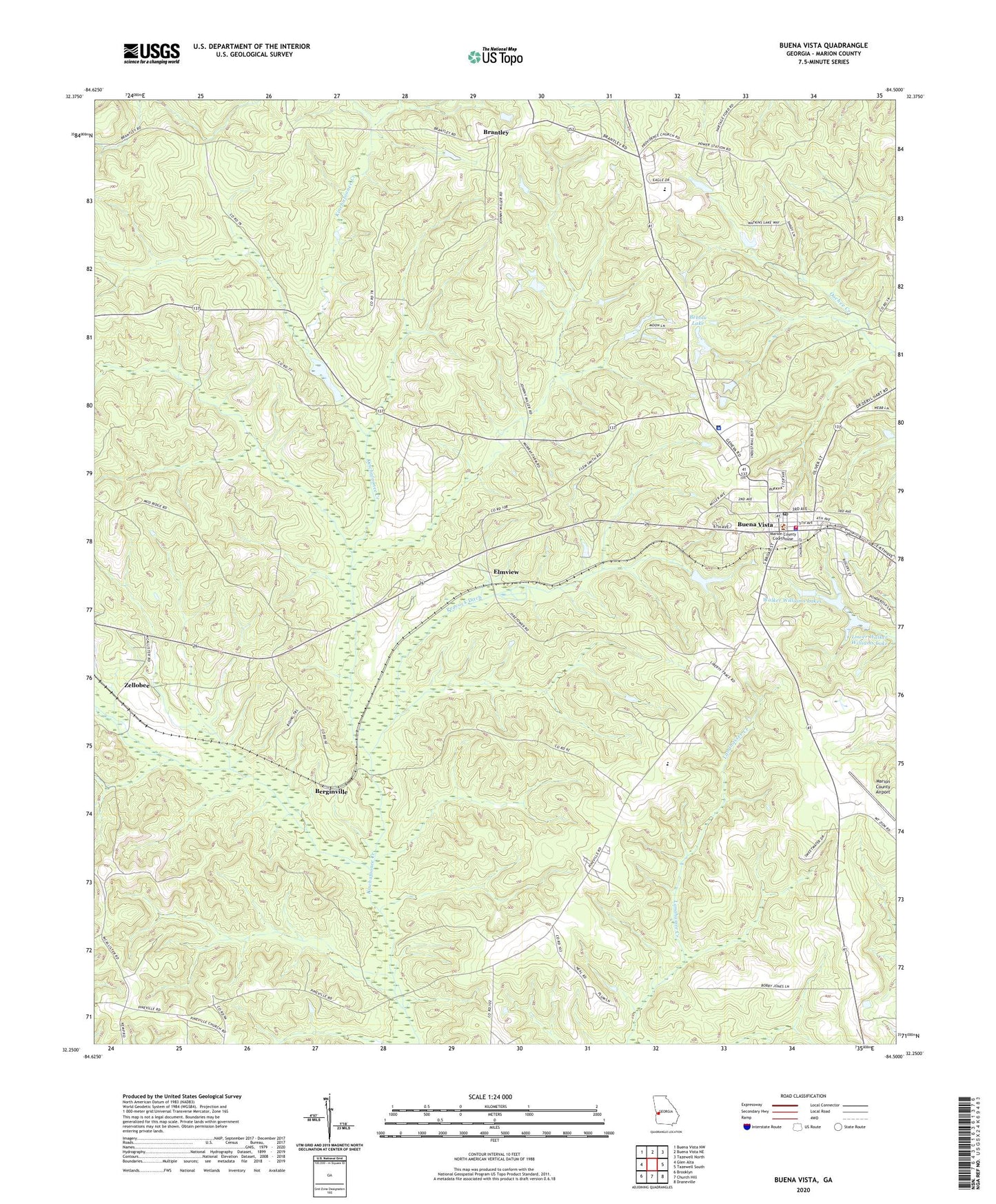
2024 topographic map quadrangle Buena Vista in the state of Georgia. Scale: 1:24000. Based on the newly updated USGS 7.5' US Topo map series, this map is in the following counties: Marion. The map contains contour data, water features, and other items you are used to seeing on USGS maps, but also has updated roads and other features. This is the next generation of topographic maps. Printed on high-quality waterproof paper with UV fade-resistant inks.
Quads adjacent to this one:
West: Glen Alta
Northwest: Buena Vista NW
North: Buena Vista NE
Northeast: Tazewell North
East: Tazewell South
Southeast: Draneville
South: Church Hill
Southwest: Brooklyn
This map covers the same area as the classic USGS quad with code o32084c5.
Contains the following named places: Bebolu Lake, Berginville, Bethel Church, Brantley, Brantley Church, Browns Chapel, Buena Vista, Buena Vista Cemetery, Buena Vista Division, Buena Vista Fire Department and Rescue Station, Buena Vista Police Department, Buena Vista Post Office, City of Buena Vista, City of Buena Vista Cemetery, Elmview, Hall Chapel, Lower Walker Williams Lake, Lower Walker Williams Lake Dam, Marion County, Marion County Airport, Marion County Courthouse, Marion County Detention Center, Marion County Sheriff's Office, Marion Hospital Heliport, Marion Memorial Hospital, Mariona Tower, New Providence Church, New Providence Church Cemetery, Peacock Ditch, Pineville, Pineville Church, Poplar Springs Church, Ramah Church, Ramah Church Cemetery, Saint Pauls Church, Shady Grove Church, Walker Williams Lakes, Zellobee