MyTopo
Buena Vista NW Georgia US Topo Map
Couldn't load pickup availability
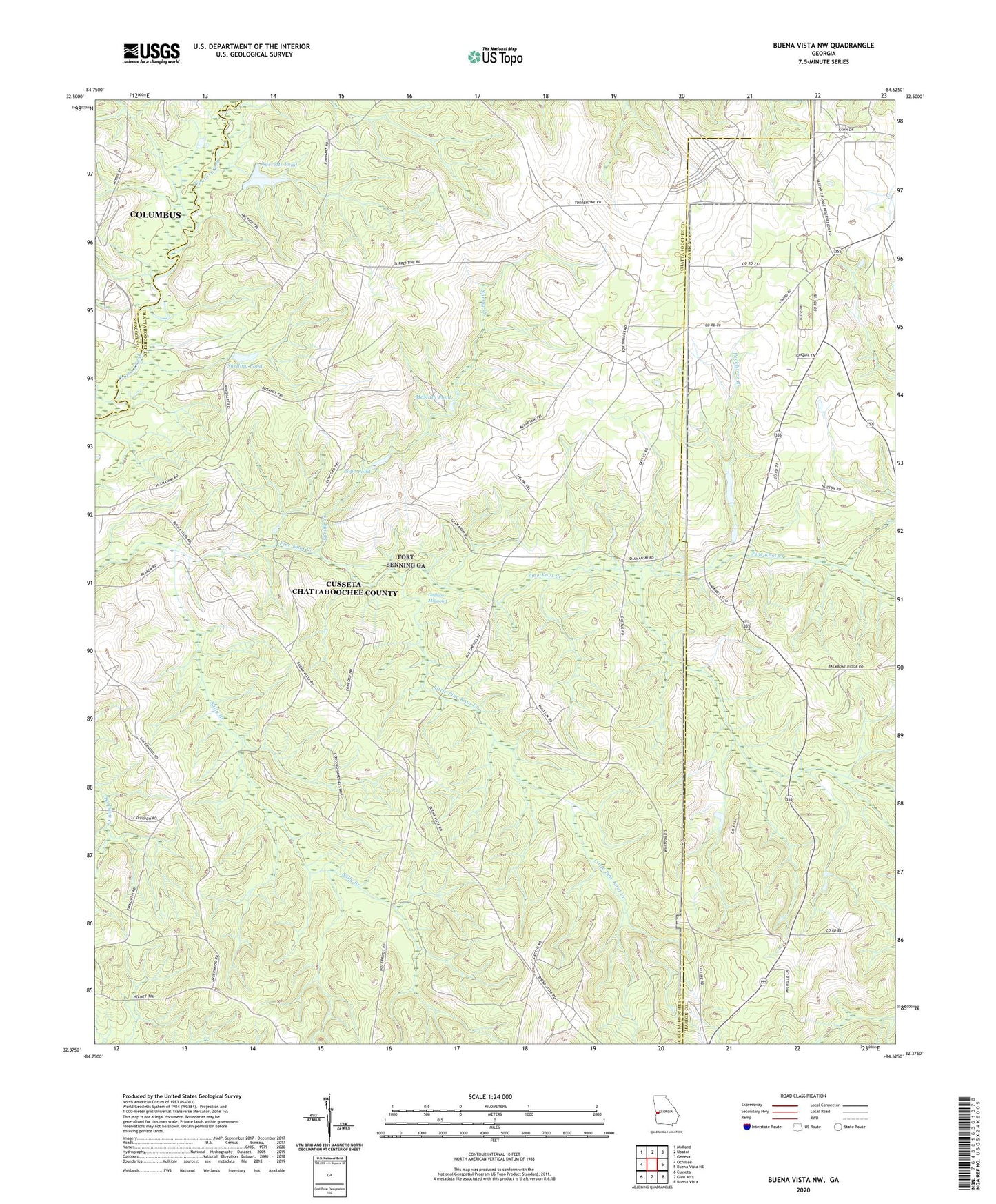
2024 topographic map quadrangle Buena Vista NW in the state of Georgia. Scale: 1:24000. Based on the newly updated USGS 7.5' US Topo map series, this map is in the following counties: Chattahoochee, Marion, Muscogee. The map contains contour data, water features, and other items you are used to seeing on USGS maps, but also has updated roads and other features. This is the next generation of topographic maps. Printed on high-quality waterproof paper with UV fade-resistant inks.
Quads adjacent to this one:
West: Ochillee
Northwest: Midland
North: Upatoi
Northeast: Geneva
East: Buena Vista NE
Southeast: Buena Vista
South: Glen Alta
Southwest: Cusseta
This map covers the same area as the classic USGS quad with code o32084d6.
Contains the following named places: Averetts Pond, Brown Springs Church, Carhart Store, County Line Church, Culpepper Store, Favorsville School, Fellowship Church, Gallups Mill, Gallups Millpond, Little Pine Knot Creek, McMath Pond, Mount Pilgrim Church, Mount Zion Church, Peachtree Branch, Pine Knot School, Pope Pond, Sally Branch, Snelling Pond, Spring Creek, Thomas Mill, Underwood Mill, Willetts Lake, Willietts Lake Dam, Woodruff Pond