MyTopo
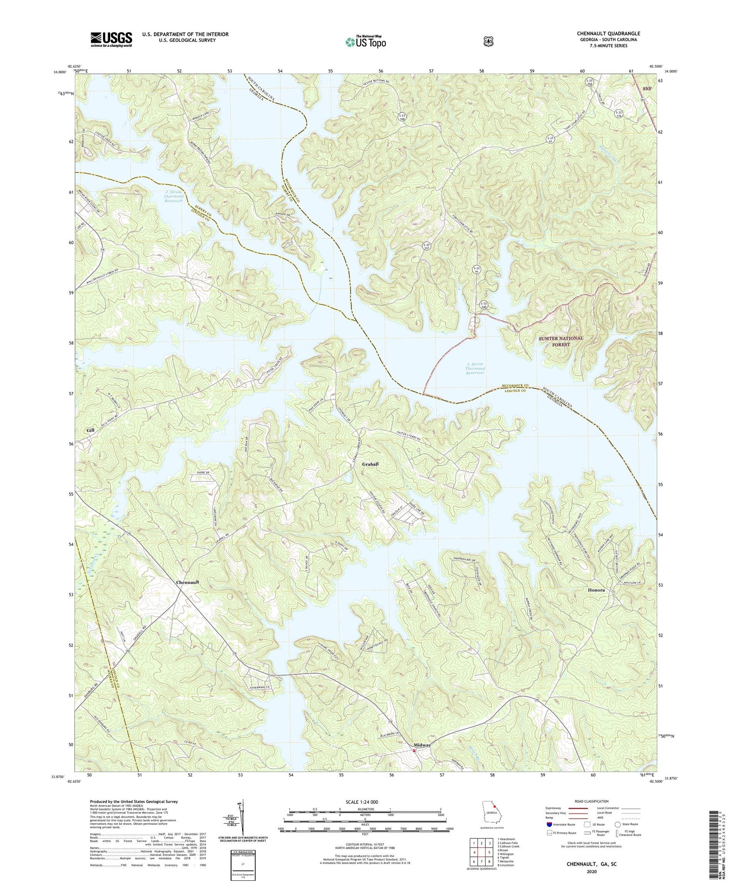
Chennault Georgia US Topo Map
Couldn't load pickup availability
Also explore the Chennault Forest Service Topo of this same quad for updated USFS data
2024 topographic map quadrangle Chennault in the states of Georgia, South Carolina. Scale: 1:24000. Based on the newly updated USGS 7.5' US Topo map series, this map is in the following counties: Lincoln, McCormick, Elbert, Wilkes. The map contains contour data, water features, and other items you are used to seeing on USGS maps, but also has updated roads and other features. This is the next generation of topographic maps. Printed on high-quality waterproof paper with UV fade-resistant inks.
Quads adjacent to this one:
West: Broad
Northwest: Heardmont
North: Calhoun Falls
Northeast: Calhoun Creek
East: Willington
Southeast: Lincolnton
South: Metasville
Southwest: Tignall
Contains the following named places: Bobby Brown State Park, Broad River, Cades Ferry, Chennault, Coody Creek, Dubose Ferry, Fishing Creek, Francis Lake, Francis Lake Dam, Gill, Graball, Green Olive Church, Green Olive School, Hesters Ferry, Honora, Lisbon, Midway, Midway Volunteer Fire Department, Morrahs Ferry, Mount Carmel Campground, Mount Carmel Park, Mount Pleasant Church, Mount Pleasant School, New Tabernacle Baptist Church, New Tabernacle School, Newford Creek, Patterson Branch Picnic Area, Patterson Creek, Pistol Creek, Russells Creek, Spring Grove Church