MyTopo
Heardmont Georgia US Topo Map
Couldn't load pickup availability
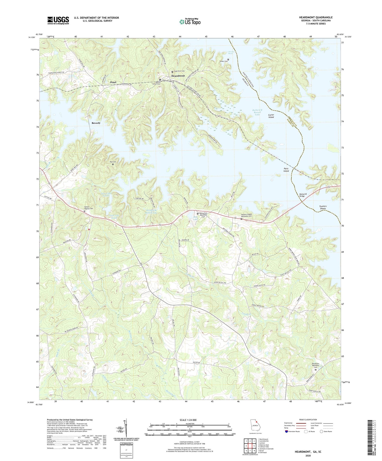
2024 topographic map quadrangle Heardmont in the states of Georgia, South Carolina. Scale: 1:24000. Based on the newly updated USGS 7.5' US Topo map series, this map is in the following counties: Elbert, Abbeville. The map contains contour data, water features, and other items you are used to seeing on USGS maps, but also has updated roads and other features. This is the next generation of topographic maps. Printed on high-quality waterproof paper with UV fade-resistant inks.
Quads adjacent to this one:
West: Elberton East
Northwest: Rock Branch
North: Lowndesville
Northeast: Latimer
East: Calhoun Falls
Southeast: Chennault
South: Broad
Southwest: Jacksons Crossroads
Contains the following named places: Banks School, Beaverdam Creek, Beaverdam Mill, Bethel Baptist Cemetery, Bethel Church, Bethel Grove Cemetery, Bethel Grove Church, Bethlehem Church, Bethlehem Methodist Cemetery, Beulah School, Beverly, Blue Branch, Carter Island, Cherokee Ferry, Cherokee Ford, Cherokee Shoals, Dry Holler School, Dye Cemetery, Elbert County Fire Department Longstreet Station, Gods Acre Cemetery, Gray Branch, Heardmont, Hunters Chapel, Hunters Chapel Methodist Cemetery, Jones Branch, Lake Russell Dam, Memorial Bridge, Millwood, Moseley Ferry, New Hope Church, Paris Island, Pearl, Rice Lake, Rice Lake Dam, Rocky River, Stansell, Trotters Shoals, Tucker Cemetery, Twin Lake North, Twin Lake North Dam, Twin Lake South, Twin Lake South Dam, Twin Lakes, Welcome Church, Woodlawn Church, Woodlawn Methodist Cemetery